Osgood Topo Map Missouri
To zoom in, hover over the map of Osgood
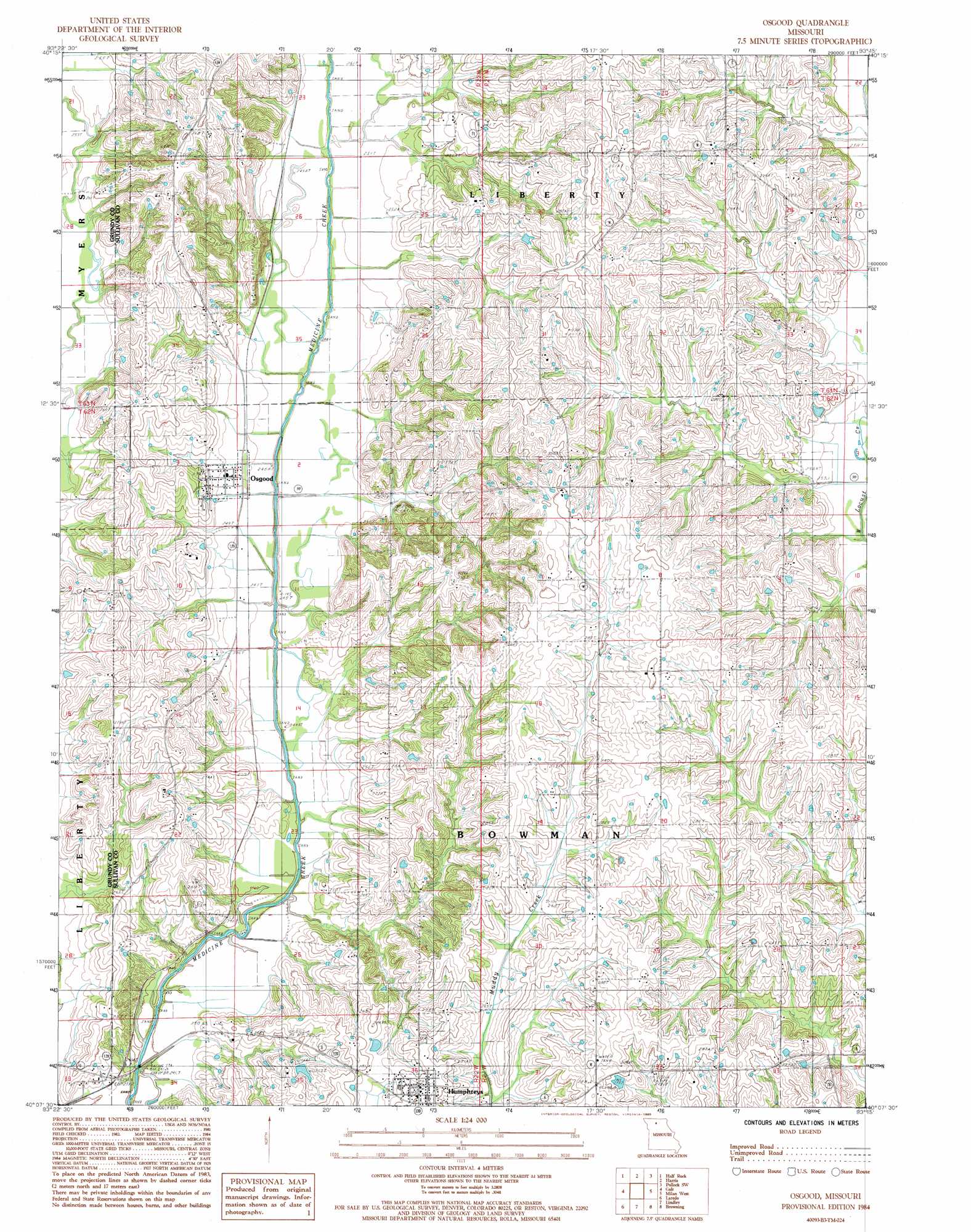
USGS Topo Quad 40093b3 - 1:24,000 scale
| Topo Map Name: | Osgood |
| USGS Topo Quad ID: | 40093b3 |
| Print Size: | ca. 21 1/4" wide x 27" high |
| Southeast Coordinates: | 40.125° N latitude / 93.25° W longitude |
| Map Center Coordinates: | 40.1875° N latitude / 93.3125° W longitude |
| U.S. State: | MO |
| Filename: | o40093b3.jpg |
| Download Map JPG Image: | Osgood topo map 1:24,000 scale |
| Map Type: | Topographic |
| Topo Series: | 7.5´ |
| Map Scale: | 1:24,000 |
| Source of Map Images: | United States Geological Survey (USGS) |
| Alternate Map Versions: |
Osgood MO 1984, updated 1985 Download PDF Buy paper map Osgood MO 2012 Download PDF Buy paper map Osgood MO 2014 Download PDF Buy paper map |
1:24,000 Topo Quads surrounding Osgood
Princeton |
Ravanna |
Lucerne |
Pollock Nw |
Unionville West |
Mill Grove |
Half Rock |
Harris |
Pollock Sw |
Pollock |
Spickard |
Galt |
Osgood |
Milan West |
Milan East |
Trenton East |
Laredo |
Lindley |
Browning |
Milan Se |
Farmersville |
Chula |
Eversonville |
Linneus |
Shelby |
> Back to 40093a1 at 1:100,000 scale
> Back to 40092a1 at 1:250,000 scale
> Back to U.S. Topo Maps home
Osgood topo map: Gazetteer
Osgood: Dams
Humphreys Lake Dam elevation 275m 902′Rusk Lake Dam elevation 262m 859′
Osgood: Populated Places
Cookman elevation 293m 961′Humphreys elevation 283m 928′
Osgood elevation 252m 826′
Osgood digital topo map on disk
Buy this Osgood topo map showing relief, roads, GPS coordinates and other geographical features, as a high-resolution digital map file on DVD: