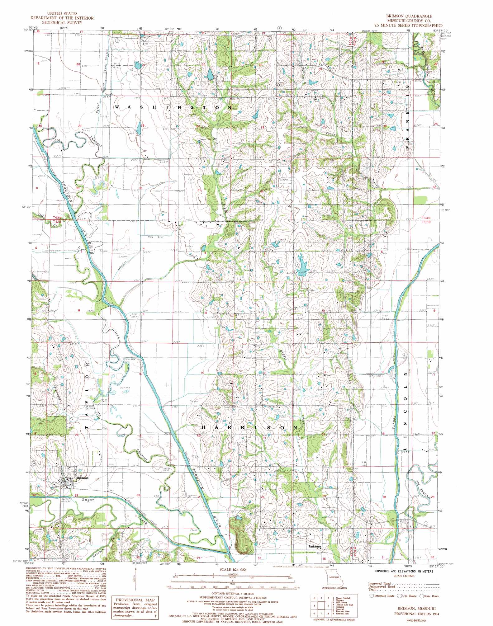
Brimson Topo Map Missouri
To zoom in, hover over the map of Brimson
USGS Topo Quad 40093b6 - 1:24,000 scale
| Topo Map Name: | Brimson |
| USGS Topo Quad ID: | 40093b6 |
| Print Size: | ca. 21 1/4" wide x 27" high |
| Southeast Coordinates: | 40.125° N latitude / 93.625° W longitude |
| Map Center Coordinates: | 40.1875° N latitude / 93.6875° W longitude |
| U.S. State: | MO |
| Filename: | o40093b6.jpg |
| Download Map JPG Image: | Brimson topo map 1:24,000 scale |
| Map Type: | Topographic |
| Topo Series: | 7.5´ |
| Map Scale: | 1:24,000 |
| Source of Map Images: | United States Geological Survey (USGS) |
| Alternate Map Versions: |
Brimson MO 1984, updated 1985 Download PDF Buy paper map Brimson MO 2012 Download PDF Buy paper map Brimson MO 2014 Download PDF Buy paper map |
1:24,000 Topo Quads surrounding Brimson
Eagleville |
Cainsville |
Goshen |
Princeton |
Ravanna |
Gardner |
Mount Moriah |
Modena |
Mill Grove |
Half Rock |
Gilman City West |
Gilman City East |
Brimson |
Spickard |
Galt |
Jameson |
Bancroft |
Trenton West |
Trenton East |
Laredo |
Gallatin |
Jamesport |
Shearwood |
Farmersville |
Chula |
> Back to 40093a1 at 1:100,000 scale
> Back to 40092a1 at 1:250,000 scale
> Back to U.S. Topo Maps home
Brimson topo map: Gazetteer
Brimson: Dams
Dolan Dam elevation 256m 839′Hanes Lake Dam elevation 251m 823′
Hein Lake Dam elevation 265m 869′
Knosby Lake Dam elevation 240m 787′
Number 579 Dam elevation 236m 774′
Preston Lake Dam elevation 278m 912′
Stamper Lake Dam elevation 266m 872′
Brimson: Populated Places
Brimson elevation 236m 774′Buttsville elevation 281m 921′
Parkerton elevation 235m 770′
Shott elevation 258m 846′
Brimson: Reservoirs
Dolan Lake elevation 256m 839′Stamper Pond elevation 266m 872′
Brimson: Streams
Cat Creek elevation 235m 770′Cattail Creek elevation 232m 761′
Furnace Creek elevation 234m 767′
Lost Creek elevation 231m 757′
Old Channel Weldon River elevation 231m 757′
Peteet Creek elevation 236m 774′
Raccoon Creek elevation 228m 748′
Sugar Creek elevation 227m 744′
Brimson digital topo map on disk
Buy this Brimson topo map showing relief, roads, GPS coordinates and other geographical features, as a high-resolution digital map file on DVD: