Seymour East Topo Map Iowa
To zoom in, hover over the map of Seymour East
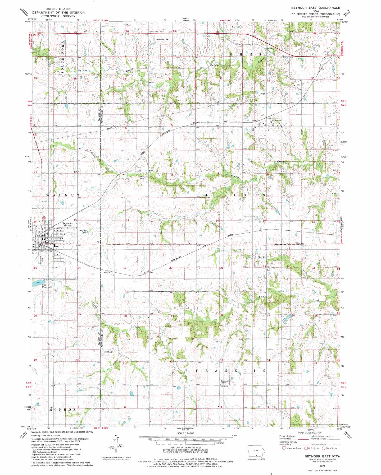
USGS Topo Quad 40093f1 - 1:24,000 scale
| Topo Map Name: | Seymour East |
| USGS Topo Quad ID: | 40093f1 |
| Print Size: | ca. 21 1/4" wide x 27" high |
| Southeast Coordinates: | 40.625° N latitude / 93° W longitude |
| Map Center Coordinates: | 40.6875° N latitude / 93.0625° W longitude |
| U.S. State: | IA |
| Filename: | o40093f1.jpg |
| Download Map JPG Image: | Seymour East topo map 1:24,000 scale |
| Map Type: | Topographic |
| Topo Series: | 7.5´ |
| Map Scale: | 1:24,000 |
| Source of Map Images: | United States Geological Survey (USGS) |
| Alternate Map Versions: |
Seymour East IA 1979, updated 1980 Download PDF Buy paper map Seymour East IA 2010 Download PDF Buy paper map Seymour East IA 2013 Download PDF Buy paper map Seymour East IA 2015 Download PDF Buy paper map |
1:24,000 Topo Quads surrounding Seymour East
Corydon Ne |
Russell |
Melrose |
Iconium |
Moravia |
Corydon |
Confidence |
Plano |
Mystic |
Hiattsville |
Allerton |
Seymour West |
Seymour East |
Centerville West |
Centerville East |
Powersville |
Saint John |
Lake Thunderhead |
Mendota |
Omaha |
Lucerne |
Pollock Nw |
Unionville West |
Unionville East |
Graysville |
> Back to 40093e1 at 1:100,000 scale
> Back to 40092a1 at 1:250,000 scale
> Back to U.S. Topo Maps home
Seymour East topo map: Gazetteer
Seymour East: Parks
Seymour Lake Park elevation 314m 1030′Seymour East: Populated Places
Jerome elevation 313m 1026′Seymour elevation 323m 1059′
Seymour East: Post Offices
Harkes Post Office (historical) elevation 307m 1007′Jerome Post Office (historical) elevation 313m 1026′
Johnstown Post Office (historical) elevation 314m 1030′
Marsdenville Post Office (historical) elevation 302m 990′
Seymour Post Office elevation 325m 1066′
Walsh Post Office (historical) elevation 320m 1049′
Seymour East: Reservoirs
Seymour City Reservoir elevation 315m 1033′Seymour East: Streams
Hickory Creek elevation 286m 938′Seymour East digital topo map on disk
Buy this Seymour East topo map showing relief, roads, GPS coordinates and other geographical features, as a high-resolution digital map file on DVD: