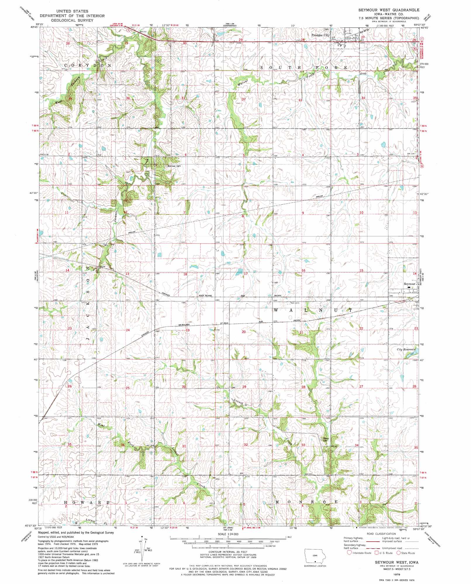
Seymour West Topo Map Iowa
To zoom in, hover over the map of Seymour West
USGS Topo Quad 40093f2 - 1:24,000 scale
| Topo Map Name: | Seymour West |
| USGS Topo Quad ID: | 40093f2 |
| Print Size: | ca. 21 1/4" wide x 27" high |
| Southeast Coordinates: | 40.625° N latitude / 93.125° W longitude |
| Map Center Coordinates: | 40.6875° N latitude / 93.1875° W longitude |
| U.S. State: | IA |
| Filename: | o40093f2.jpg |
| Download Map JPG Image: | Seymour West topo map 1:24,000 scale |
| Map Type: | Topographic |
| Topo Series: | 7.5´ |
| Map Scale: | 1:24,000 |
| Source of Map Images: | United States Geological Survey (USGS) |
| Alternate Map Versions: |
Seymour West IA 1979, updated 1980 Download PDF Buy paper map Seymour West IA 2010 Download PDF Buy paper map Seymour West IA 2013 Download PDF Buy paper map Seymour West IA 2015 Download PDF Buy paper map |
1:24,000 Topo Quads surrounding Seymour West
Derby |
Corydon Ne |
Russell |
Melrose |
Iconium |
Humeston |
Corydon |
Confidence |
Plano |
Mystic |
Clio |
Allerton |
Seymour West |
Seymour East |
Centerville West |
Cleopatra |
Powersville |
Saint John |
Lake Thunderhead |
Mendota |
Ravanna |
Lucerne |
Pollock Nw |
Unionville West |
Unionville East |
> Back to 40093e1 at 1:100,000 scale
> Back to 40092a1 at 1:250,000 scale
> Back to U.S. Topo Maps home
Seymour West topo map: Gazetteer
Seymour West: Populated Places
Promise City elevation 321m 1053′Seymour West: Post Offices
Kniffin Post Office (historical) elevation 329m 1079′Promise City Post Office elevation 321m 1053′
Seymour West: Streams
West Jackson Creek elevation 298m 977′Seymour West digital topo map on disk
Buy this Seymour West topo map showing relief, roads, GPS coordinates and other geographical features, as a high-resolution digital map file on DVD: