Clio Topo Map Iowa
To zoom in, hover over the map of Clio
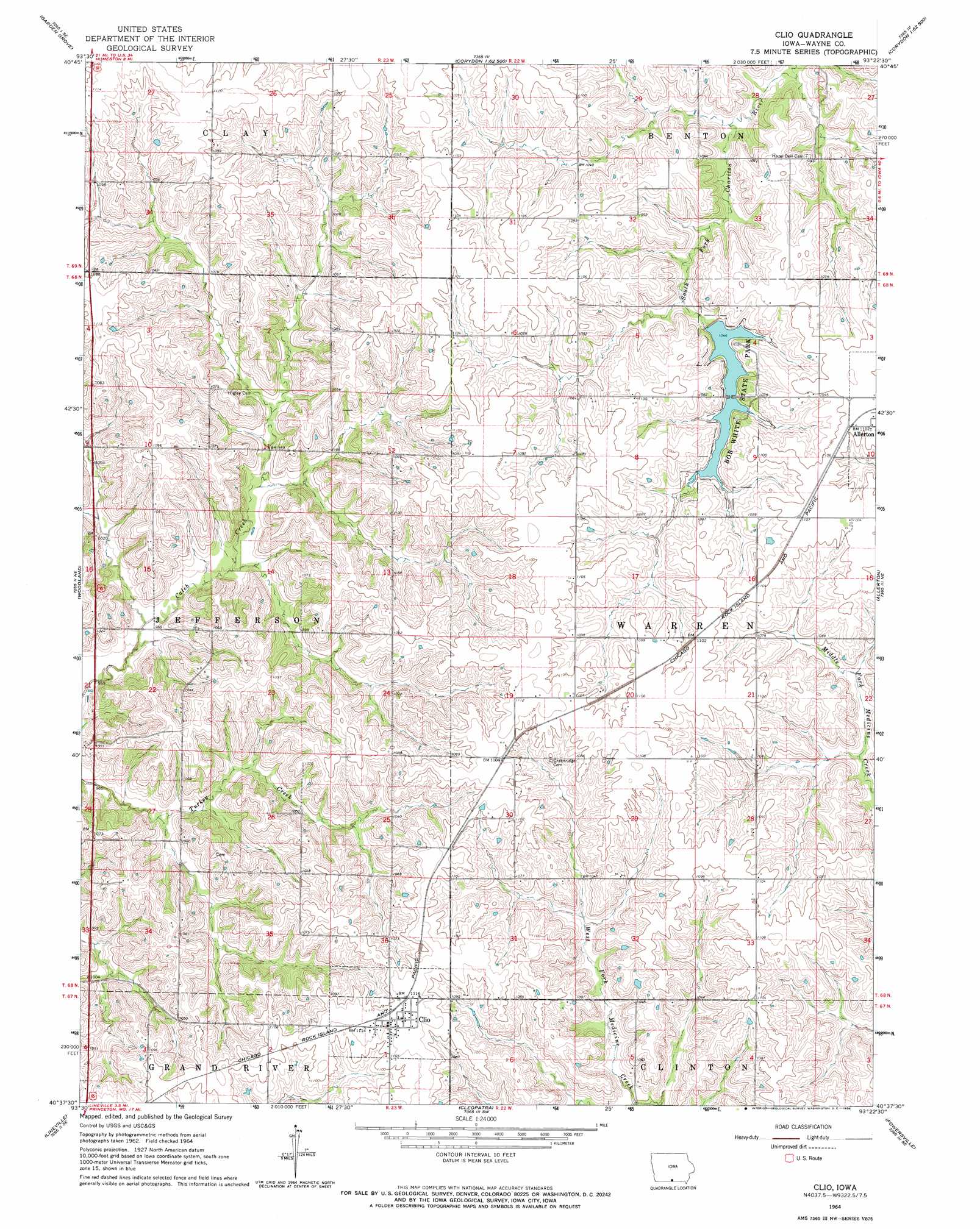
USGS Topo Quad 40093f4 - 1:24,000 scale
| Topo Map Name: | Clio |
| USGS Topo Quad ID: | 40093f4 |
| Print Size: | ca. 21 1/4" wide x 27" high |
| Southeast Coordinates: | 40.625° N latitude / 93.375° W longitude |
| Map Center Coordinates: | 40.6875° N latitude / 93.4375° W longitude |
| U.S. State: | IA |
| Filename: | o40093f4.jpg |
| Download Map JPG Image: | Clio topo map 1:24,000 scale |
| Map Type: | Topographic |
| Topo Series: | 7.5´ |
| Map Scale: | 1:24,000 |
| Source of Map Images: | United States Geological Survey (USGS) |
| Alternate Map Versions: |
Clio IA 1964, updated 1966 Download PDF Buy paper map Clio IA 2010 Download PDF Buy paper map Clio IA 2013 Download PDF Buy paper map Clio IA 2015 Download PDF Buy paper map |
1:24,000 Topo Quads surrounding Clio
Weldon |
Le Roy |
Derby |
Corydon Ne |
Russell |
Garden Grove Sw |
Garden Grove |
Humeston |
Corydon |
Confidence |
Leon |
Woodland |
Clio |
Allerton |
Seymour West |
Pleasanton |
Lineville |
Cleopatra |
Powersville |
Saint John |
Goshen |
Princeton |
Ravanna |
Lucerne |
Pollock Nw |
> Back to 40093e1 at 1:100,000 scale
> Back to 40092a1 at 1:250,000 scale
> Back to U.S. Topo Maps home
Clio topo map: Gazetteer
Clio: Parks
Bob White State Park elevation 317m 1040′Clio: Populated Places
Clio elevation 339m 1112′Hodge elevation 335m 1099′
Clio: Post Offices
Clio Post Office elevation 340m 1115′Hodge Post Office (historical) elevation 335m 1099′
Clio digital topo map on disk
Buy this Clio topo map showing relief, roads, GPS coordinates and other geographical features, as a high-resolution digital map file on DVD: