Leon Topo Map Iowa
To zoom in, hover over the map of Leon
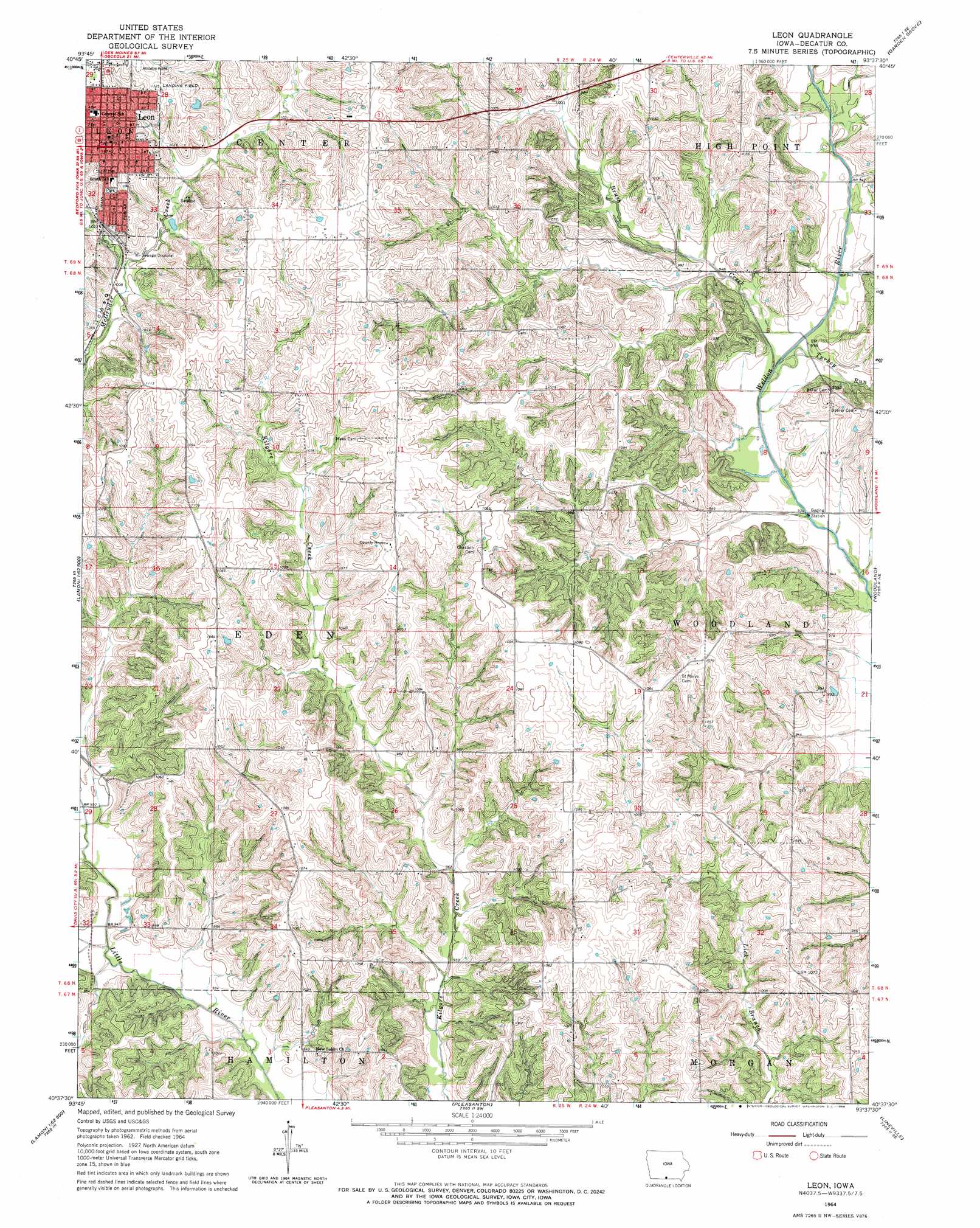
USGS Topo Quad 40093f6 - 1:24,000 scale
| Topo Map Name: | Leon |
| USGS Topo Quad ID: | 40093f6 |
| Print Size: | ca. 21 1/4" wide x 27" high |
| Southeast Coordinates: | 40.625° N latitude / 93.625° W longitude |
| Map Center Coordinates: | 40.6875° N latitude / 93.6875° W longitude |
| U.S. State: | IA |
| Filename: | o40093f6.jpg |
| Download Map JPG Image: | Leon topo map 1:24,000 scale |
| Map Type: | Topographic |
| Topo Series: | 7.5´ |
| Map Scale: | 1:24,000 |
| Source of Map Images: | United States Geological Survey (USGS) |
| Alternate Map Versions: |
Leon IA 1964, updated 1966 Download PDF Buy paper map Leon IA 2010 Download PDF Buy paper map Leon IA 2013 Download PDF Buy paper map Leon IA 2015 Download PDF Buy paper map |
1:24,000 Topo Quads surrounding Leon
Hopeville |
Lacelle |
Weldon |
Le Roy |
Derby |
Grand River |
Van Wert |
Garden Grove Sw |
Garden Grove |
Humeston |
Lamoni North |
Davis City |
Leon |
Woodland |
Clio |
Lamoni South |
Akron |
Pleasanton |
Lineville |
Cleopatra |
Eagleville |
Cainsville |
Goshen |
Princeton |
Ravanna |
> Back to 40093e1 at 1:100,000 scale
> Back to 40092a1 at 1:250,000 scale
> Back to U.S. Topo Maps home
Leon topo map: Gazetteer
Leon: Parks
Memorial to All Veterans Historical Marker elevation 343m 1125′Leon: Populated Places
Brucewell elevation 323m 1059′Leon elevation 343m 1125′
Leon: Post Offices
Bracewell Post Office (historical) elevation 323m 1059′Highbrier Post Office (historical) elevation 324m 1062′
Leon Post Office elevation 341m 1118′
Leon: Streams
Brush Creek elevation 281m 921′Turkey Run elevation 280m 918′
Leon digital topo map on disk
Buy this Leon topo map showing relief, roads, GPS coordinates and other geographical features, as a high-resolution digital map file on DVD: