Humeston Topo Map Iowa
To zoom in, hover over the map of Humeston
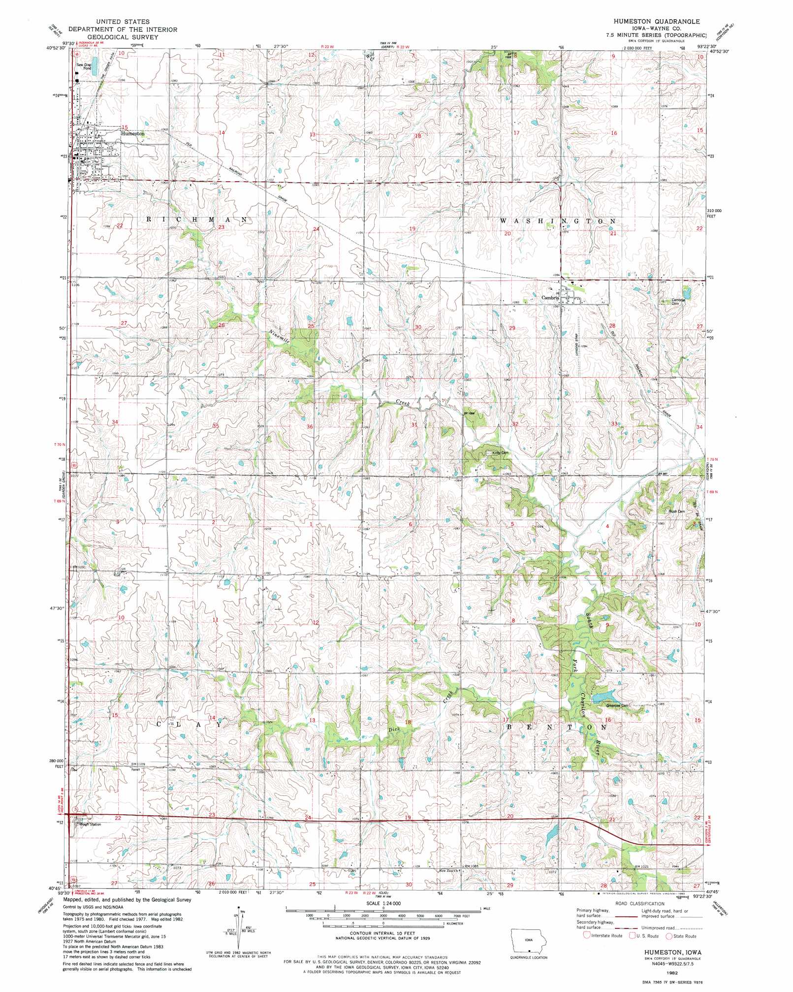
USGS Topo Quad 40093g4 - 1:24,000 scale
| Topo Map Name: | Humeston |
| USGS Topo Quad ID: | 40093g4 |
| Print Size: | ca. 21 1/4" wide x 27" high |
| Southeast Coordinates: | 40.75° N latitude / 93.375° W longitude |
| Map Center Coordinates: | 40.8125° N latitude / 93.4375° W longitude |
| U.S. State: | IA |
| Filename: | o40093g4.jpg |
| Download Map JPG Image: | Humeston topo map 1:24,000 scale |
| Map Type: | Topographic |
| Topo Series: | 7.5´ |
| Map Scale: | 1:24,000 |
| Source of Map Images: | United States Geological Survey (USGS) |
| Alternate Map Versions: |
Humeston IA 1982, updated 1983 Download PDF Buy paper map Humeston IA 2010 Download PDF Buy paper map Humeston IA 2013 Download PDF Buy paper map Humeston IA 2015 Download PDF Buy paper map |
1:24,000 Topo Quads surrounding Humeston
Jamison |
Woodburn |
Lucas |
Chariton |
Olmitz |
Weldon |
Le Roy |
Derby |
Corydon Ne |
Russell |
Garden Grove Sw |
Garden Grove |
Humeston |
Corydon |
Confidence |
Leon |
Woodland |
Clio |
Allerton |
Seymour West |
Pleasanton |
Lineville |
Cleopatra |
Powersville |
Saint John |
> Back to 40093e1 at 1:100,000 scale
> Back to 40092a1 at 1:250,000 scale
> Back to U.S. Topo Maps home
Humeston topo map: Gazetteer
Humeston: Areas
Railroad right-of-way Public Hunting Area elevation 330m 1082′Humeston: Parks
Wolf Hollow Wildlife Area elevation 308m 1010′Humeston: Populated Places
Cambria elevation 333m 1092′Humeston elevation 336m 1102′
Saxon elevation 334m 1095′
Humeston: Post Offices
Cambria Post Office (historical) elevation 333m 1092′Humeston Post Office elevation 336m 1102′
Lucerne Post Office (historical) elevation 322m 1056′
Orlando Post Office (historical) elevation 328m 1076′
Saxon Post Office (historical) elevation 334m 1095′
Humeston: Streams
Dick Creek elevation 302m 990′Ninemile Creek elevation 297m 974′
Humeston digital topo map on disk
Buy this Humeston topo map showing relief, roads, GPS coordinates and other geographical features, as a high-resolution digital map file on DVD: