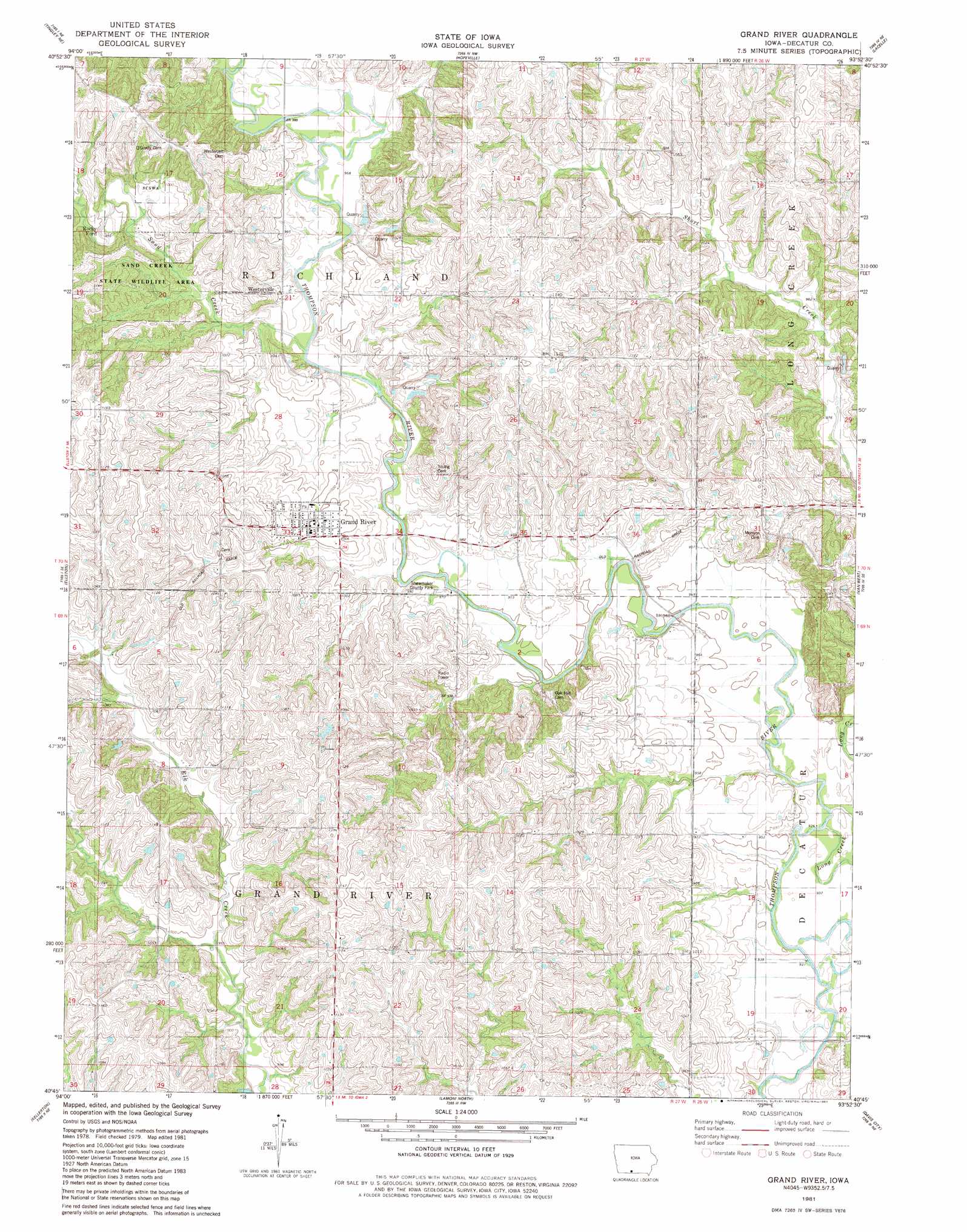
Grand River Topo Map Iowa
To zoom in, hover over the map of Grand River
USGS Topo Quad 40093g8 - 1:24,000 scale
| Topo Map Name: | Grand River |
| USGS Topo Quad ID: | 40093g8 |
| Print Size: | ca. 21 1/4" wide x 27" high |
| Southeast Coordinates: | 40.75° N latitude / 93.875° W longitude |
| Map Center Coordinates: | 40.8125° N latitude / 93.9375° W longitude |
| U.S. State: | IA |
| Filename: | o40093g8.jpg |
| Download Map JPG Image: | Grand River topo map 1:24,000 scale |
| Map Type: | Topographic |
| Topo Series: | 7.5´ |
| Map Scale: | 1:24,000 |
| Source of Map Images: | United States Geological Survey (USGS) |
| Alternate Map Versions: |
Grand River IA 1981, updated 1981 Download PDF Buy paper map Grand River IA 2010 Download PDF Buy paper map Grand River IA 2013 Download PDF Buy paper map Grand River IA 2015 Download PDF Buy paper map |
1:24,000 Topo Quads surrounding Grand River
Afton |
Lorimor South |
Murray |
Osceola |
Jamison |
Arispe |
Tingley Ne |
Hopeville |
Lacelle |
Weldon |
Tingley |
Ellston |
Grand River |
Van Wert |
Garden Grove Sw |
Mount Ayr |
Kellerton |
Lamoni North |
Davis City |
Leon |
Hatfield |
Pawnee |
Lamoni South |
Akron |
Pleasanton |
> Back to 40093e1 at 1:100,000 scale
> Back to 40092a1 at 1:250,000 scale
> Back to U.S. Topo Maps home
Grand River topo map: Gazetteer
Grand River: Parks
Shewmaker County Park elevation 291m 954′Grand River: Populated Places
Grand River elevation 310m 1017′Grand River: Post Offices
Funks Mills Post Office (historical) elevation 325m 1066′Green Valley Post Office (historical) elevation 338m 1108′
Westerville Post Office (historical) elevation 302m 990′
Grand River: Streams
Long Creek elevation 283m 928′Sand Creek elevation 292m 958′
Grand River digital topo map on disk
Buy this Grand River topo map showing relief, roads, GPS coordinates and other geographical features, as a high-resolution digital map file on DVD: