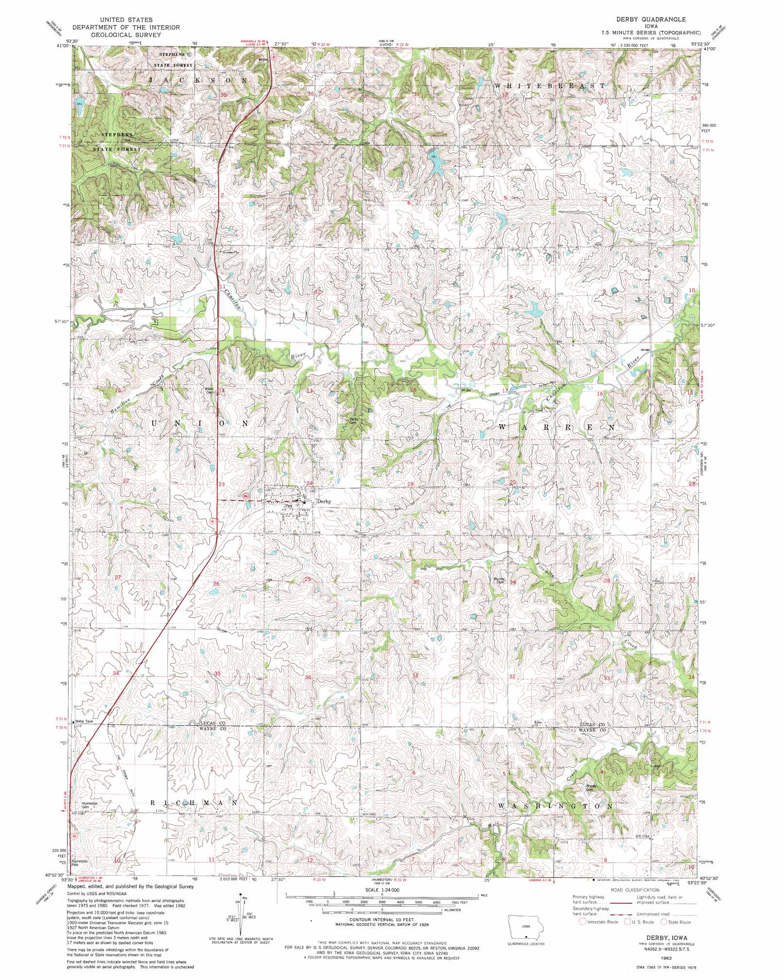
Derby Topo Map Iowa
To zoom in, hover over the map of Derby
USGS Topo Quad 40093h4 - 1:24,000 scale
| Topo Map Name: | Derby |
| USGS Topo Quad ID: | 40093h4 |
| Print Size: | ca. 21 1/4" wide x 27" high |
| Southeast Coordinates: | 40.875° N latitude / 93.375° W longitude |
| Map Center Coordinates: | 40.9375° N latitude / 93.4375° W longitude |
| U.S. State: | IA |
| Filename: | o40093h4.jpg |
| Download Map JPG Image: | Derby topo map 1:24,000 scale |
| Map Type: | Topographic |
| Topo Series: | 7.5´ |
| Map Scale: | 1:24,000 |
| Source of Map Images: | United States Geological Survey (USGS) |
| Alternate Map Versions: |
Derby IA 1982, updated 1983 Download PDF Buy paper map Derby IA 2010 Download PDF Buy paper map Derby IA 2013 Download PDF Buy paper map Derby IA 2015 Download PDF Buy paper map |
1:24,000 Topo Quads surrounding Derby
New Virginia |
Medora |
Lacona |
Newbern |
Melcher |
Jamison |
Woodburn |
Lucas |
Chariton |
Olmitz |
Weldon |
Le Roy |
Derby |
Corydon Ne |
Russell |
Garden Grove Sw |
Garden Grove |
Humeston |
Corydon |
Confidence |
Leon |
Woodland |
Clio |
Allerton |
Seymour West |
> Back to 40093e1 at 1:100,000 scale
> Back to 40092a1 at 1:250,000 scale
> Back to U.S. Topo Maps home
Derby topo map: Gazetteer
Derby: Parks
Humeston Park elevation 334m 1095′Derby: Populated Places
Derby elevation 329m 1079′Derby: Post Offices
Argo Post Office (historical) elevation 325m 1066′Derby Post Office elevation 329m 1079′
Earle Post Office (historical) elevation 336m 1102′
Freeland Post Office (historical) elevation 324m 1062′
Warren Centre Post Office (historical) elevation 326m 1069′
Derby: Streams
Hamilton Creek elevation 302m 990′Derby: Trails
Cinder Path elevation 299m 980′Derby digital topo map on disk
Buy this Derby topo map showing relief, roads, GPS coordinates and other geographical features, as a high-resolution digital map file on DVD: