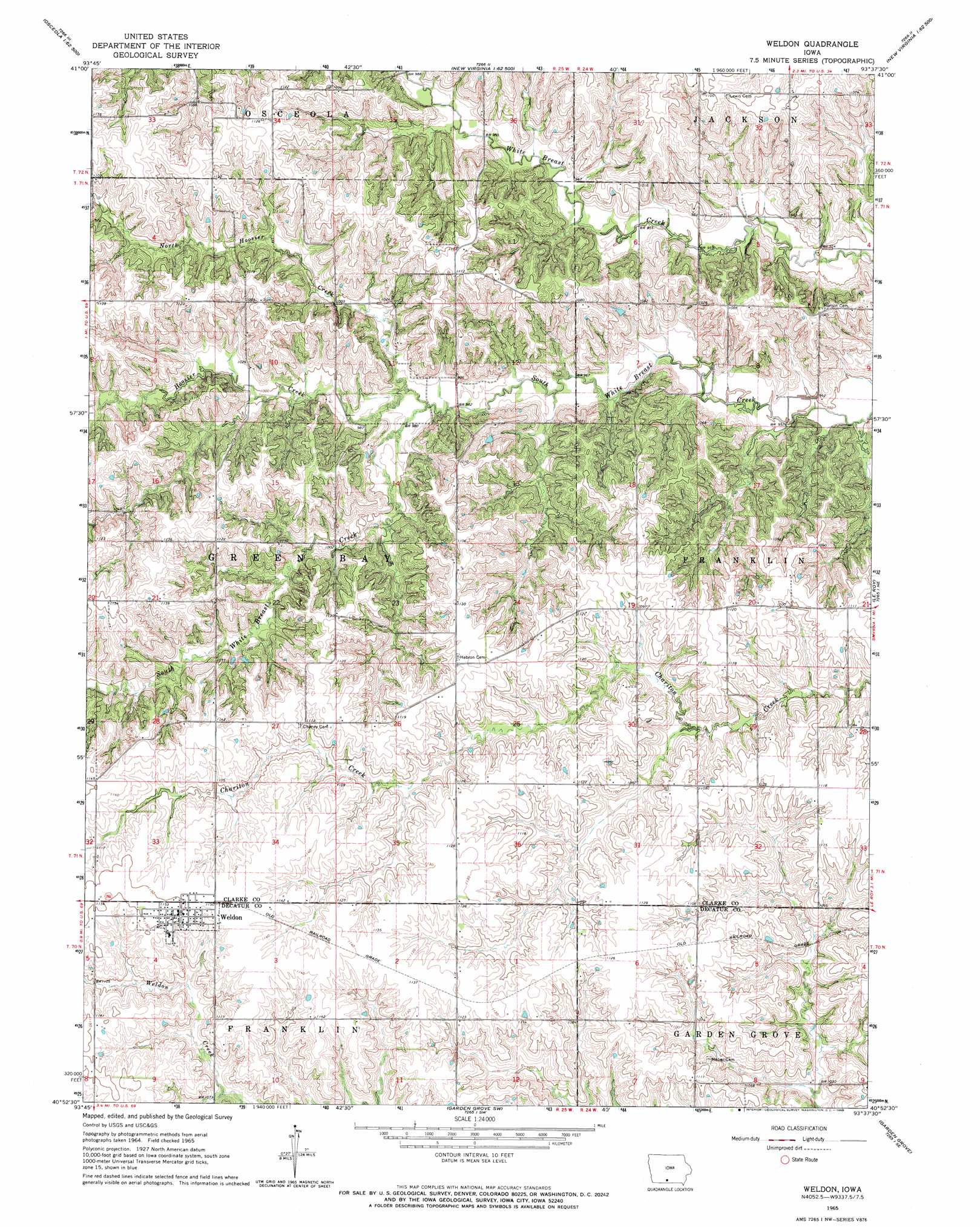
Weldon Topo Map Iowa
To zoom in, hover over the map of Weldon
USGS Topo Quad 40093h6 - 1:24,000 scale
| Topo Map Name: | Weldon |
| USGS Topo Quad ID: | 40093h6 |
| Print Size: | ca. 21 1/4" wide x 27" high |
| Southeast Coordinates: | 40.875° N latitude / 93.625° W longitude |
| Map Center Coordinates: | 40.9375° N latitude / 93.6875° W longitude |
| U.S. State: | IA |
| Filename: | o40093h6.jpg |
| Download Map JPG Image: | Weldon topo map 1:24,000 scale |
| Map Type: | Topographic |
| Topo Series: | 7.5´ |
| Map Scale: | 1:24,000 |
| Source of Map Images: | United States Geological Survey (USGS) |
| Alternate Map Versions: |
Weldon IA 1965, updated 1966 Download PDF Buy paper map Weldon IA 2010 Download PDF Buy paper map Weldon IA 2013 Download PDF Buy paper map Weldon IA 2015 Download PDF Buy paper map |
1:24,000 Topo Quads surrounding Weldon
East Peru |
Truro |
New Virginia |
Medora |
Lacona |
Murray |
Osceola |
Jamison |
Woodburn |
Lucas |
Hopeville |
Lacelle |
Weldon |
Le Roy |
Derby |
Grand River |
Van Wert |
Garden Grove Sw |
Garden Grove |
Humeston |
Lamoni North |
Davis City |
Leon |
Woodland |
Clio |
> Back to 40093e1 at 1:100,000 scale
> Back to 40092a1 at 1:250,000 scale
> Back to U.S. Topo Maps home
Weldon topo map: Gazetteer
Weldon: Parks
Turkey Ridge Wildlife Area elevation 324m 1062′Weldon: Populated Places
Weldon elevation 350m 1148′Weldon: Post Offices
Bartlettville Post Office (historical) elevation 332m 1089′Jack Creek Post Office (historical) elevation 324m 1062′
Shelby Post Office (historical) elevation 336m 1102′
Weldon Post Office elevation 350m 1148′
Weldon: Streams
Hoosier Creek elevation 296m 971′North Hoosier Creek elevation 296m 971′
Weldon digital topo map on disk
Buy this Weldon topo map showing relief, roads, GPS coordinates and other geographical features, as a high-resolution digital map file on DVD: