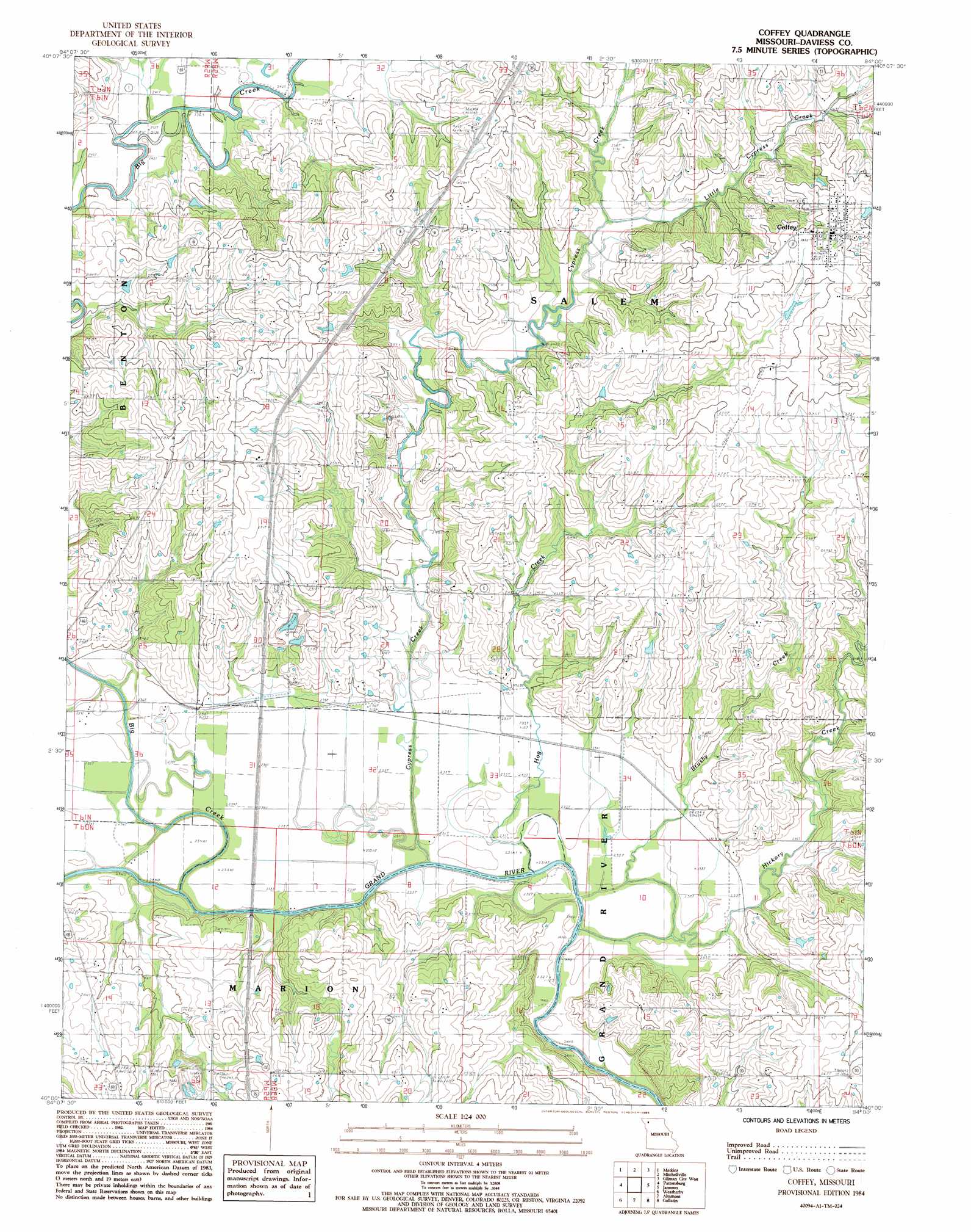
Coffey Topo Map Missouri
To zoom in, hover over the map of Coffey
USGS Topo Quad 40094a1 - 1:24,000 scale
| Topo Map Name: | Coffey |
| USGS Topo Quad ID: | 40094a1 |
| Print Size: | ca. 21 1/4" wide x 27" high |
| Southeast Coordinates: | 40° N latitude / 94° W longitude |
| Map Center Coordinates: | 40.0625° N latitude / 94.0625° W longitude |
| U.S. State: | MO |
| Filename: | o40094a1.jpg |
| Download Map JPG Image: | Coffey topo map 1:24,000 scale |
| Map Type: | Topographic |
| Topo Series: | 7.5´ |
| Map Scale: | 1:24,000 |
| Source of Map Images: | United States Geological Survey (USGS) |
| Alternate Map Versions: |
Coffey MO 1984, updated 1985 Download PDF Buy paper map Coffey MO 2011 Download PDF Buy paper map Coffey MO 2014 Download PDF Buy paper map |
1:24,000 Topo Quads surrounding Coffey
Albany North |
New Hampton |
Bethany |
Gardner |
Mount Moriah |
Albany South |
Matkin |
Mitchellville |
Gilman City West |
Gilman City East |
Berlin |
Pattonsburg |
Coffey |
Jameson |
Bancroft |
Maysville |
Weatherby |
Altamont |
Gallatin |
Jamesport |
Fordham |
Winston |
Kidder |
Nettleton |
Breckenridge |
> Back to 40094a1 at 1:100,000 scale
> Back to 40094a1 at 1:250,000 scale
> Back to U.S. Topo Maps home
Coffey topo map: Gazetteer
Coffey: Bridges
Mooney Bridge elevation 241m 790′Coffey: Populated Places
Coffey elevation 287m 941′Cypress elevation 247m 810′
Pattonsburg elevation 276m 905′
Salem Coffey P O and Station elevation 285m 935′
Coffey: Streams
Big Creek elevation 232m 761′Brushy Creek elevation 229m 751′
Cypress Creek elevation 228m 748′
Hickory Creek elevation 229m 751′
Hog Creek elevation 228m 748′
Little Cypress Creek elevation 249m 816′
Coffey digital topo map on disk
Buy this Coffey topo map showing relief, roads, GPS coordinates and other geographical features, as a high-resolution digital map file on DVD: