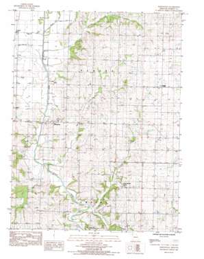
Whitesville Topo Map Missouri
To zoom in, hover over the map of Whitesville
USGS Topo Quad 40094a6 - 1:24,000 scale
| Topo Map Name: | Whitesville |
| USGS Topo Quad ID: | 40094a6 |
| Print Size: | ca. 21 1/4" wide x 27" high |
| Southeast Coordinates: | 40° N latitude / 94.625° W longitude |
| Map Center Coordinates: | 40.0625° N latitude / 94.6875° W longitude |
| U.S. State: | MO |
| Filename: | o40094a6.jpg |
| Download Map JPG Image: | Whitesville topo map 1:24,000 scale |
| Map Type: | Topographic |
| Topo Series: | 7.5´ |
| Map Scale: | 1:24,000 |
| Source of Map Images: | United States Geological Survey (USGS) |
| Alternate Map Versions: |
Whitesville MO 1984, updated 1985 Download PDF Buy paper map Whitesville MO 2011 Download PDF Buy paper map Whitesville MO 2014 Download PDF Buy paper map |
1:24,000 Topo Quads surrounding Whitesville
> Back to 40094a1 at 1:100,000 scale
> Back to 40094a1 at 1:250,000 scale
> Back to U.S. Topo Maps home
Whitesville topo map: Gazetteer
Whitesville: Airports
Hannah Airport elevation 285m 935′Whitesville: Populated Places
Cawood elevation 288m 944′Empire Prairie elevation 333m 1092′
Flag Springs elevation 309m 1013′
Whitesville elevation 291m 954′
Whitesville: Streams
Agee Creek elevation 273m 895′Clear Creek elevation 280m 918′
Crooked Creek elevation 272m 892′
Hickory Creek elevation 281m 921′
Whitesville digital topo map on disk
Buy this Whitesville topo map showing relief, roads, GPS coordinates and other geographical features, as a high-resolution digital map file on DVD:


