Fillmore Topo Map Missouri
To zoom in, hover over the map of Fillmore
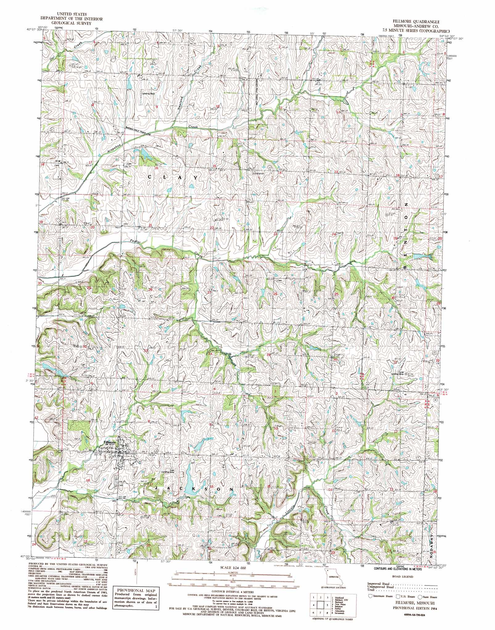
USGS Topo Quad 40094a8 - 1:24,000 scale
| Topo Map Name: | Fillmore |
| USGS Topo Quad ID: | 40094a8 |
| Print Size: | ca. 21 1/4" wide x 27" high |
| Southeast Coordinates: | 40° N latitude / 94.875° W longitude |
| Map Center Coordinates: | 40.0625° N latitude / 94.9375° W longitude |
| U.S. State: | MO |
| Filename: | o40094a8.jpg |
| Download Map JPG Image: | Fillmore topo map 1:24,000 scale |
| Map Type: | Topographic |
| Topo Series: | 7.5´ |
| Map Scale: | 1:24,000 |
| Source of Map Images: | United States Geological Survey (USGS) |
| Alternate Map Versions: |
Fillmore MO 1984, updated 1985 Download PDF Buy paper map Fillmore MO 2011 Download PDF Buy paper map Fillmore MO 2014 Download PDF Buy paper map |
1:24,000 Topo Quads surrounding Fillmore
Dotham |
Skidmore |
Maryville West |
Maryville East |
Ravenwood |
Mound City |
Maitland |
Bolckow Nw |
Barnard |
Guilford |
Kimsey Creek |
New Point |
Fillmore |
Blockow |
Whitesville |
Oregon |
Forbes |
Amazonia |
Savannah |
Helena |
Sparks |
Troy |
Wathena |
Saint Joseph North |
Cosby |
> Back to 40094a1 at 1:100,000 scale
> Back to 40094a1 at 1:250,000 scale
> Back to U.S. Topo Maps home
Fillmore topo map: Gazetteer
Fillmore: Airports
Cole Landing Strip elevation 310m 1017′Furst Landing Strip elevation 333m 1092′
Lazy W Farms Airport elevation 280m 918′
Fillmore: Dams
Cole Lake Dam elevation 281m 921′Dysart Lake Dam elevation 273m 895′
Smith Lake Dam elevation 297m 974′
Fillmore: Populated Places
Fillmore elevation 288m 944′Nida (historical) elevation 314m 1030′
Rankin elevation 292m 958′
Fillmore: Post Offices
Parker Post Office elevation 268m 879′Fillmore: Reservoirs
Cole Lake elevation 281m 921′Dysart Lake elevation 273m 895′
Smith Lake elevation 297m 974′
Fillmore: Streams
Newland Creek elevation 264m 866′Fillmore digital topo map on disk
Buy this Fillmore topo map showing relief, roads, GPS coordinates and other geographical features, as a high-resolution digital map file on DVD: