Mitchellville Topo Map Missouri
To zoom in, hover over the map of Mitchellville
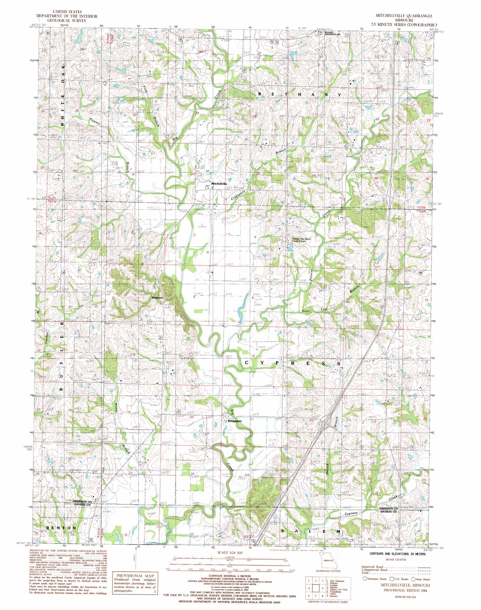
USGS Topo Quad 40094b1 - 1:24,000 scale
| Topo Map Name: | Mitchellville |
| USGS Topo Quad ID: | 40094b1 |
| Print Size: | ca. 21 1/4" wide x 27" high |
| Southeast Coordinates: | 40.125° N latitude / 94° W longitude |
| Map Center Coordinates: | 40.1875° N latitude / 94.0625° W longitude |
| U.S. State: | MO |
| Filename: | o40094b1.jpg |
| Download Map JPG Image: | Mitchellville topo map 1:24,000 scale |
| Map Type: | Topographic |
| Topo Series: | 7.5´ |
| Map Scale: | 1:24,000 |
| Source of Map Images: | United States Geological Survey (USGS) |
| Alternate Map Versions: |
Mitchellville MO 1984, updated 1985 Download PDF Buy paper map Mitchellville MO 2011 Download PDF Buy paper map Mitchellville MO 2014 Download PDF Buy paper map |
1:24,000 Topo Quads surrounding Mitchellville
Allendale |
Washington Center |
Brooklyn |
Eagleville |
Cainsville |
Albany North |
New Hampton |
Bethany |
Gardner |
Mount Moriah |
Albany South |
Matkin |
Mitchellville |
Gilman City West |
Gilman City East |
Berlin |
Pattonsburg |
Coffey |
Jameson |
Bancroft |
Maysville |
Weatherby |
Altamont |
Gallatin |
Jamesport |
> Back to 40094a1 at 1:100,000 scale
> Back to 40094a1 at 1:250,000 scale
> Back to U.S. Topo Maps home
Mitchellville topo map: Gazetteer
Mitchellville: Dams
Nelson Lake Dam elevation 287m 941′Mitchellville: Parks
Miracle Hills Ranch elevation 281m 921′Mitchellville: Populated Places
Bridgeport elevation 253m 830′Mitchellville elevation 262m 859′
Pleasant Ridge elevation 299m 980′
Wildwood elevation 275m 902′
Mitchellville: Post Offices
Happy Valley Post Office elevation 248m 813′Mitchellville: Reservoirs
Nelson Lake elevation 287m 941′Mitchellville: Streams
Crabapple Branch elevation 250m 820′Fleenor Branch elevation 250m 820′
Flint Branch elevation 252m 826′
Herald Branch elevation 253m 830′
Nobel Branch elevation 240m 787′
Polecat Creek elevation 244m 800′
Poor Tom Branch elevation 248m 813′
Mitchellville digital topo map on disk
Buy this Mitchellville topo map showing relief, roads, GPS coordinates and other geographical features, as a high-resolution digital map file on DVD: