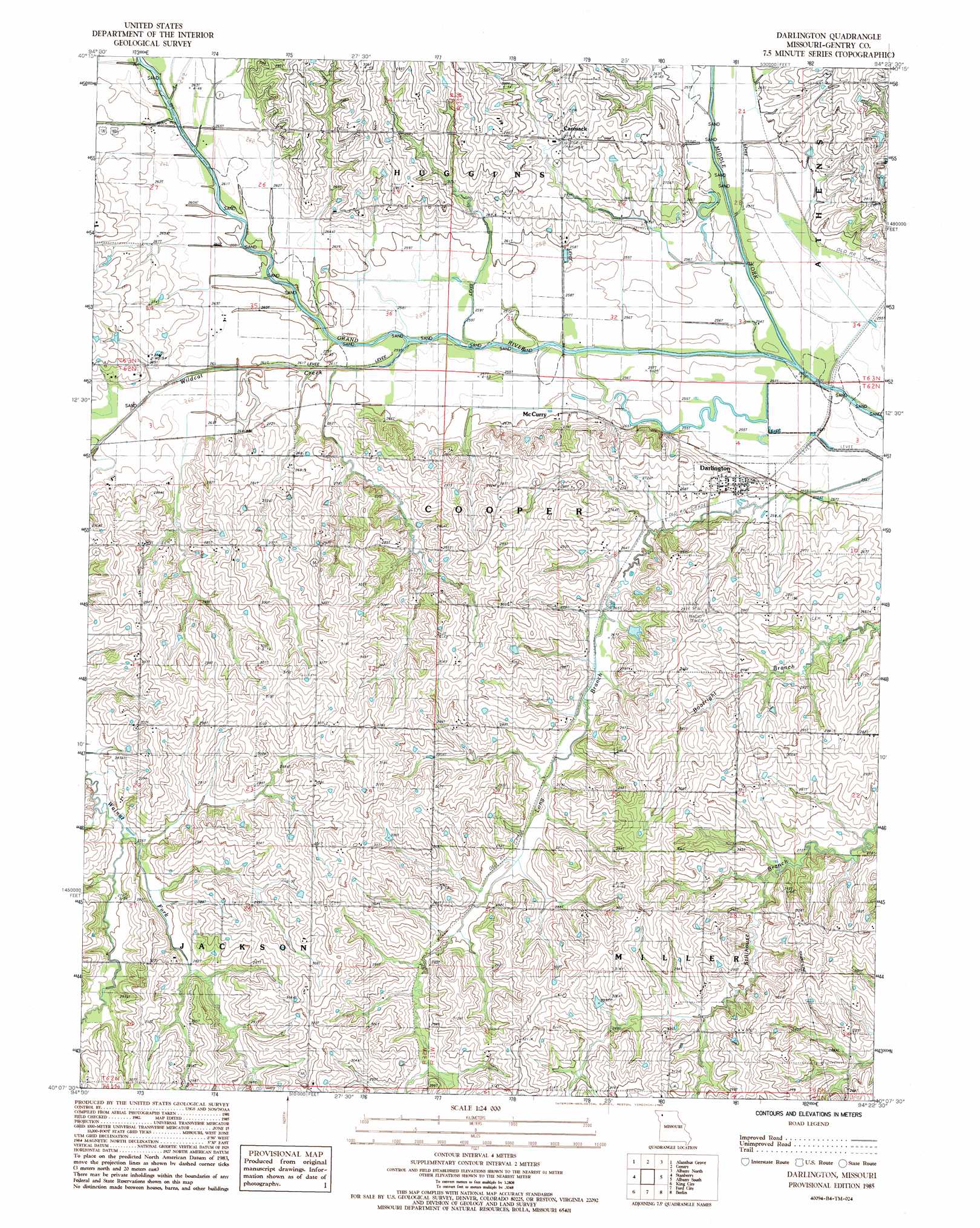
Darlington Topo Map Missouri
To zoom in, hover over the map of Darlington
USGS Topo Quad 40094b4 - 1:24,000 scale
| Topo Map Name: | Darlington |
| USGS Topo Quad ID: | 40094b4 |
| Print Size: | ca. 21 1/4" wide x 27" high |
| Southeast Coordinates: | 40.125° N latitude / 94.375° W longitude |
| Map Center Coordinates: | 40.1875° N latitude / 94.4375° W longitude |
| U.S. State: | MO |
| Filename: | o40094b4.jpg |
| Download Map JPG Image: | Darlington topo map 1:24,000 scale |
| Map Type: | Topographic |
| Topo Series: | 7.5´ |
| Map Scale: | 1:24,000 |
| Source of Map Images: | United States Geological Survey (USGS) |
| Alternate Map Versions: |
Darlington MO 1985, updated 1986 Download PDF Buy paper map Darlington MO 2011 Download PDF Buy paper map Darlington MO 2014 Download PDF Buy paper map |
1:24,000 Topo Quads surrounding Darlington
Parnell West |
Parnell East |
Grant City |
Allendale |
Washington Center |
Ravenwood |
Alanthus Grove |
Gentry |
Albany North |
New Hampton |
Guilford |
Stanberry |
Darlington |
Albany South |
Matkin |
Whitesville |
King City |
Ford City |
Berlin |
Pattonsburg |
Helena |
Union Star |
Wood |
Maysville |
Weatherby |
> Back to 40094a1 at 1:100,000 scale
> Back to 40094a1 at 1:250,000 scale
> Back to U.S. Topo Maps home
Darlington topo map: Gazetteer
Darlington: Dams
Davis Lake Dam elevation 271m 889′Hammond Lake Dam elevation 272m 892′
Lindley Lake Dam elevation 307m 1007′
Thomas Lake Dam elevation 261m 856′
Darlington: Lakes
Rice Lake (historical) elevation 254m 833′Darlington: Populated Places
Carmack elevation 276m 905′Darlington elevation 258m 846′
McCurry elevation 261m 856′
Darlington: Reservoirs
Ettieville Lake elevation 272m 892′Darlington: Streams
Middle Fork Grand River elevation 252m 826′Wildcat Creek elevation 258m 846′
Darlington digital topo map on disk
Buy this Darlington topo map showing relief, roads, GPS coordinates and other geographical features, as a high-resolution digital map file on DVD: