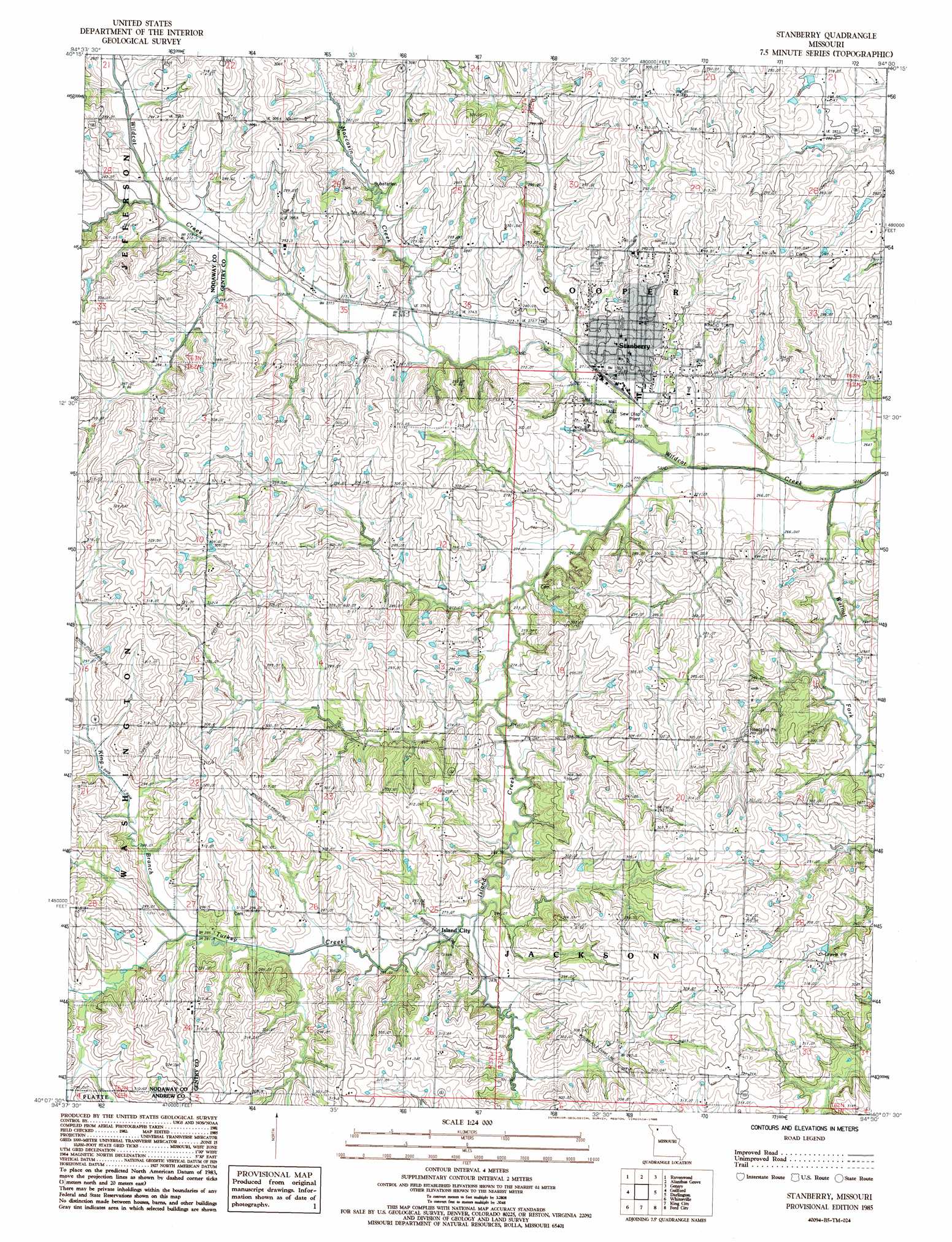
Stanberry Topo Map Missouri
To zoom in, hover over the map of Stanberry
USGS Topo Quad 40094b5 - 1:24,000 scale
| Topo Map Name: | Stanberry |
| USGS Topo Quad ID: | 40094b5 |
| Print Size: | ca. 21 1/4" wide x 27" high |
| Southeast Coordinates: | 40.125° N latitude / 94.5° W longitude |
| Map Center Coordinates: | 40.1875° N latitude / 94.5625° W longitude |
| U.S. State: | MO |
| Filename: | o40094b5.jpg |
| Download Map JPG Image: | Stanberry topo map 1:24,000 scale |
| Map Type: | Topographic |
| Topo Series: | 7.5´ |
| Map Scale: | 1:24,000 |
| Source of Map Images: | United States Geological Survey (USGS) |
| Alternate Map Versions: |
Stanberry MO 1985, updated 1985 Download PDF Buy paper map Stanberry MO 2011 Download PDF Buy paper map Stanberry MO 2014 Download PDF Buy paper map |
1:24,000 Topo Quads surrounding Stanberry
Pickering |
Parnell West |
Parnell East |
Grant City |
Allendale |
Maryville East |
Ravenwood |
Alanthus Grove |
Gentry |
Albany North |
Barnard |
Guilford |
Stanberry |
Darlington |
Albany South |
Blockow |
Whitesville |
King City |
Ford City |
Berlin |
Savannah |
Helena |
Union Star |
Wood |
Maysville |
> Back to 40094a1 at 1:100,000 scale
> Back to 40094a1 at 1:250,000 scale
> Back to U.S. Topo Maps home
Stanberry topo map: Gazetteer
Stanberry: Populated Places
Island City elevation 287m 941′Mount Pleasant elevation 277m 908′
Stanberry elevation 291m 954′
Stanberry: Streams
Island Creek elevation 264m 866′King Branch elevation 284m 931′
Moccasin Creek elevation 268m 879′
Turkey Creek elevation 277m 908′
Walnut Fork elevation 264m 866′
Stanberry digital topo map on disk
Buy this Stanberry topo map showing relief, roads, GPS coordinates and other geographical features, as a high-resolution digital map file on DVD: