Barnard Topo Map Missouri
To zoom in, hover over the map of Barnard
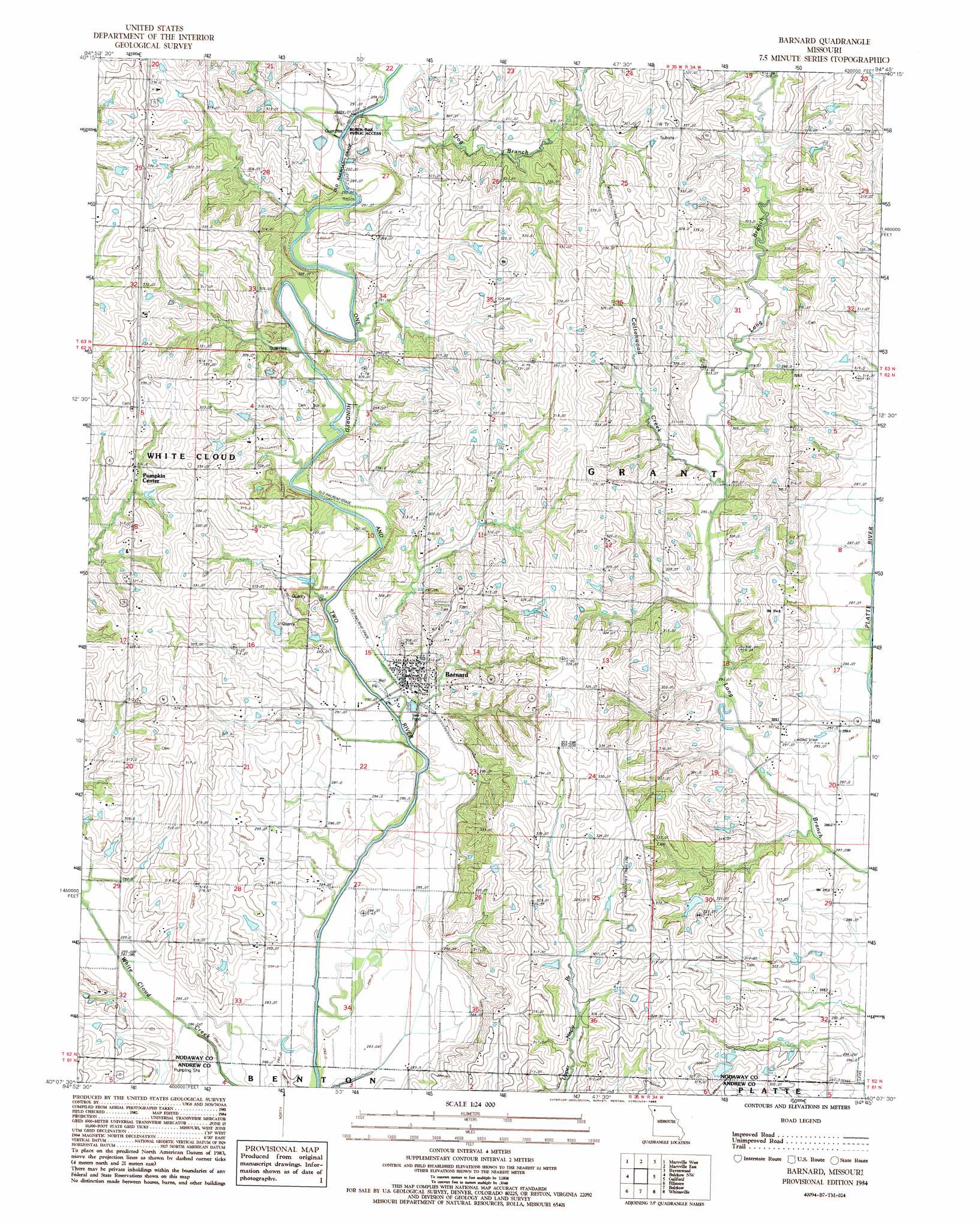
USGS Topo Quad 40094b7 - 1:24,000 scale
| Topo Map Name: | Barnard |
| USGS Topo Quad ID: | 40094b7 |
| Print Size: | ca. 21 1/4" wide x 27" high |
| Southeast Coordinates: | 40.125° N latitude / 94.75° W longitude |
| Map Center Coordinates: | 40.1875° N latitude / 94.8125° W longitude |
| U.S. State: | MO |
| Filename: | o40094b7.jpg |
| Download Map JPG Image: | Barnard topo map 1:24,000 scale |
| Map Type: | Topographic |
| Topo Series: | 7.5´ |
| Map Scale: | 1:24,000 |
| Source of Map Images: | United States Geological Survey (USGS) |
| Alternate Map Versions: |
Barnard MO 1984, updated 1985 Download PDF Buy paper map Barnard MO 2011 Download PDF Buy paper map Barnard MO 2014 Download PDF Buy paper map |
1:24,000 Topo Quads surrounding Barnard
Burlington Junction |
Wilcox |
Pickering |
Parnell West |
Parnell East |
Skidmore |
Maryville West |
Maryville East |
Ravenwood |
Alanthus Grove |
Maitland |
Bolckow Nw |
Barnard |
Guilford |
Stanberry |
New Point |
Fillmore |
Blockow |
Whitesville |
King City |
Forbes |
Amazonia |
Savannah |
Helena |
Union Star |
> Back to 40094a1 at 1:100,000 scale
> Back to 40094a1 at 1:250,000 scale
> Back to U.S. Topo Maps home
Barnard topo map: Gazetteer
Barnard: Dams
Hannah Lake Dam elevation 306m 1003′Barnard: Populated Places
Barnard elevation 294m 964′Pumpkin Center elevation 312m 1023′
Barnard: Reservoirs
Hannah Lake elevation 306m 1003′Barnard: Streams
Cottonwood Creek elevation 292m 958′Dog Branch elevation 289m 948′
Barnard digital topo map on disk
Buy this Barnard topo map showing relief, roads, GPS coordinates and other geographical features, as a high-resolution digital map file on DVD: