Bolckow Nw Topo Map Missouri
To zoom in, hover over the map of Bolckow Nw
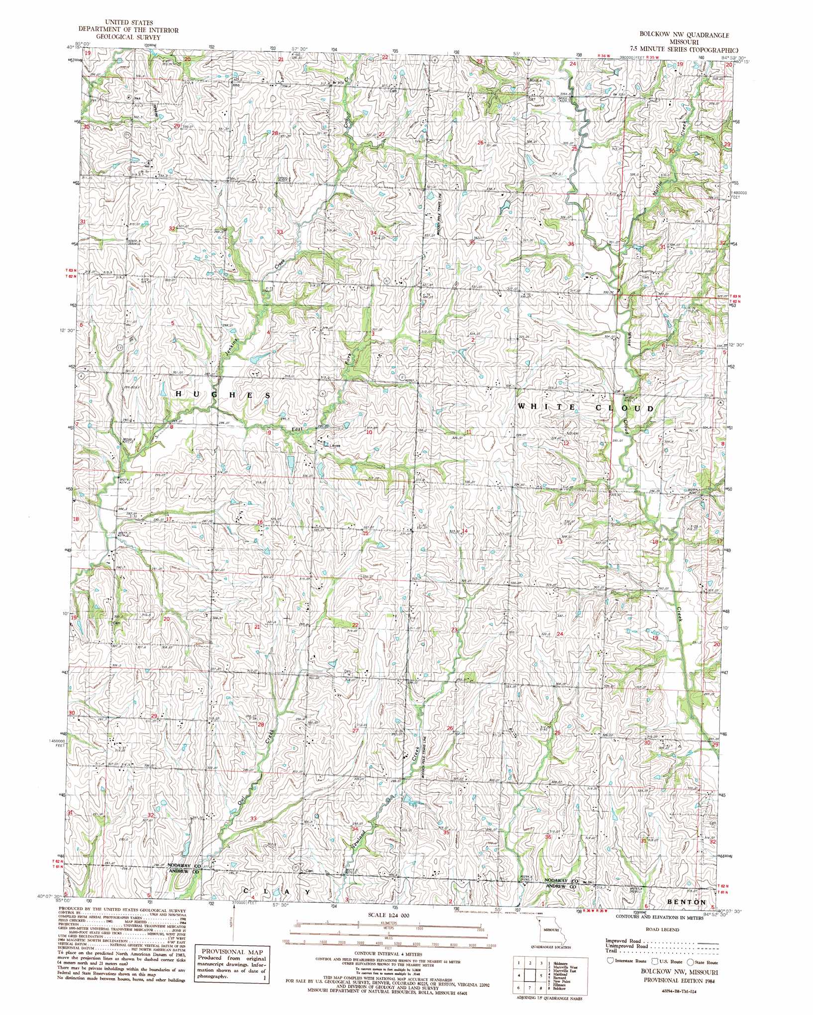
USGS Topo Quad 40094b8 - 1:24,000 scale
| Topo Map Name: | Bolckow Nw |
| USGS Topo Quad ID: | 40094b8 |
| Print Size: | ca. 21 1/4" wide x 27" high |
| Southeast Coordinates: | 40.125° N latitude / 94.875° W longitude |
| Map Center Coordinates: | 40.1875° N latitude / 94.9375° W longitude |
| U.S. State: | MO |
| Filename: | o40094b8.jpg |
| Download Map JPG Image: | Bolckow Nw topo map 1:24,000 scale |
| Map Type: | Topographic |
| Topo Series: | 7.5´ |
| Map Scale: | 1:24,000 |
| Source of Map Images: | United States Geological Survey (USGS) |
| Alternate Map Versions: |
Bolckow NW MO 1984, updated 1985 Download PDF Buy paper map Bolckow NW MO 2011 Download PDF Buy paper map Bolckow NW MO 2014 Download PDF Buy paper map |
1:24,000 Topo Quads surrounding Bolckow Nw
Skidmore Nw |
Burlington Junction |
Wilcox |
Pickering |
Parnell West |
Dotham |
Skidmore |
Maryville West |
Maryville East |
Ravenwood |
Mound City |
Maitland |
Bolckow Nw |
Barnard |
Guilford |
Kimsey Creek |
New Point |
Fillmore |
Blockow |
Whitesville |
Oregon |
Forbes |
Amazonia |
Savannah |
Helena |
> Back to 40094a1 at 1:100,000 scale
> Back to 40094a1 at 1:250,000 scale
> Back to U.S. Topo Maps home
Bolckow Nw topo map: Gazetteer
Bolckow Nw: Populated Places
Whitecloud elevation 303m 994′Bolckow Nw: Post Offices
White Cloud Post Office elevation 303m 994′Bolckow Nw: Streams
Coal Creek elevation 296m 971′East Fork Jenkins Creek elevation 280m 918′
Mullin Creek elevation 300m 984′
Bolckow Nw digital topo map on disk
Buy this Bolckow Nw topo map showing relief, roads, GPS coordinates and other geographical features, as a high-resolution digital map file on DVD: