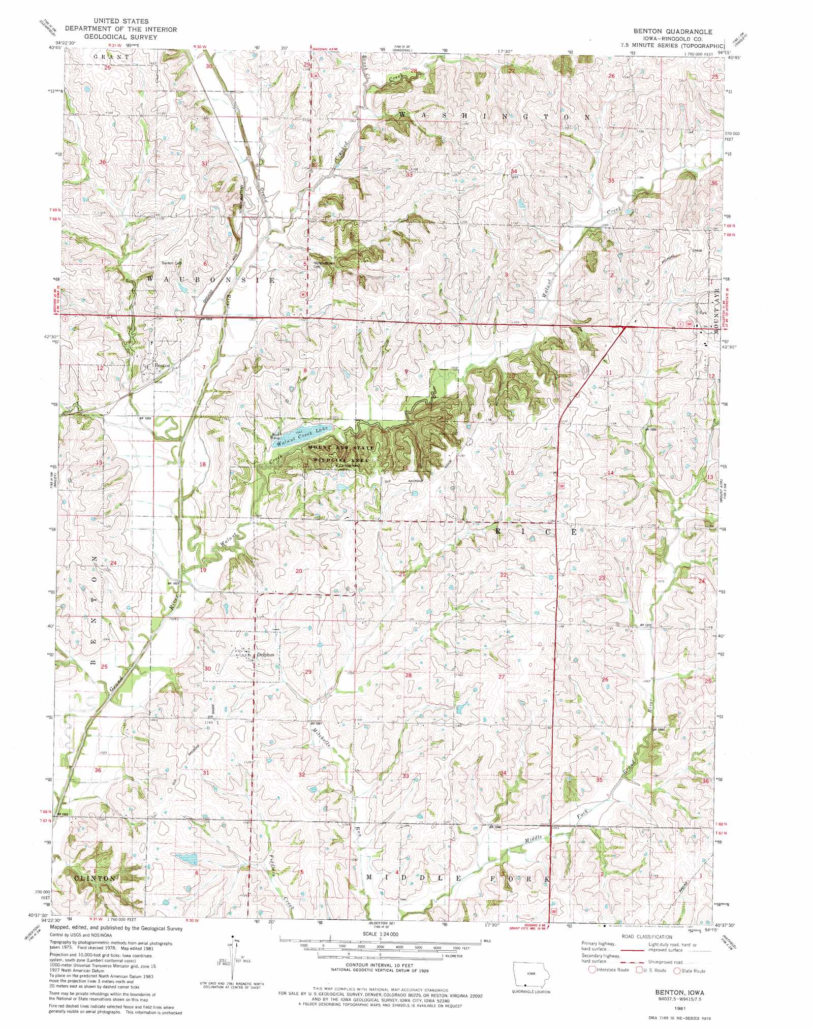
Benton Topo Map Iowa
To zoom in, hover over the map of Benton
USGS Topo Quad 40094f3 - 1:24,000 scale
| Topo Map Name: | Benton |
| USGS Topo Quad ID: | 40094f3 |
| Print Size: | ca. 21 1/4" wide x 27" high |
| Southeast Coordinates: | 40.625° N latitude / 94.25° W longitude |
| Map Center Coordinates: | 40.6875° N latitude / 94.3125° W longitude |
| U.S. State: | IA |
| Filename: | o40094f3.jpg |
| Download Map JPG Image: | Benton topo map 1:24,000 scale |
| Map Type: | Topographic |
| Topo Series: | 7.5´ |
| Map Scale: | 1:24,000 |
| Source of Map Images: | United States Geological Survey (USGS) |
| Alternate Map Versions: |
Benton IA 1981, updated 1981 Download PDF Buy paper map Benton IA 2010 Download PDF Buy paper map Benton IA 2013 Download PDF Buy paper map Benton IA 2015 Download PDF Buy paper map |
1:24,000 Topo Quads surrounding Benton
Lenox |
Kent |
Shannon City |
Arispe |
Tingley Ne |
Merle Junction |
Clearfield |
Diagonal |
Tingley |
Ellston |
Conway |
Maloy |
Benton |
Mount Ayr |
Kellerton |
Sheridan |
Blockton |
Blockton Se |
Hatfield |
Pawnee |
Parnell East |
Grant City |
Allendale |
Washington Center |
Brooklyn |
> Back to 40094e1 at 1:100,000 scale
> Back to 40094a1 at 1:250,000 scale
> Back to U.S. Topo Maps home
Benton topo map: Gazetteer
Benton: Areas
Mount Ayr State Wildlife Area elevation 343m 1125′Benton: Dams
Walnut Creek Duck Marsh Dam elevation 318m 1043′Benton: Populated Places
Benton elevation 330m 1082′Delphos elevation 347m 1138′
Marshall (historical) elevation 332m 1089′
Benton: Post Offices
Benton Post Office elevation 330m 1082′Delphos Post Office elevation 346m 1135′
Estella Post Office (historical) elevation 336m 1102′
Benton: Reservoirs
Walnut Creek Lake elevation 322m 1056′Benton: Streams
Brush Creek elevation 320m 1049′Crooked Creek elevation 313m 1026′
Walnut Creek elevation 313m 1026′
Benton digital topo map on disk
Buy this Benton topo map showing relief, roads, GPS coordinates and other geographical features, as a high-resolution digital map file on DVD: