Arispe Topo Map Iowa
To zoom in, hover over the map of Arispe
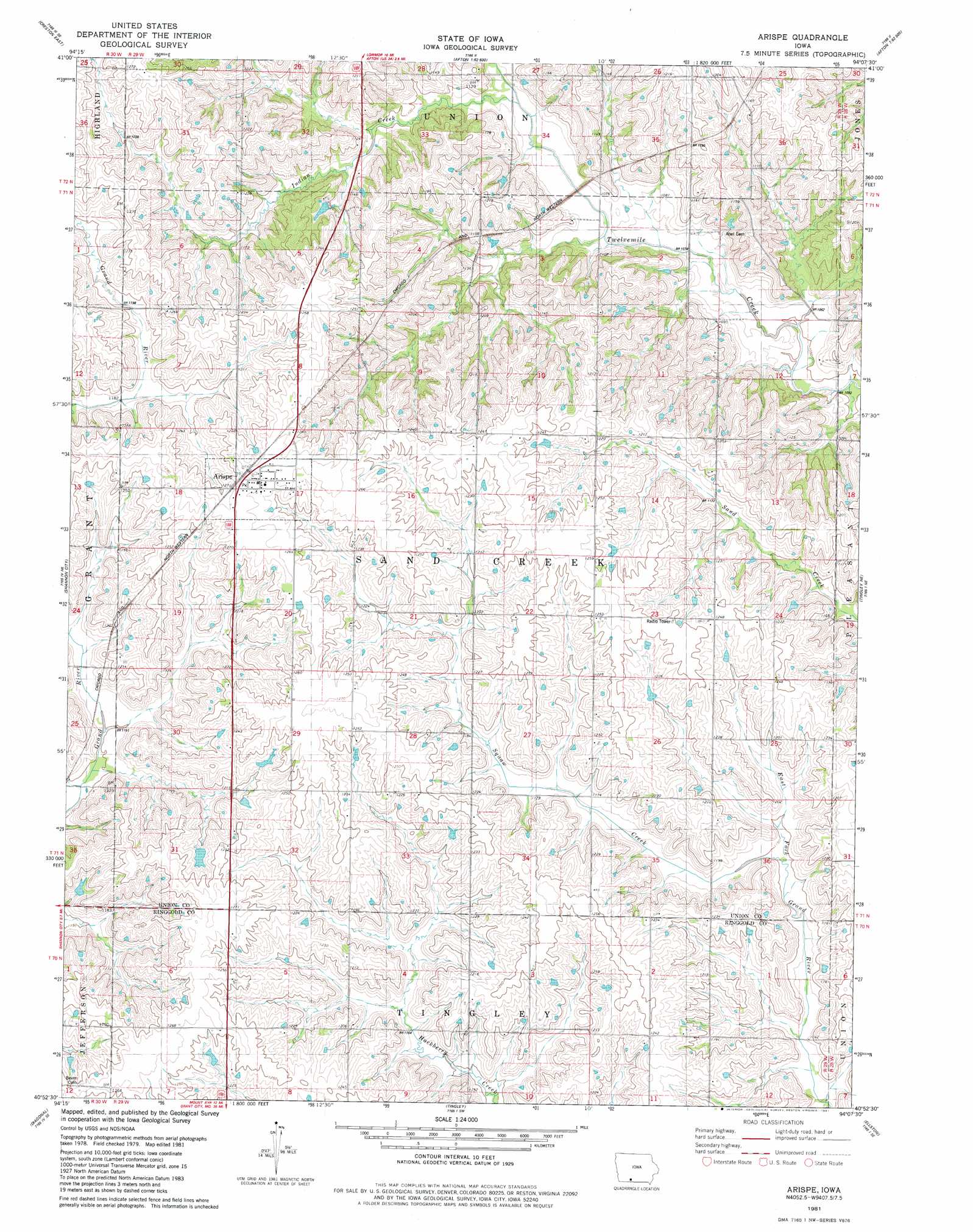
USGS Topo Quad 40094h2 - 1:24,000 scale
| Topo Map Name: | Arispe |
| USGS Topo Quad ID: | 40094h2 |
| Print Size: | ca. 21 1/4" wide x 27" high |
| Southeast Coordinates: | 40.875° N latitude / 94.125° W longitude |
| Map Center Coordinates: | 40.9375° N latitude / 94.1875° W longitude |
| U.S. State: | IA |
| Filename: | o40094h2.jpg |
| Download Map JPG Image: | Arispe topo map 1:24,000 scale |
| Map Type: | Topographic |
| Topo Series: | 7.5´ |
| Map Scale: | 1:24,000 |
| Source of Map Images: | United States Geological Survey (USGS) |
| Alternate Map Versions: |
Arispe IA 1981, updated 1981 Download PDF Buy paper map Arispe IA 2010 Download PDF Buy paper map Arispe IA 2013 Download PDF Buy paper map Arispe IA 2015 Download PDF Buy paper map |
1:24,000 Topo Quads surrounding Arispe
Orient |
Zion |
Macksburg |
Lorimor North |
East Peru |
Creston West |
Creston East |
Afton |
Lorimor South |
Murray |
Kent |
Shannon City |
Arispe |
Tingley Ne |
Hopeville |
Clearfield |
Diagonal |
Tingley |
Ellston |
Grand River |
Maloy |
Benton |
Mount Ayr |
Kellerton |
Lamoni North |
> Back to 40094e1 at 1:100,000 scale
> Back to 40094a1 at 1:250,000 scale
> Back to U.S. Topo Maps home
Arispe topo map: Gazetteer
Arispe: Populated Places
Arispe elevation 387m 1269′Shepard (historical) elevation 353m 1158′
Arispe: Post Offices
Arispe Post Office elevation 387m 1269′Olivet Post Office (historical) elevation 384m 1259′
Shepard Post Office (historical) elevation 354m 1161′
Arispe: Streams
Indian Creek elevation 327m 1072′Arispe digital topo map on disk
Buy this Arispe topo map showing relief, roads, GPS coordinates and other geographical features, as a high-resolution digital map file on DVD: