Kimsey Creek Topo Map Missouri
To zoom in, hover over the map of Kimsey Creek
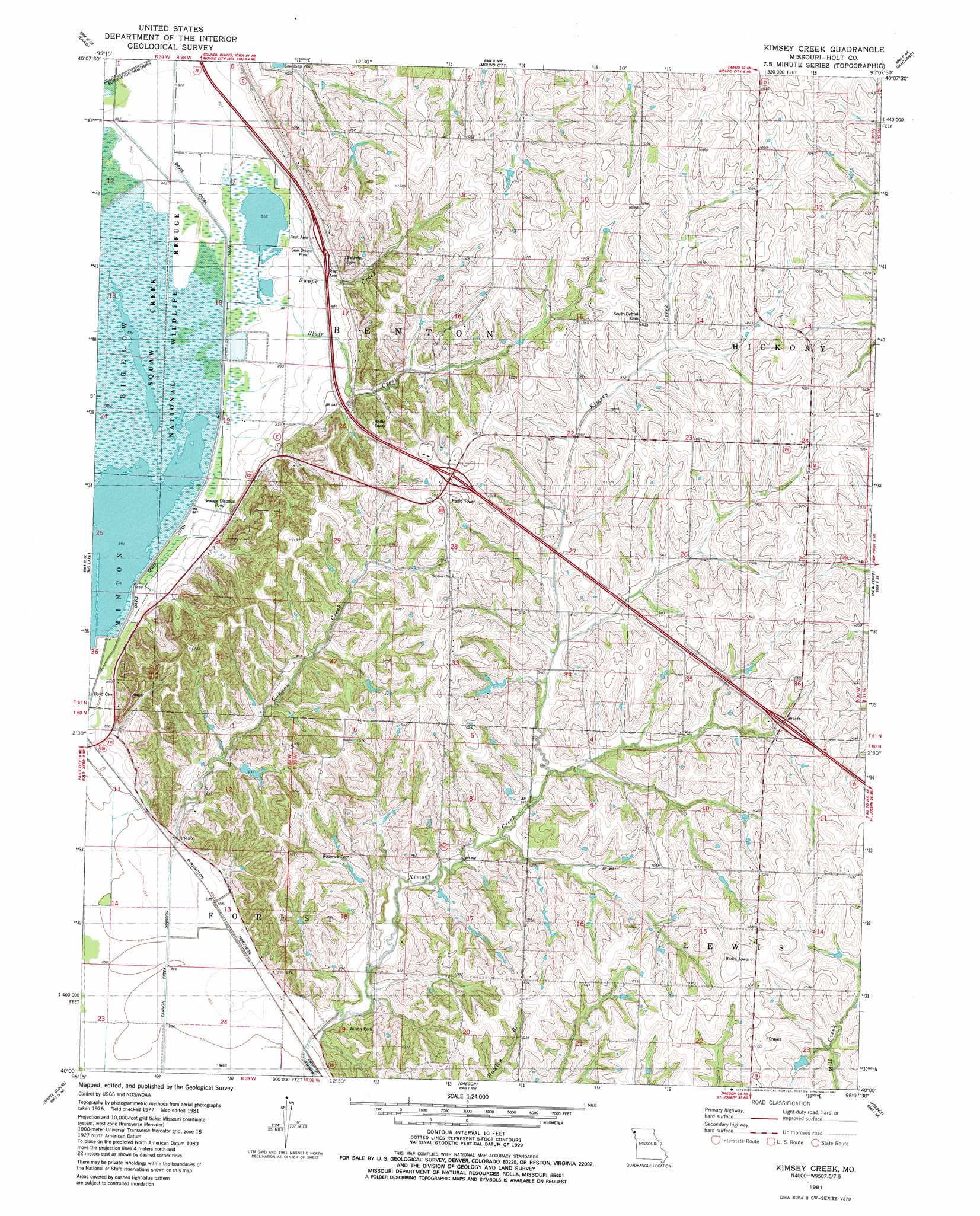
USGS Topo Quad 40095a2 - 1:24,000 scale
| Topo Map Name: | Kimsey Creek |
| USGS Topo Quad ID: | 40095a2 |
| Print Size: | ca. 21 1/4" wide x 27" high |
| Southeast Coordinates: | 40° N latitude / 95.125° W longitude |
| Map Center Coordinates: | 40.0625° N latitude / 95.1875° W longitude |
| U.S. State: | MO |
| Filename: | o40095a2.jpg |
| Download Map JPG Image: | Kimsey Creek topo map 1:24,000 scale |
| Map Type: | Topographic |
| Topo Series: | 7.5´ |
| Map Scale: | 1:24,000 |
| Source of Map Images: | United States Geological Survey (USGS) |
| Alternate Map Versions: |
Kimsey Creek MO 1981, updated 1982 Download PDF Buy paper map Kimsey Creek MO 2012 Download PDF Buy paper map Kimsey Creek MO 2015 Download PDF Buy paper map |
1:24,000 Topo Quads surrounding Kimsey Creek
Fairfax |
Tarkio Se |
Dotham |
Skidmore |
Maryville West |
Corning |
Craig |
Mound City |
Maitland |
Bolckow Nw |
Rulo |
Big Lake |
Kimsey Creek |
New Point |
Fillmore |
Highland Nw |
White Cloud |
Oregon |
Forbes |
Amazonia |
Robinson |
Highland |
Sparks |
Troy |
Wathena |
> Back to 40095a1 at 1:100,000 scale
> Back to 40094a1 at 1:250,000 scale
> Back to U.S. Topo Maps home
Kimsey Creek topo map: Gazetteer
Kimsey Creek: Canals
Cannon Creek Diversion elevation 260m 853′Kimsey Creek: Dams
Bailey Lake Dam elevation 311m 1020′Gordan Lake Dam elevation 284m 931′
John Hall Dam elevation 295m 967′
Marion Mendenhall Dam elevation 283m 928′
Number 831 Dam elevation 318m 1043′
Kimsey Creek: Lakes
Bluff Pool elevation 261m 856′Eagle Pool elevation 260m 853′
Kimsey Creek: Reservoirs
Bailey Lake elevation 311m 1020′Gordan Lake elevation 284m 931′
John Hall Lake elevation 295m 967′
Kimsey Creek: Streams
Blair Creek elevation 262m 859′Cannon Creek elevation 261m 856′
Davis Creek elevation 260m 853′
Kimsey Creek elevation 260m 853′
Little Tarkio Creek elevation 259m 849′
Swope Creek elevation 263m 862′
Kimsey Creek digital topo map on disk
Buy this Kimsey Creek topo map showing relief, roads, GPS coordinates and other geographical features, as a high-resolution digital map file on DVD: