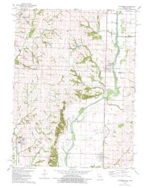
Clearmont Topo Map Missouri
To zoom in, hover over the map of Clearmont
USGS Topo Quad 40095e1 - 1:24,000 scale
| Topo Map Name: | Clearmont |
| USGS Topo Quad ID: | 40095e1 |
| Print Size: | ca. 21 1/4" wide x 27" high |
| Southeast Coordinates: | 40.5° N latitude / 95° W longitude |
| Map Center Coordinates: | 40.5625° N latitude / 95.0625° W longitude |
| U.S. States: | MO, IA |
| Filename: | o40095e1.jpg |
| Download Map JPG Image: | Clearmont topo map 1:24,000 scale |
| Map Type: | Topographic |
| Topo Series: | 7.5´ |
| Map Scale: | 1:24,000 |
| Source of Map Images: | United States Geological Survey (USGS) |
| Alternate Map Versions: |
Clearmont MO 1981, updated 1981 Download PDF Buy paper map Clearmont MO 2010 Download PDF Buy paper map Clearmont MO 2012 Download PDF Buy paper map Clearmont MO 2015 Download PDF Buy paper map |
1:24,000 Topo Quads surrounding Clearmont
> Back to 40095e1 at 1:100,000 scale
> Back to 40094a1 at 1:250,000 scale
> Back to U.S. Topo Maps home
Clearmont topo map: Gazetteer
Clearmont: Dams
Pruitt Lake Dam elevation 318m 1043′Clearmont: Mines
Shambaugh Quarry elevation 292m 958′Clearmont: Parks
Braddy Park elevation 301m 987′Clearmont: Populated Places
Braddyville elevation 300m 984′Clearmont elevation 296m 971′
College Springs elevation 351m 1151′
Elmo elevation 313m 1026′
Clearmont: Post Offices
Braddyville Post Office elevation 303m 994′College Springs Post Office elevation 351m 1151′
Clearmont: Reservoirs
Pruitt Lake elevation 318m 1043′Clearmont: Streams
Buchanan Creek elevation 287m 941′East Mill Creek elevation 307m 1007′
Jerry Creek elevation 290m 951′
Middle Mill Creek elevation 311m 1020′
Moss Branch elevation 290m 951′
Sink Creek elevation 281m 921′
Wolf Creek elevation 282m 925′
Clearmont digital topo map on disk
Buy this Clearmont topo map showing relief, roads, GPS coordinates and other geographical features, as a high-resolution digital map file on DVD:


