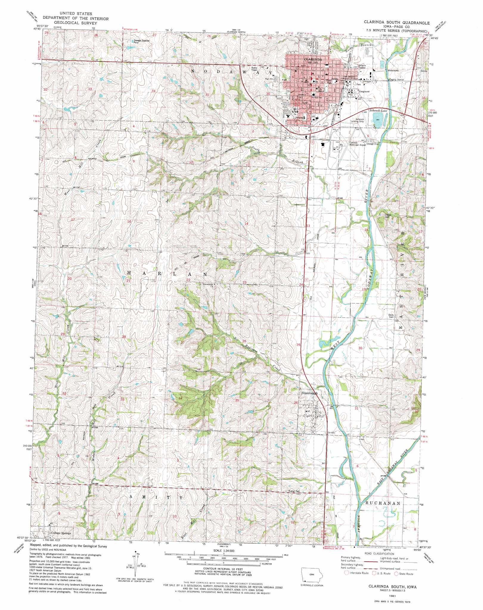
Clarinda South Topo Map Iowa
To zoom in, hover over the map of Clarinda South
USGS Topo Quad 40095f1 - 1:24,000 scale
| Topo Map Name: | Clarinda South |
| USGS Topo Quad ID: | 40095f1 |
| Print Size: | ca. 21 1/4" wide x 27" high |
| Southeast Coordinates: | 40.625° N latitude / 95° W longitude |
| Map Center Coordinates: | 40.6875° N latitude / 95.0625° W longitude |
| U.S. State: | IA |
| Filename: | o40095f1.jpg |
| Download Map JPG Image: | Clarinda South topo map 1:24,000 scale |
| Map Type: | Topographic |
| Topo Series: | 7.5´ |
| Map Scale: | 1:24,000 |
| Source of Map Images: | United States Geological Survey (USGS) |
| Alternate Map Versions: |
Clarinda South IA 1981, updated 1981 Download PDF Buy paper map Clarinda South IA 2010 Download PDF Buy paper map Clarinda South IA 2013 Download PDF Buy paper map Clarinda South IA 2015 Download PDF Buy paper map |
1:24,000 Topo Quads surrounding Clarinda South
Coburg |
Red Oak South |
Stanton |
Villisca |
Brooks |
Shenandoah East |
Stanton Sw |
Clarinda North |
Hawleyville |
Guss |
Bingham |
Coin |
Clarinda South |
New Market |
Ladoga |
Westboro |
Blanchard |
Clearmont |
Hopkins Sw |
Hopkins |
Tarkio East |
Skidmore Nw |
Burlington Junction |
Wilcox |
Pickering |
> Back to 40095e1 at 1:100,000 scale
> Back to 40094a1 at 1:250,000 scale
> Back to U.S. Topo Maps home
Clarinda South topo map: Gazetteer
Clarinda South: Airports
Clarinda Municipal Airport elevation 300m 984′Schenck Landing Strip elevation 300m 984′
Clarinda South: Lakes
Schenck Lake elevation 299m 980′Clarinda South: Parks
Clarinda City Park elevation 304m 997′Foster Park elevation 309m 1013′
Jessie Field Shambaugh State Historical Marker elevation 304m 997′
Site of First School Building in Clarinda Historical Marker elevation 317m 1040′
Tribute to Glenn Miller Historical Marker elevation 305m 1000′
Clarinda South: Populated Places
Clarinda elevation 318m 1043′Shambaugh elevation 300m 984′
Clarinda South: Post Offices
Clarinda Post Office elevation 317m 1040′Nodaway Mills Post Office (historical) elevation 299m 980′
Shambaugh Post Office elevation 300m 984′
Clarinda South: Streams
East Nodaway River elevation 288m 944′No Business Creek elevation 287m 941′
North Branch West Nodaway River elevation 296m 971′
South Branch West Nodaway River elevation 292m 958′
Thomas Ditch elevation 297m 974′
West Nodaway River elevation 288m 944′
Clarinda South digital topo map on disk
Buy this Clarinda South topo map showing relief, roads, GPS coordinates and other geographical features, as a high-resolution digital map file on DVD: