Stanton Sw Topo Map Iowa
To zoom in, hover over the map of Stanton Sw
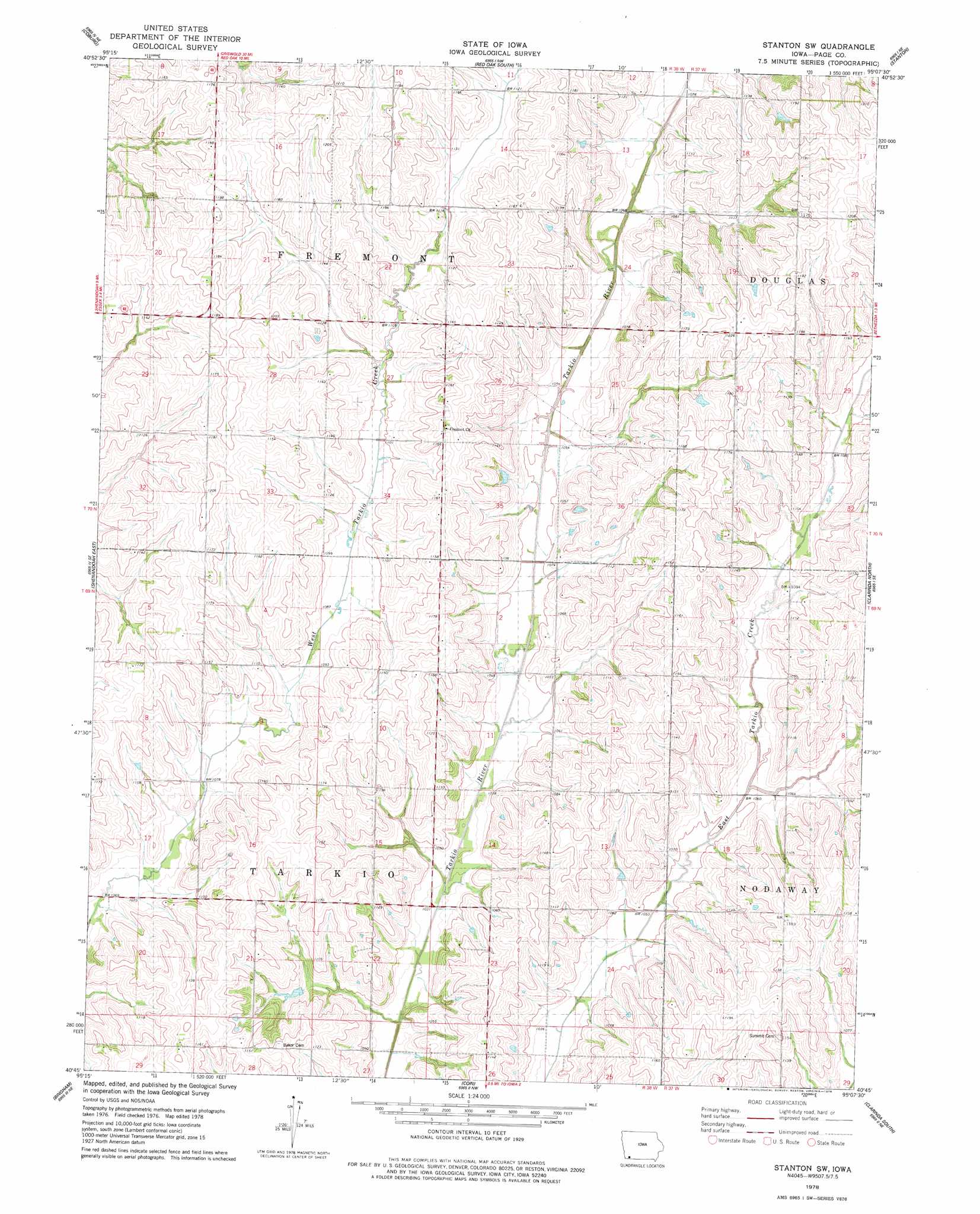
USGS Topo Quad 40095g2 - 1:24,000 scale
| Topo Map Name: | Stanton Sw |
| USGS Topo Quad ID: | 40095g2 |
| Print Size: | ca. 21 1/4" wide x 27" high |
| Southeast Coordinates: | 40.75° N latitude / 95.125° W longitude |
| Map Center Coordinates: | 40.8125° N latitude / 95.1875° W longitude |
| U.S. State: | IA |
| Filename: | o40095g2.jpg |
| Download Map JPG Image: | Stanton Sw topo map 1:24,000 scale |
| Map Type: | Topographic |
| Topo Series: | 7.5´ |
| Map Scale: | 1:24,000 |
| Source of Map Images: | United States Geological Survey (USGS) |
| Alternate Map Versions: |
Stanton SW IA 1978, updated 1978 Download PDF Buy paper map Stanton SW IA 2010 Download PDF Buy paper map Stanton SW IA 2013 Download PDF Buy paper map Stanton SW IA 2015 Download PDF Buy paper map |
1:24,000 Topo Quads surrounding Stanton Sw
Emerson |
Walles |
Red Oak North |
Wallin |
Morton Mills |
Imogene |
Coburg |
Red Oak South |
Stanton |
Villisca |
Shenandoah West |
Shenandoah East |
Stanton Sw |
Clarinda North |
Hawleyville |
Farragut |
Bingham |
Coin |
Clarinda South |
New Market |
Farmers City |
Westboro |
Blanchard |
Clearmont |
Hopkins Sw |
> Back to 40095e1 at 1:100,000 scale
> Back to 40094a1 at 1:250,000 scale
> Back to U.S. Topo Maps home
Stanton Sw topo map: Gazetteer
Stanton Sw: Post Offices
Darwin Post Office (historical) elevation 332m 1089′Dasie Post Office (historical) elevation 349m 1145′
North Grove Post Office (historical) elevation 370m 1213′
Stanton Sw digital topo map on disk
Buy this Stanton Sw topo map showing relief, roads, GPS coordinates and other geographical features, as a high-resolution digital map file on DVD: