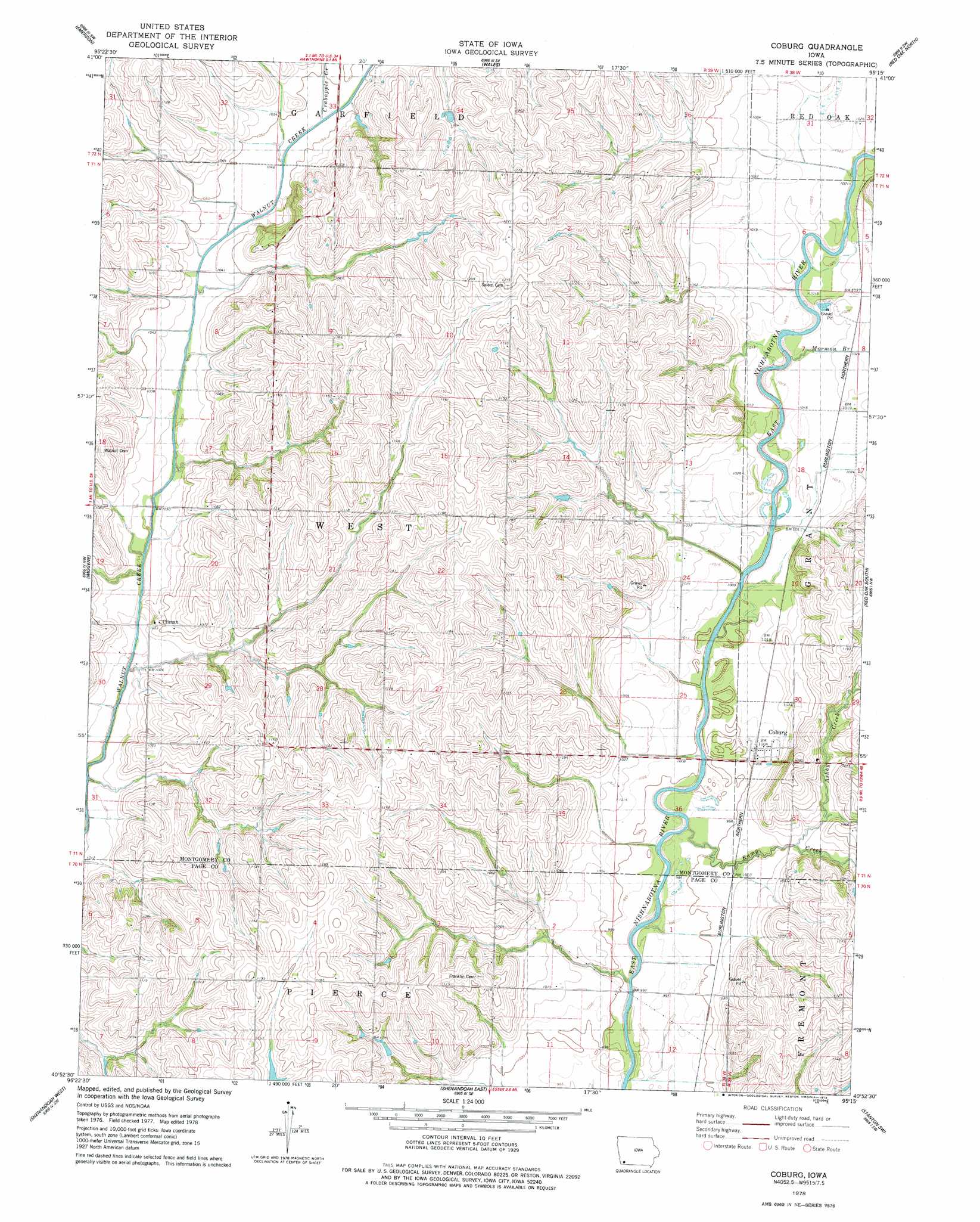
Coburg Topo Map Iowa
To zoom in, hover over the map of Coburg
USGS Topo Quad 40095h3 - 1:24,000 scale
| Topo Map Name: | Coburg |
| USGS Topo Quad ID: | 40095h3 |
| Print Size: | ca. 21 1/4" wide x 27" high |
| Southeast Coordinates: | 40.875° N latitude / 95.25° W longitude |
| Map Center Coordinates: | 40.9375° N latitude / 95.3125° W longitude |
| U.S. State: | IA |
| Filename: | o40095h3.jpg |
| Download Map JPG Image: | Coburg topo map 1:24,000 scale |
| Map Type: | Topographic |
| Topo Series: | 7.5´ |
| Map Scale: | 1:24,000 |
| Source of Map Images: | United States Geological Survey (USGS) |
| Alternate Map Versions: |
Coburg IA 1978, updated 1978 Download PDF Buy paper map Coburg IA 2010 Download PDF Buy paper map Coburg IA 2013 Download PDF Buy paper map Coburg IA 2015 Download PDF Buy paper map |
1:24,000 Topo Quads surrounding Coburg
Treynor |
Carson |
Carson Ne |
Griswold |
Griswold Ne |
Malvern |
Emerson |
Walles |
Red Oak North |
Wallin |
Tabor Ne |
Imogene |
Coburg |
Red Oak South |
Stanton |
Randolph |
Shenandoah West |
Shenandoah East |
Stanton Sw |
Clarinda North |
Riverton |
Farragut |
Bingham |
Coin |
Clarinda South |
> Back to 40095e1 at 1:100,000 scale
> Back to 40094a1 at 1:250,000 scale
> Back to U.S. Topo Maps home
Coburg topo map: Gazetteer
Coburg: Populated Places
Climax elevation 314m 1030′Coburg elevation 307m 1007′
Coburg: Post Offices
Carr's Point Post Office (historical) elevation 324m 1062′Climax Post Office (historical) elevation 314m 1030′
Coburg Post Office (historical) elevation 307m 1007′
Franklin Grove Post Office (historical) elevation 340m 1115′
Coburg: Streams
Ashby Creek elevation 306m 1003′Crabapple Creek elevation 317m 1040′
Mormon Branch elevation 307m 1007′
Ramp Creek elevation 302m 990′
Coburg digital topo map on disk
Buy this Coburg topo map showing relief, roads, GPS coordinates and other geographical features, as a high-resolution digital map file on DVD: