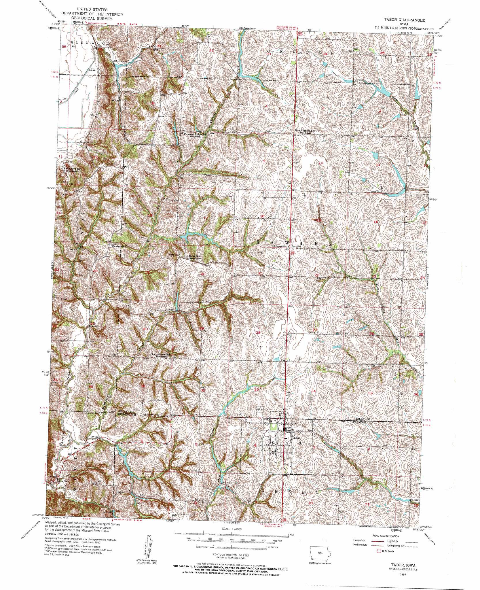
Tabor Topo Map Iowa
To zoom in, hover over the map of Tabor
USGS Topo Quad 40095h6 - 1:24,000 scale
| Topo Map Name: | Tabor |
| USGS Topo Quad ID: | 40095h6 |
| Print Size: | ca. 21 1/4" wide x 27" high |
| Southeast Coordinates: | 40.875° N latitude / 95.625° W longitude |
| Map Center Coordinates: | 40.9375° N latitude / 95.6875° W longitude |
| U.S. State: | IA |
| Filename: | o40095h6.jpg |
| Download Map JPG Image: | Tabor topo map 1:24,000 scale |
| Map Type: | Topographic |
| Topo Series: | 7.5´ |
| Map Scale: | 1:24,000 |
| Source of Map Images: | United States Geological Survey (USGS) |
| Alternate Map Versions: |
Tabor IA 1957, updated 1958 Download PDF Buy paper map Tabor IA 1957, updated 1964 Download PDF Buy paper map Tabor IA 2010 Download PDF Buy paper map Tabor IA 2013 Download PDF Buy paper map Tabor IA 2015 Download PDF Buy paper map |
1:24,000 Topo Quads surrounding Tabor
Omaha South |
Council Bluffs South |
Mineola |
Treynor |
Carson |
Plattsmouth |
Pacific Junction |
Glenwood |
Malvern |
Emerson |
Murray |
Rock Bluff |
Tabor |
Tabor Ne |
Imogene |
Nehawka |
Mcpaul |
Tabor Sw |
Randolph |
Shenandoah West |
Nebraska City Nw |
Nebraska City |
Sidney |
Riverton |
Farragut |
> Back to 40095e1 at 1:100,000 scale
> Back to 40094a1 at 1:250,000 scale
> Back to U.S. Topo Maps home
Tabor topo map: Gazetteer
Tabor: Parks
Grave of Chief Waubonsie Historical Marker elevation 347m 1138′Pinky's Glen elevation 334m 1095′
Tabor City Park elevation 383m 1256′
Tabor: Populated Places
Tabor elevation 382m 1253′Tabor: Post Offices
Tabor Post Office elevation 382m 1253′Wahaghbonsy Post Office (historical) elevation 364m 1194′
Tabor: Streams
McPherron Creek elevation 295m 967′Tabor digital topo map on disk
Buy this Tabor topo map showing relief, roads, GPS coordinates and other geographical features, as a high-resolution digital map file on DVD: