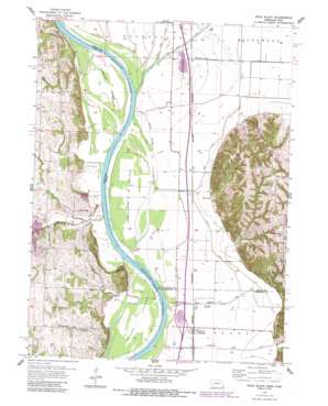
Rock Bluff Topo Map Iowa
To zoom in, hover over the map of Rock Bluff
USGS Topo Quad 40095h7 - 1:24,000 scale
| Topo Map Name: | Rock Bluff |
| USGS Topo Quad ID: | 40095h7 |
| Print Size: | ca. 21 1/4" wide x 27" high |
| Southeast Coordinates: | 40.875° N latitude / 95.75° W longitude |
| Map Center Coordinates: | 40.9375° N latitude / 95.8125° W longitude |
| U.S. States: | IA, NE |
| Filename: | o40095h7.jpg |
| Download Map JPG Image: | Rock Bluff topo map 1:24,000 scale |
| Map Type: | Topographic |
| Topo Series: | 7.5´ |
| Map Scale: | 1:24,000 |
| Source of Map Images: | United States Geological Survey (USGS) |
| Alternate Map Versions: |
Rock Bluff NE 1956, updated 1957 Download PDF Buy paper map Rock Bluff NE 1956, updated 1962 Download PDF Buy paper map Rock Butte NE 1956, updated 1984 Download PDF Buy paper map Rock Bluff NE 2010 Download PDF Buy paper map Rock Bluff NE 2011 Download PDF Buy paper map Rock Bluff NE 2014 Download PDF Buy paper map |
1:24,000 Topo Quads surrounding Rock Bluff
> Back to 40095e1 at 1:100,000 scale
> Back to 40094a1 at 1:250,000 scale
> Back to U.S. Topo Maps home
Rock Bluff topo map: Gazetteer
Rock Bluff: Canals
Mills Fremont Ditch elevation 288m 944′Waubonsie Creek Ditch elevation 290m 951′
Rock Bluff: Cliffs
Queen Hill elevation 332m 1089′Rock Bluff elevation 307m 1007′
Rock Bluff: Crossings
Interchange 24 elevation 289m 948′Rock Bluff: Dams
Bartlett Hills Lake Dam elevation 317m 1040′Beaver Lake Dam elevation 310m 1017′
Rock Bluff: Guts
Honey Slough elevation 290m 951′Rock Bluff: Islands
Goose Island elevation 287m 941′Noddleman Island elevation 288m 944′
Tobacco Island elevation 290m 951′
Rock Bluff: Lakes
Lake Wahaboncey (historical) elevation 288m 944′Rock Bluff: Parks
Bartlett State Wildlife Management Area elevation 286m 938′Keg Lake Wildlife Management Area elevation 290m 951′
Rock Bluff: Populated Places
Bartlett elevation 288m 944′Burr Oak elevation 300m 984′
Kanosha (historical) elevation 322m 1056′
Rock Bluff (historical) elevation 305m 1000′
Rock Bluff: Post Offices
Alps Post Office (historical) elevation 289m 948′Bartlett Post Office (historical) elevation 288m 944′
Haynie Post Office (historical) elevation 287m 941′
Kanosha Post Office (historical) elevation 322m 1056′
Osage Post Office (historical) elevation 288m 944′
Rock Bluff Post Office (historical) elevation 305m 1000′
Rock Bluff: Reservoirs
Beaver Lake elevation 310m 1017′Keg Creek Lake elevation 290m 951′
Rock Bluff: Ridges
Sargents Spur elevation 289m 948′Rock Bluff: Streams
Keg Creek elevation 284m 931′Kenosha Creek elevation 289m 948′
Mud Creek elevation 287m 941′
Pony Creek elevation 290m 951′
Waubonsie Creek elevation 288m 944′
Rock Bluff: Summits
King Hill elevation 359m 1177′Rock Bluff digital topo map on disk
Buy this Rock Bluff topo map showing relief, roads, GPS coordinates and other geographical features, as a high-resolution digital map file on DVD:


