Ruskin Topo Map Nebraska
To zoom in, hover over the map of Ruskin
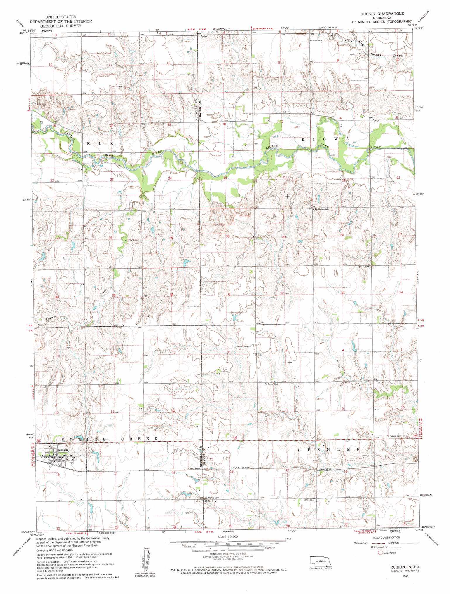
USGS Topo Quad 40097b7 - 1:24,000 scale
| Topo Map Name: | Ruskin |
| USGS Topo Quad ID: | 40097b7 |
| Print Size: | ca. 21 1/4" wide x 27" high |
| Southeast Coordinates: | 40.125° N latitude / 97.75° W longitude |
| Map Center Coordinates: | 40.1875° N latitude / 97.8125° W longitude |
| U.S. State: | NE |
| Filename: | O40097b7.jpg |
| Download Map JPG Image: | Ruskin topo map 1:24,000 scale |
| Map Type: | Topographic |
| Topo Series: | 7.5´ |
| Map Scale: | 1:24,000 |
| Source of Map Images: | United States Geological Survey (USGS) |
| Alternate Map Versions: |
Ruskin NE 1960, updated 1962 Download PDF Buy paper map Ruskin NE 2011 Download PDF Buy paper map Ruskin NE 2014 Download PDF Buy paper map |
1:24,000 Topo Quads surrounding Ruskin
Fairfield |
Edgar Nw |
Ong |
Shickley |
Strang |
Fairfield Se |
Edgar |
Davenport |
Carleton |
Bruning |
Nelson |
Oak |
Ruskin |
Deshler |
Hebron |
Superior |
Hardy |
Byron |
Hebron Sw |
Chester |
Webber |
Scandia Nw |
Republic |
Belleville Nw |
Munden |
> Back to 40097a1 at 1:100,000 scale
> Back to 40096a1 at 1:250,000 scale
> Back to U.S. Topo Maps home
Ruskin topo map: Gazetteer
Ruskin: Dams
Drohman Dam elevation 492m 1614′Ehlers Dam elevation 484m 1587′
Lipker Dam elevation 500m 1640′
Ruskin: Parks
Ruskin Ball Field and Park elevation 512m 1679′Ruskin: Populated Places
Ruskin elevation 512m 1679′Ruskin: Post Offices
Ruskin Post Office elevation 512m 1679′Ruskin: Reservoirs
Drohman Reservoir elevation 492m 1614′Ehlers Reservoir elevation 484m 1587′
Lipker Reservoir elevation 500m 1640′
Ruskin: Streams
Thawes Creek elevation 468m 1535′Turtle Creek elevation 473m 1551′
Ruskin digital topo map on disk
Buy this Ruskin topo map showing relief, roads, GPS coordinates and other geographical features, as a high-resolution digital map file on DVD: