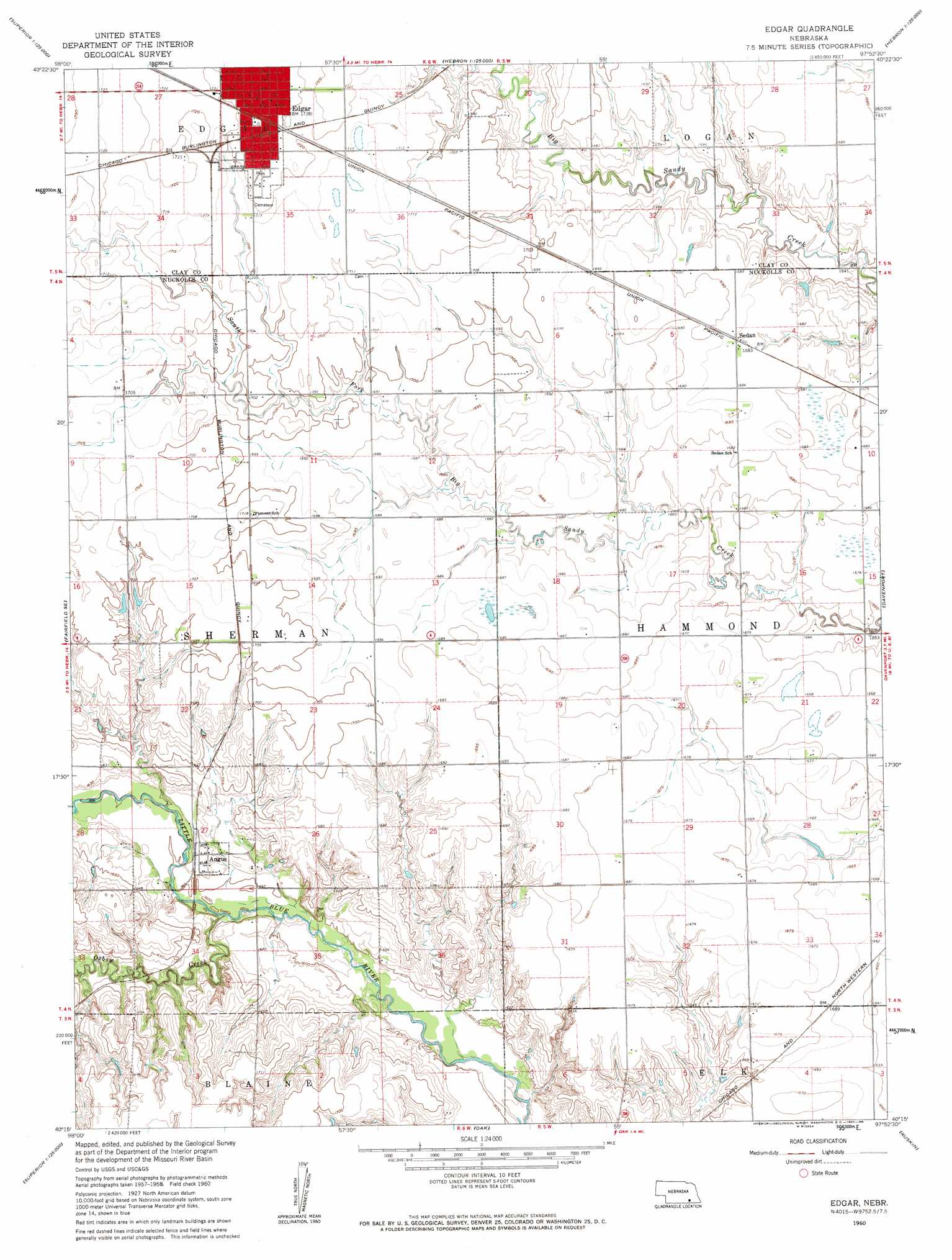
Edgar Topo Map Nebraska
To zoom in, hover over the map of Edgar
USGS Topo Quad 40097c8 - 1:24,000 scale
| Topo Map Name: | Edgar |
| USGS Topo Quad ID: | 40097c8 |
| Print Size: | ca. 21 1/4" wide x 27" high |
| Southeast Coordinates: | 40.25° N latitude / 97.875° W longitude |
| Map Center Coordinates: | 40.3125° N latitude / 97.9375° W longitude |
| U.S. State: | NE |
| Filename: | O40097c8.jpg |
| Download Map JPG Image: | Edgar topo map 1:24,000 scale |
| Map Type: | Topographic |
| Topo Series: | 7.5´ |
| Map Scale: | 1:24,000 |
| Source of Map Images: | United States Geological Survey (USGS) |
| Alternate Map Versions: |
Edgar NE 1960, updated 1961 Download PDF Buy paper map Edgar NE 2011 Download PDF Buy paper map Edgar NE 2014 Download PDF Buy paper map |
1:24,000 Topo Quads surrounding Edgar
Inland |
Harvard |
Saronville |
Sutton |
Geneva Sw |
Fairfield Nw |
Fairfield |
Edgar Nw |
Ong |
Shickley |
Deweese |
Fairfield Se |
Edgar |
Davenport |
Carleton |
Mount Clare |
Nelson |
Oak |
Ruskin |
Deshler |
Bostwick |
Superior |
Hardy |
Byron |
Hebron Sw |
> Back to 40097a1 at 1:100,000 scale
> Back to 40096a1 at 1:250,000 scale
> Back to U.S. Topo Maps home
Edgar topo map: Gazetteer
Edgar: Dams
Drohman Dam-1 Dam elevation 499m 1637′Jensen Dam elevation 494m 1620′
Mazour-Schroeder Dam elevation 510m 1673′
Mountford Dam elevation 497m 1630′
Edgar: Parks
South Park elevation 525m 1722′Standpipe Park elevation 524m 1719′
Edgar: Populated Places
Angus elevation 495m 1624′Edgar elevation 525m 1722′
Sedan elevation 514m 1686′
Edgar: Post Offices
Angus Post Office (historical) elevation 495m 1624′Edgar Post Office elevation 524m 1719′
Sedan Post Office (historical) elevation 514m 1686′
Edgar: Reservoirs
Drohman Reservoir elevation 499m 1637′Jensen Reservoir elevation 494m 1620′
Mazour-Schroeder Reservoir elevation 510m 1673′
Mountford Lake elevation 497m 1630′
Edgar: Streams
Oxbow Creek elevation 485m 1591′Edgar digital topo map on disk
Buy this Edgar topo map showing relief, roads, GPS coordinates and other geographical features, as a high-resolution digital map file on DVD: