Friend Se Topo Map Nebraska
To zoom in, hover over the map of Friend Se
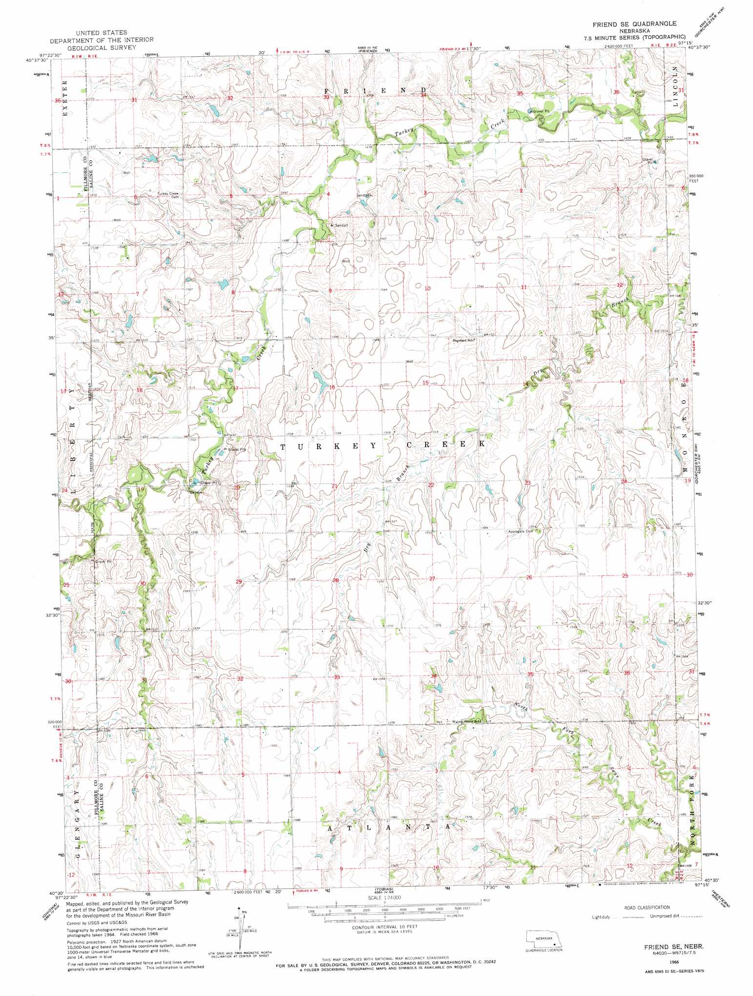
USGS Topo Quad 40097e3 - 1:24,000 scale
| Topo Map Name: | Friend Se |
| USGS Topo Quad ID: | 40097e3 |
| Print Size: | ca. 21 1/4" wide x 27" high |
| Southeast Coordinates: | 40.5° N latitude / 97.25° W longitude |
| Map Center Coordinates: | 40.5625° N latitude / 97.3125° W longitude |
| U.S. State: | NE |
| Filename: | O40097e3.jpg |
| Download Map JPG Image: | Friend Se topo map 1:24,000 scale |
| Map Type: | Topographic |
| Topo Series: | 7.5´ |
| Map Scale: | 1:24,000 |
| Source of Map Images: | United States Geological Survey (USGS) |
| Alternate Map Versions: |
Friend SE NE 1966, updated 1967 Download PDF Buy paper map Friend SE NE 2011 Download PDF Buy paper map Friend SE NE 2014 Download PDF Buy paper map |
1:24,000 Topo Quads surrounding Friend Se
York South |
Utica Sw |
Beaver Crossing |
Goehner |
Milford |
Fairmont |
Exeter |
Friend |
Dorchester Nw |
Dorchester |
Geneva |
Friend Sw |
Friend Se |
Dorchester Sw |
Pleasant Hill |
Strang |
Ohiowa |
Tobias |
Western |
Swanton |
Bruning |
Tobias Sw |
Daykin |
Western Sw |
Western Se |
> Back to 40097e1 at 1:100,000 scale
> Back to 40096a1 at 1:250,000 scale
> Back to U.S. Topo Maps home
Friend Se topo map: Gazetteer
Friend Se: Dams
Bruntz Dam elevation 457m 1499′Oltman Dam elevation 468m 1535′
Swan Creek Dam 2 elevation 445m 1459′
Weber Dam elevation 473m 1551′
Friend Se: Reservoirs
Bruntz Reservoir elevation 457m 1499′Swan Creek Reservoir 5-C elevation 445m 1459′
Weber Reservoir elevation 473m 1551′
Friend Se digital topo map on disk
Buy this Friend Se topo map showing relief, roads, GPS coordinates and other geographical features, as a high-resolution digital map file on DVD: