Franklin Ne Topo Map Nebraska
To zoom in, hover over the map of Franklin Ne
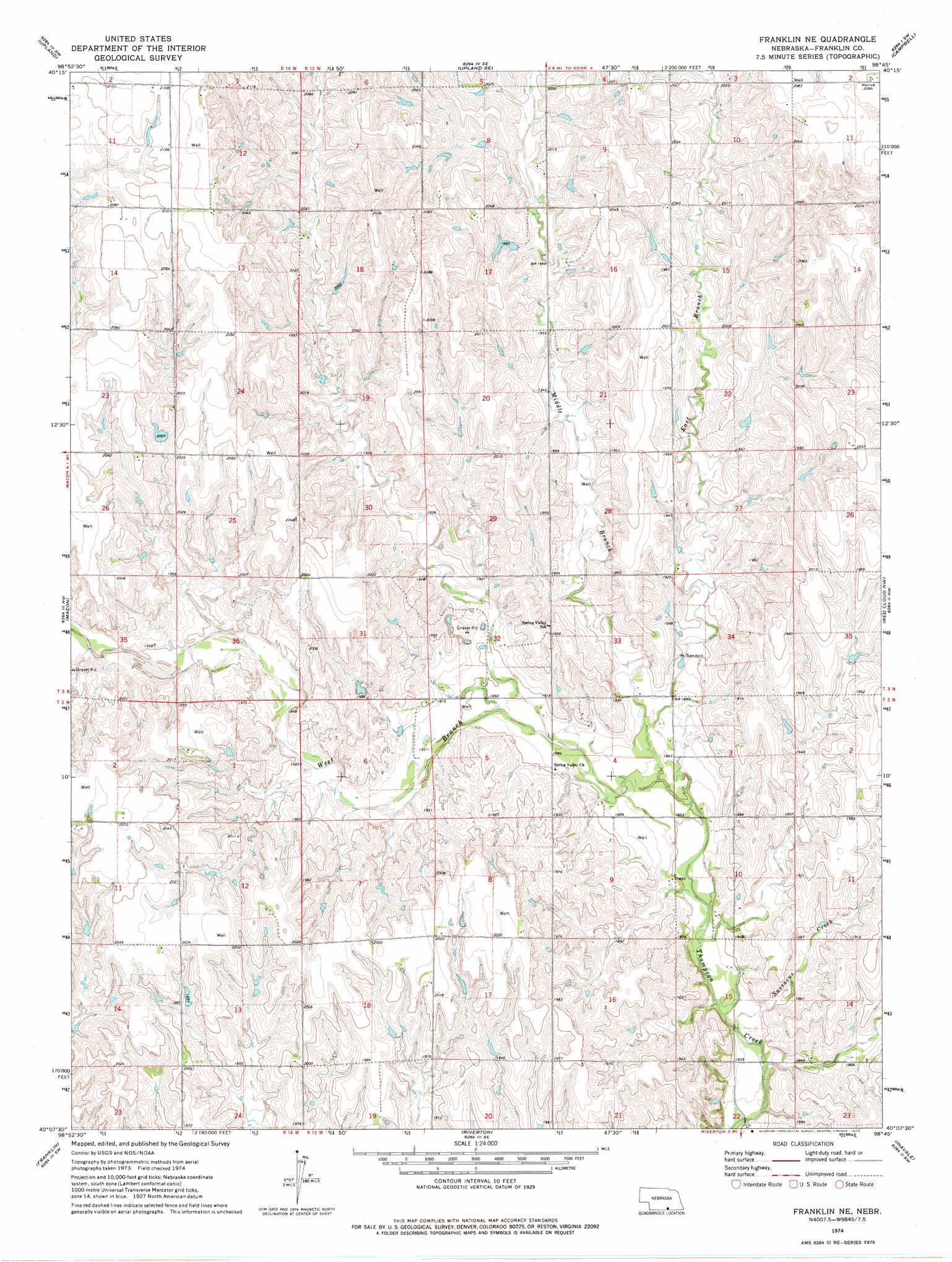
USGS Topo Quad 40098b7 - 1:24,000 scale
| Topo Map Name: | Franklin Ne |
| USGS Topo Quad ID: | 40098b7 |
| Print Size: | ca. 21 1/4" wide x 27" high |
| Southeast Coordinates: | 40.125° N latitude / 98.75° W longitude |
| Map Center Coordinates: | 40.1875° N latitude / 98.8125° W longitude |
| U.S. State: | NE |
| Filename: | O40098b7.jpg |
| Download Map JPG Image: | Franklin Ne topo map 1:24,000 scale |
| Map Type: | Topographic |
| Topo Series: | 7.5´ |
| Map Scale: | 1:24,000 |
| Source of Map Images: | United States Geological Survey (USGS) |
| Alternate Map Versions: |
Franklin NE NE 1974, updated 1977 Download PDF Buy paper map Franklin NE NE 2011 Download PDF Buy paper map Franklin NE NE 2014 Download PDF Buy paper map |
1:24,000 Topo Quads surrounding Franklin Ne
Axtell East |
Minden South |
Norman |
Holstein |
Roseland |
Hildreth |
Upland |
Upland Se |
Campbell |
Bladen |
Republican City Ne |
Macon |
Franklin Ne |
Red Cloud Nw |
Red Cloud Ne |
Bloomington |
Franklin |
Riverton |
Inavale |
Red Cloud |
Kensington Ne |
Bachelors Run |
Reamsville |
Cora |
Mccracken Branch |
> Back to 40098a1 at 1:100,000 scale
> Back to 40098a1 at 1:250,000 scale
> Back to U.S. Topo Maps home
Franklin Ne topo map: Gazetteer
Franklin Ne: Dams
Bartels Dam elevation 614m 2014′Franklin Ne: Reservoirs
Bartels Reservoir elevation 614m 2014′Franklin Ne: Streams
East Branch Thompson Creek elevation 573m 1879′Middle Branch Thompson Creek elevation 573m 1879′
Sassacus Creek elevation 558m 1830′
West Branch Thompson Creek elevation 565m 1853′
Franklin Ne digital topo map on disk
Buy this Franklin Ne topo map showing relief, roads, GPS coordinates and other geographical features, as a high-resolution digital map file on DVD: