Campbell Topo Map Nebraska
To zoom in, hover over the map of Campbell
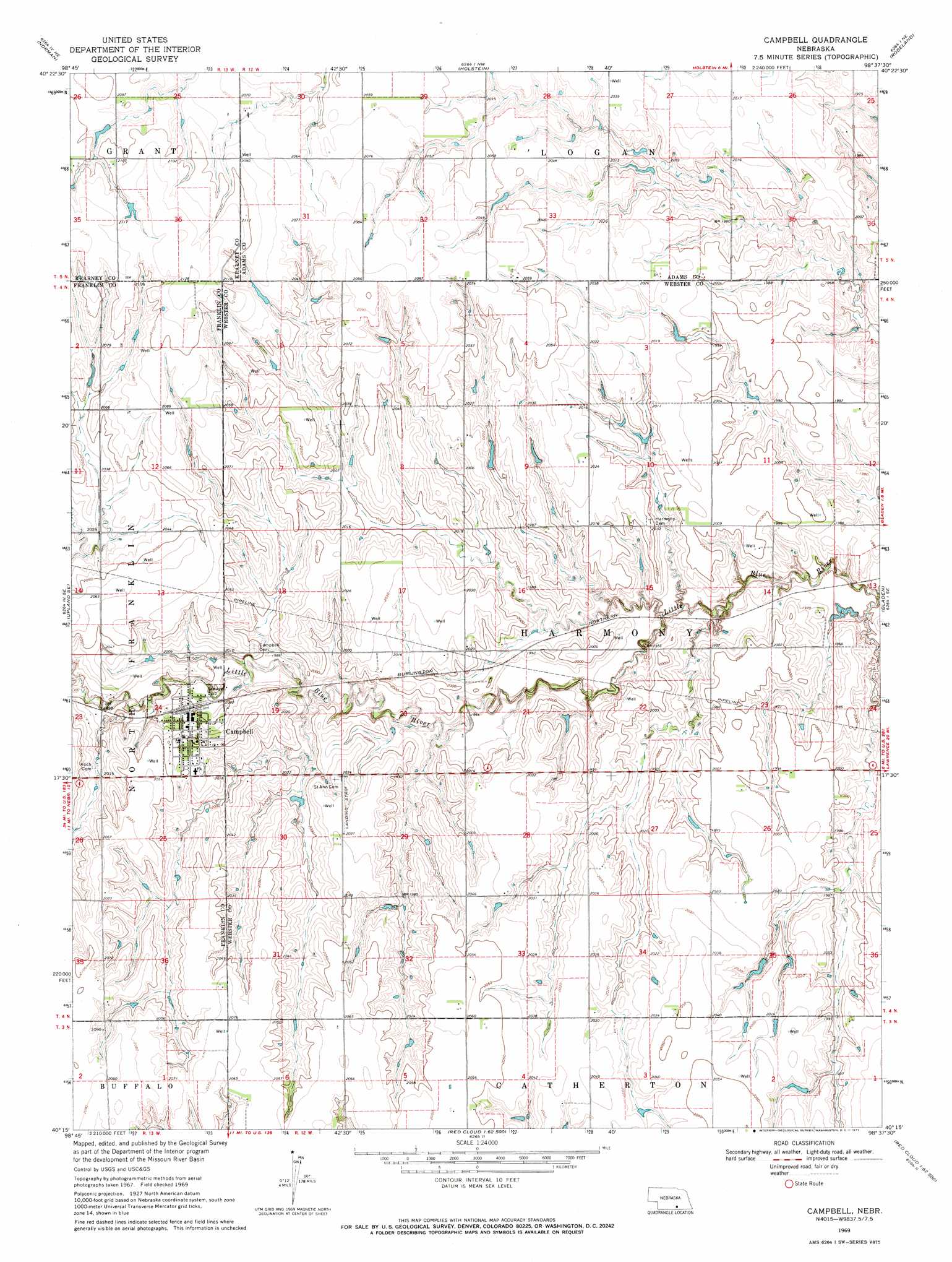
USGS Topo Quad 40098c6 - 1:24,000 scale
| Topo Map Name: | Campbell |
| USGS Topo Quad ID: | 40098c6 |
| Print Size: | ca. 21 1/4" wide x 27" high |
| Southeast Coordinates: | 40.25° N latitude / 98.625° W longitude |
| Map Center Coordinates: | 40.3125° N latitude / 98.6875° W longitude |
| U.S. State: | NE |
| Filename: | O40098c6.jpg |
| Download Map JPG Image: | Campbell topo map 1:24,000 scale |
| Map Type: | Topographic |
| Topo Series: | 7.5´ |
| Map Scale: | 1:24,000 |
| Source of Map Images: | United States Geological Survey (USGS) |
| Alternate Map Versions: |
Campbell NE 1969, updated 1971 Download PDF Buy paper map Campbell NE 2011 Download PDF Buy paper map Campbell NE 2014 Download PDF Buy paper map |
1:24,000 Topo Quads surrounding Campbell
Minden North |
Heartwell |
Kenesaw |
Juniata |
Hastings West |
Minden South |
Norman |
Holstein |
Roseland |
Ayr |
Upland |
Upland Se |
Campbell |
Bladen |
Blue Hill |
Macon |
Franklin Ne |
Red Cloud Nw |
Red Cloud Ne |
Cowles |
Franklin |
Riverton |
Inavale |
Red Cloud |
Amboy |
> Back to 40098a1 at 1:100,000 scale
> Back to 40098a1 at 1:250,000 scale
> Back to U.S. Topo Maps home
Campbell topo map: Gazetteer
Campbell: Airports
RS AG - Land Airport elevation 630m 2066′Campbell: Dams
Genereux Dam elevation 620m 2034′Hoffman Dam elevation 608m 1994′
Lutkemeier Dam elevation 613m 2011′
Ray Dam elevation 624m 2047′
Vance Dam elevation 610m 2001′
Campbell: Populated Places
Campbell elevation 613m 2011′Campbell: Post Offices
Campbell Post Office elevation 613m 2011′Campbell: Reservoirs
Genereux Reservoir elevation 620m 2034′Hoffman Reservoir elevation 608m 1994′
Lutkemeier Reservoir elevation 613m 2011′
Ray Reservoir elevation 624m 2047′
Vance Reservoir elevation 610m 2001′
Campbell digital topo map on disk
Buy this Campbell topo map showing relief, roads, GPS coordinates and other geographical features, as a high-resolution digital map file on DVD: