Pauline Topo Map Nebraska
To zoom in, hover over the map of Pauline
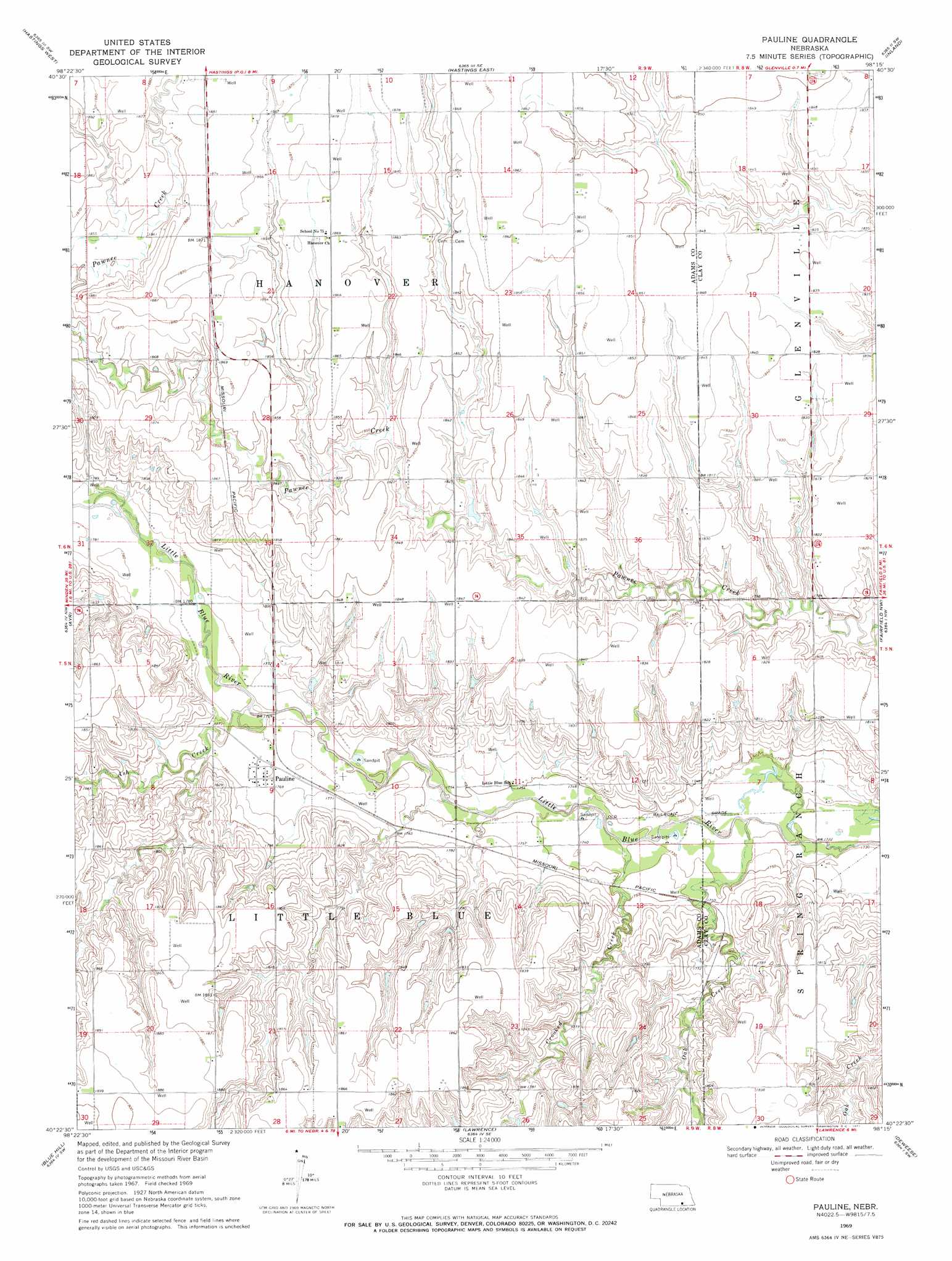
USGS Topo Quad 40098d3 - 1:24,000 scale
| Topo Map Name: | Pauline |
| USGS Topo Quad ID: | 40098d3 |
| Print Size: | ca. 21 1/4" wide x 27" high |
| Southeast Coordinates: | 40.375° N latitude / 98.25° W longitude |
| Map Center Coordinates: | 40.4375° N latitude / 98.3125° W longitude |
| U.S. State: | NE |
| Filename: | O40098d3.jpg |
| Download Map JPG Image: | Pauline topo map 1:24,000 scale |
| Map Type: | Topographic |
| Topo Series: | 7.5´ |
| Map Scale: | 1:24,000 |
| Source of Map Images: | United States Geological Survey (USGS) |
| Alternate Map Versions: |
Pauline NE 1969, updated 1972 Download PDF Buy paper map Pauline NE 2011 Download PDF Buy paper map Pauline NE 2014 Download PDF Buy paper map |
1:24,000 Topo Quads surrounding Pauline
Prosser |
Hastings Nw |
Trumbull |
Harvard Nw |
Harvard Ne |
Juniata |
Hastings West |
Hastings East |
Inland |
Harvard |
Roseland |
Ayr |
Pauline |
Fairfield Nw |
Fairfield |
Bladen |
Blue Hill |
Lawrence |
Deweese |
Fairfield Se |
Red Cloud Ne |
Cowles |
Guide Rock Ne |
Mount Clare |
Nelson |
> Back to 40098a1 at 1:100,000 scale
> Back to 40098a1 at 1:250,000 scale
> Back to U.S. Topo Maps home
Pauline topo map: Gazetteer
Pauline: Airports
Munsterman Airport elevation 561m 1840′Pauline: Populated Places
Pauline elevation 540m 1771′Pauline: Post Offices
Pauline Post Office (historical) elevation 540m 1771′Pauline: Streams
Ash Creek elevation 535m 1755′Crooked Creek elevation 527m 1729′
Oak Creek elevation 524m 1719′
Pauline digital topo map on disk
Buy this Pauline topo map showing relief, roads, GPS coordinates and other geographical features, as a high-resolution digital map file on DVD: