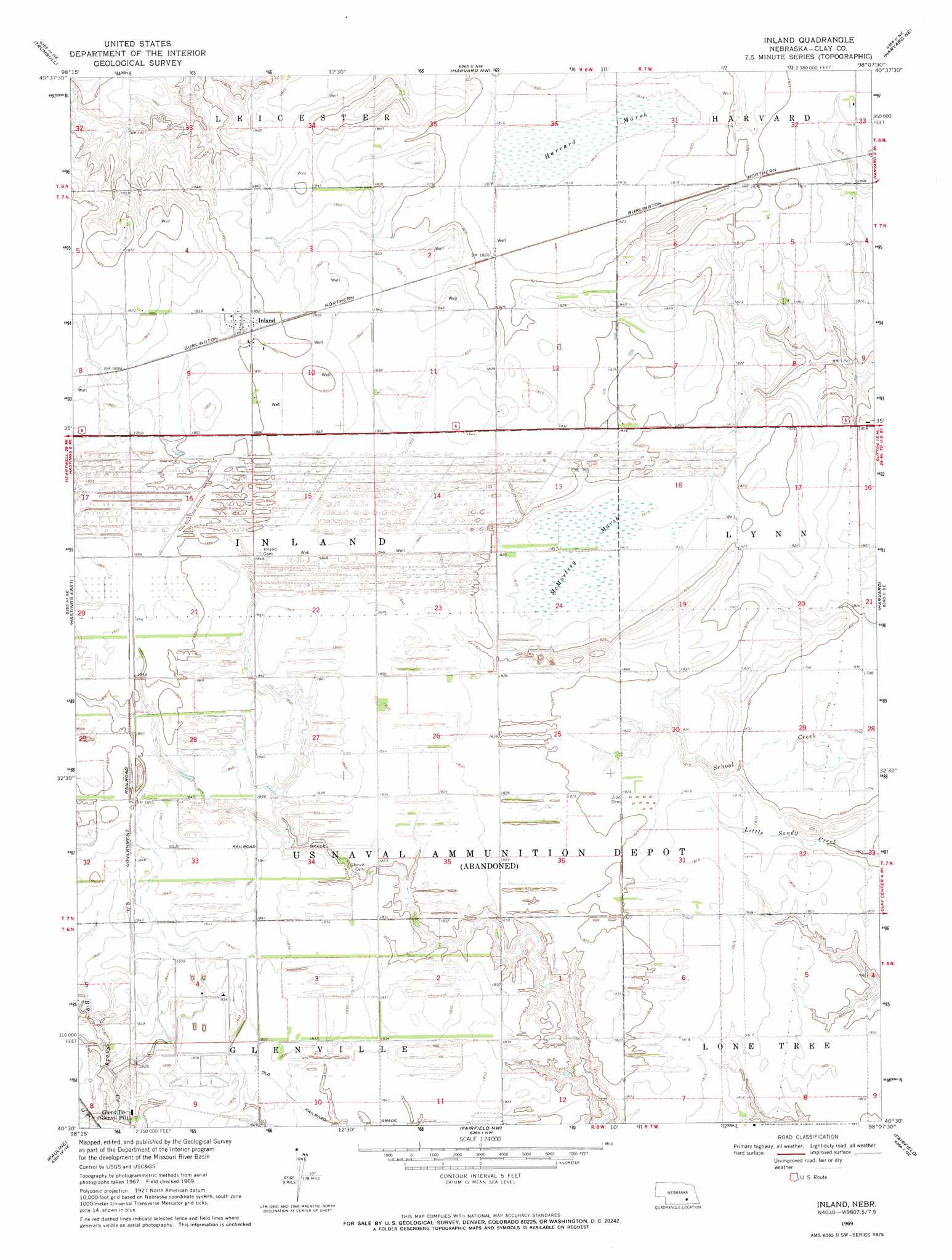
Inland Topo Map Nebraska
To zoom in, hover over the map of Inland
USGS Topo Quad 40098e2 - 1:24,000 scale
| Topo Map Name: | Inland |
| USGS Topo Quad ID: | 40098e2 |
| Print Size: | ca. 21 1/4" wide x 27" high |
| Southeast Coordinates: | 40.5° N latitude / 98.125° W longitude |
| Map Center Coordinates: | 40.5625° N latitude / 98.1875° W longitude |
| U.S. State: | NE |
| Filename: | O40098e2.jpg |
| Download Map JPG Image: | Inland topo map 1:24,000 scale |
| Map Type: | Topographic |
| Topo Series: | 7.5´ |
| Map Scale: | 1:24,000 |
| Source of Map Images: | United States Geological Survey (USGS) |
| Alternate Map Versions: |
Inland NE 1969, updated 1971 Download PDF Buy paper map Inland NE 2011 Download PDF Buy paper map Inland NE 2014 Download PDF Buy paper map |
1:24,000 Topo Quads surrounding Inland
Alda |
Doniphan |
Giltner |
Aurora West |
Aurora East |
Hastings Nw |
Trumbull |
Harvard Nw |
Harvard Ne |
Stockham |
Hastings West |
Hastings East |
Inland |
Harvard |
Saronville |
Ayr |
Pauline |
Fairfield Nw |
Fairfield |
Edgar Nw |
Blue Hill |
Lawrence |
Deweese |
Fairfield Se |
Edgar |
> Back to 40098e1 at 1:100,000 scale
> Back to 40098a1 at 1:250,000 scale
> Back to U.S. Topo Maps home
Inland topo map: Gazetteer
Inland: Parks
Harvard Federal Waterfowl Production Area elevation 553m 1814′Inland: Populated Places
Inland elevation 565m 1853′Inland: Post Offices
Inland Post Office elevation 565m 1853′Inland: Swamps
Harvard Marsh elevation 553m 1814′McMurtrey Marsh elevation 553m 1814′
Inland digital topo map on disk
Buy this Inland topo map showing relief, roads, GPS coordinates and other geographical features, as a high-resolution digital map file on DVD: