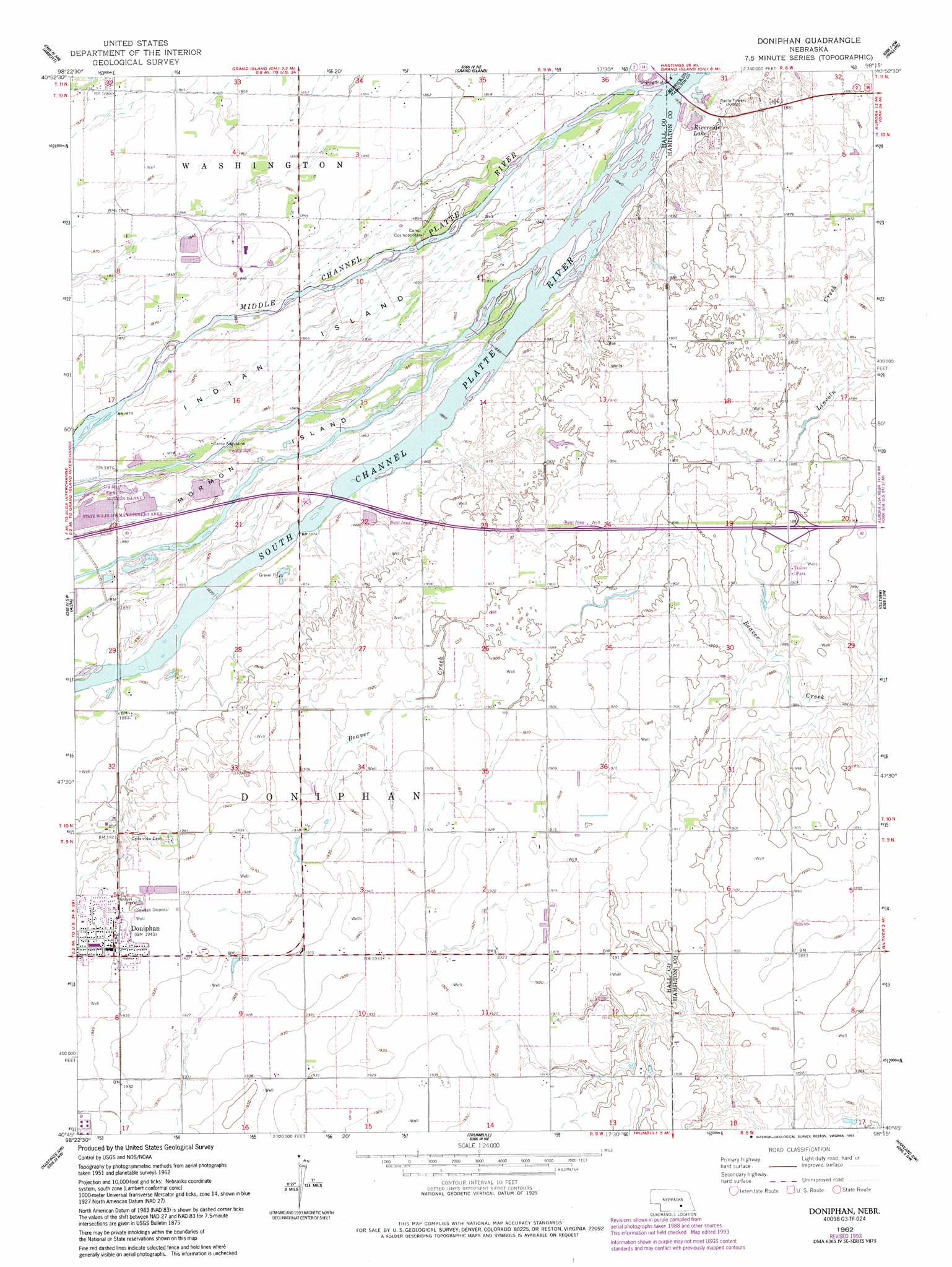
Doniphan Topo Map Nebraska
To zoom in, hover over the map of Doniphan
USGS Topo Quad 40098g3 - 1:24,000 scale
| Topo Map Name: | Doniphan |
| USGS Topo Quad ID: | 40098g3 |
| Print Size: | ca. 21 1/4" wide x 27" high |
| Southeast Coordinates: | 40.75° N latitude / 98.25° W longitude |
| Map Center Coordinates: | 40.8125° N latitude / 98.3125° W longitude |
| U.S. State: | NE |
| Filename: | O40098g3.jpg |
| Download Map JPG Image: | Doniphan topo map 1:24,000 scale |
| Map Type: | Topographic |
| Topo Series: | 7.5´ |
| Map Scale: | 1:24,000 |
| Source of Map Images: | United States Geological Survey (USGS) |
| Alternate Map Versions: |
Doniphan NE 1962, updated 1964 Download PDF Buy paper map Doniphan NE 1962, updated 1977 Download PDF Buy paper map Doniphan NE 1962, updated 1993 Download PDF Buy paper map Doniphan NE 2011 Download PDF Buy paper map Doniphan NE 2014 Download PDF Buy paper map |
1:24,000 Topo Quads surrounding Doniphan
Dannebrog |
Saint Paul Sw |
Saint Lebory |
Chapman |
Central City West |
Shelton Ne |
Abbott |
Grand Island |
Phillips |
Murphy |
Wood River |
Alda |
Doniphan |
Giltner |
Aurora West |
Prosser |
Hastings Nw |
Trumbull |
Harvard Nw |
Harvard Ne |
Juniata |
Hastings West |
Hastings East |
Inland |
Harvard |
> Back to 40098e1 at 1:100,000 scale
> Back to 40098a1 at 1:250,000 scale
> Back to U.S. Topo Maps home
Doniphan topo map: Gazetteer
Doniphan: Crossings
Interchange 318 elevation 579m 1899′Doniphan: Islands
Indian Island elevation 567m 1860′Mormon Island elevation 572m 1876′
Doniphan: Lakes
Riverside Lake elevation 559m 1833′Doniphan: Parks
Ermas Desire Sculpture elevation 570m 1870′Grand Island Historical Marker elevation 570m 1870′
Junctionville Marker elevation 569m 1866′
Morman Island State Wildlife Management Area elevation 571m 1873′
Saint Joseph and Grand Island Railroad Historical Marker elevation 592m 1942′
Doniphan: Populated Places
Do-Mar Mobile Home Park elevation 592m 1942′Doniphan elevation 592m 1942′
Doniphan: Post Offices
Doniphan Post Office elevation 592m 1942′Junctionville Post Office (historical) elevation 569m 1866′
Doniphan: Streams
Middle Channel Platte River elevation 560m 1837′South Channel Platte River elevation 566m 1856′
Doniphan digital topo map on disk
Buy this Doniphan topo map showing relief, roads, GPS coordinates and other geographical features, as a high-resolution digital map file on DVD: