Shelton Topo Map Nebraska
To zoom in, hover over the map of Shelton
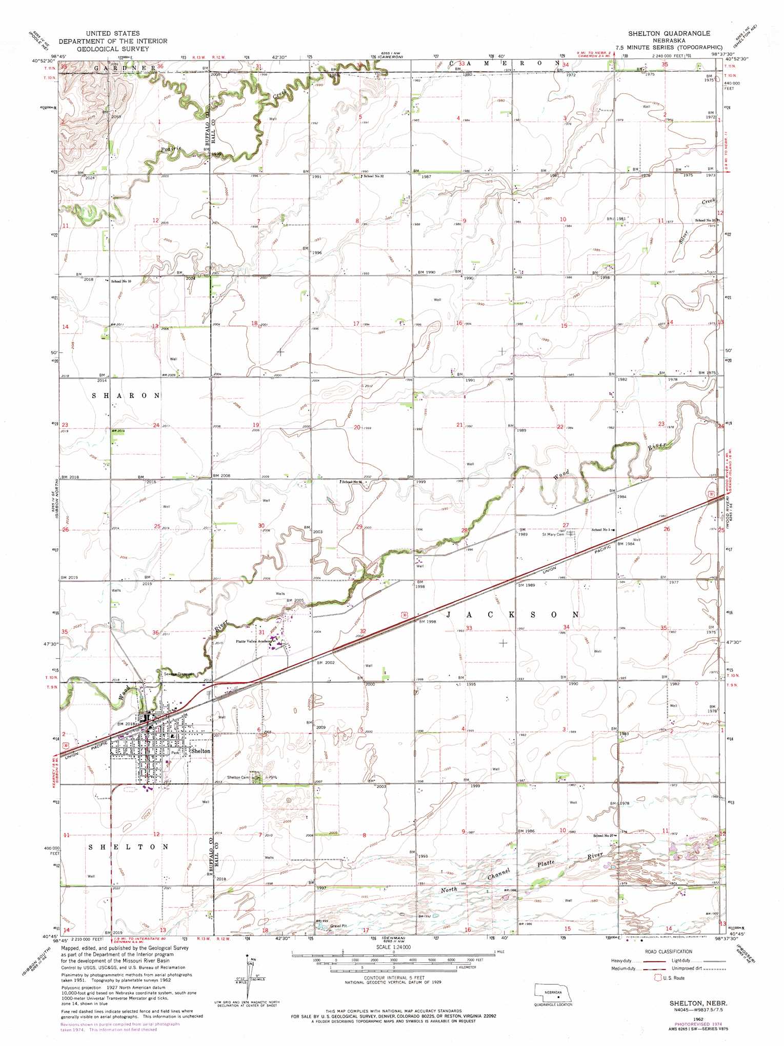
USGS Topo Quad 40098g6 - 1:24,000 scale
| Topo Map Name: | Shelton |
| USGS Topo Quad ID: | 40098g6 |
| Print Size: | ca. 21 1/4" wide x 27" high |
| Southeast Coordinates: | 40.75° N latitude / 98.625° W longitude |
| Map Center Coordinates: | 40.8125° N latitude / 98.6875° W longitude |
| U.S. State: | NE |
| Filename: | O40098g6.jpg |
| Download Map JPG Image: | Shelton topo map 1:24,000 scale |
| Map Type: | Topographic |
| Topo Series: | 7.5´ |
| Map Scale: | 1:24,000 |
| Source of Map Images: | United States Geological Survey (USGS) |
| Alternate Map Versions: |
Shelton NE 1962, updated 1964 Download PDF Buy paper map Shelton NE 1962, updated 1977 Download PDF Buy paper map Shelton NE 2011 Download PDF Buy paper map Shelton NE 2014 Download PDF Buy paper map |
1:24,000 Topo Quads surrounding Shelton
Ravenna |
Rockville |
Boelus |
Dannebrog |
Saint Paul Sw |
Poole |
Poole Ne |
Cameron |
Shelton Ne |
Abbott |
Buckeye Valley |
Gibbon North |
Shelton |
Wood River |
Alda |
Newark |
Gibbon South |
Denman |
Prosser |
Hastings Nw |
Minden North |
Heartwell |
Kenesaw |
Juniata |
Hastings West |
> Back to 40098e1 at 1:100,000 scale
> Back to 40098a1 at 1:250,000 scale
> Back to U.S. Topo Maps home
Shelton topo map: Gazetteer
Shelton: Parks
Original Townsite of Wood River Historical Marker elevation 605m 1984′Shelton: Populated Places
Shelton elevation 615m 2017′Shelton: Post Offices
Shelton Post Office elevation 615m 2017′Shelton digital topo map on disk
Buy this Shelton topo map showing relief, roads, GPS coordinates and other geographical features, as a high-resolution digital map file on DVD: