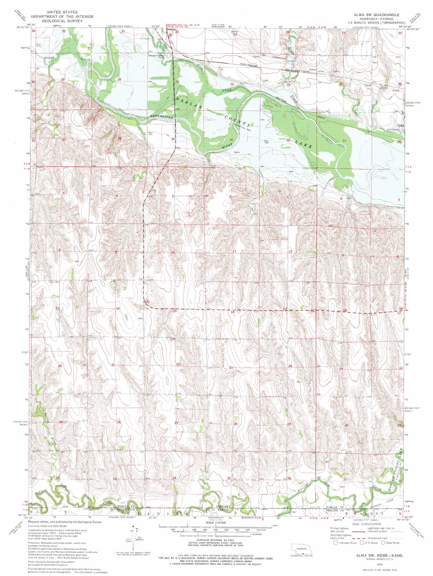
Alma Sw Topo Map Nebraska
To zoom in, hover over the map of Alma Sw
USGS Topo Quad 40099a4 - 1:24,000 scale
| Topo Map Name: | Alma Sw |
| USGS Topo Quad ID: | 40099a4 |
| Print Size: | ca. 21 1/4" wide x 27" high |
| Southeast Coordinates: | 40° N latitude / 99.375° W longitude |
| Map Center Coordinates: | 40.0625° N latitude / 99.4375° W longitude |
| U.S. States: | NE, KS |
| Filename: | O40099a4.jpg |
| Download Map JPG Image: | Alma Sw topo map 1:24,000 scale |
| Map Type: | Topographic |
| Topo Series: | 7.5´ |
| Map Scale: | 1:24,000 |
| Source of Map Images: | United States Geological Survey (USGS) |
| Alternate Map Versions: |
Alma SW NE 1974, updated 1977 Download PDF Buy paper map Alma SW NE 2011 Download PDF Buy paper map Alma SW NE 2014 Download PDF Buy paper map |
1:24,000 Topo Quads surrounding Alma Sw
Oxford |
Mascot |
Atlanta |
Ragan |
Wilcox |
Hollinger |
Stamford |
Orleans |
Huntley |
Republican City Nw |
Precept |
Stamford Se |
Alma Sw |
Alma |
Republican City |
Almena |
Long Island |
Woodruff |
Stuttgart Ne |
Kensington Nw |
Almena Sw |
Prairie View |
Stuttgart |
Phillipsburg North |
Gretna |
> Back to 40099a1 at 1:100,000 scale
> Back to 40098a1 at 1:250,000 scale
> Back to U.S. Topo Maps home
Alma Sw topo map: Gazetteer
Alma Sw: Canals
Rope Canal elevation 617m 2024′Alma Sw: Dams
Bantom-Coe Dam elevation 629m 2063′Haeker Dam elevation 610m 2001′
Wolf Dam Number 1 elevation 608m 1994′
Alma Sw: Reservoirs
Bantom-Coe Reservoir elevation 629m 2063′Haeker Reservoir elevation 610m 2001′
Wolf Reservoir Number 1 elevation 608m 1994′
Alma Sw: Streams
Dry Creek elevation 601m 1971′Flag Creek elevation 595m 1952′
Rope Creek elevation 595m 1952′
Sappa Creek elevation 601m 1971′
Spring Brook elevation 610m 2001′
Alma Sw digital topo map on disk
Buy this Alma Sw topo map showing relief, roads, GPS coordinates and other geographical features, as a high-resolution digital map file on DVD: