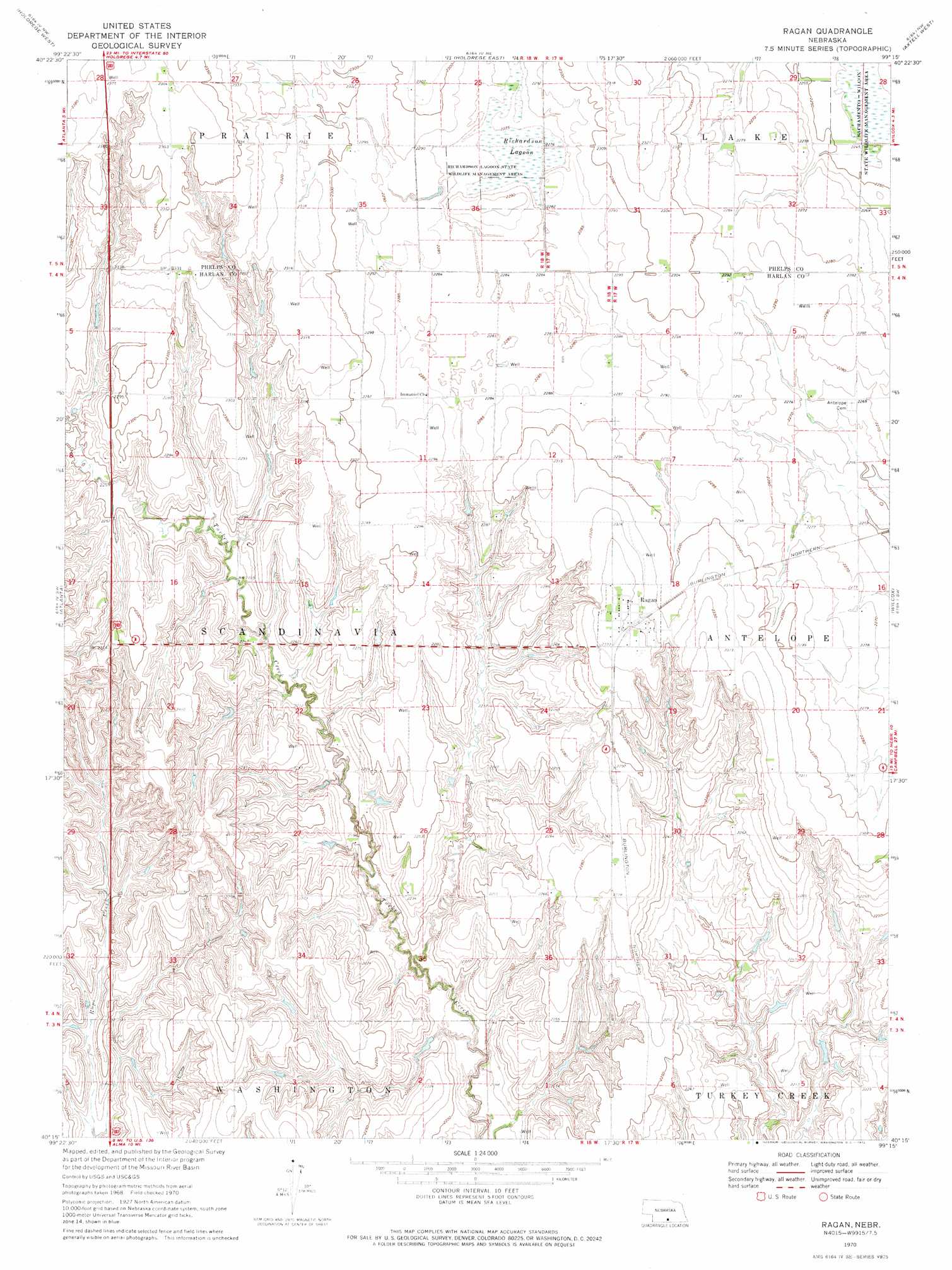
Ragan Topo Map Nebraska
To zoom in, hover over the map of Ragan
USGS Topo Quad 40099c3 - 1:24,000 scale
| Topo Map Name: | Ragan |
| USGS Topo Quad ID: | 40099c3 |
| Print Size: | ca. 21 1/4" wide x 27" high |
| Southeast Coordinates: | 40.25° N latitude / 99.25° W longitude |
| Map Center Coordinates: | 40.3125° N latitude / 99.3125° W longitude |
| U.S. State: | NE |
| Filename: | O40099c3.jpg |
| Download Map JPG Image: | Ragan topo map 1:24,000 scale |
| Map Type: | Topographic |
| Topo Series: | 7.5´ |
| Map Scale: | 1:24,000 |
| Source of Map Images: | United States Geological Survey (USGS) |
| Alternate Map Versions: |
Ragan NE 1970, updated 1972 Download PDF Buy paper map Ragan NE 2011 Download PDF Buy paper map Ragan NE 2014 Download PDF Buy paper map |
1:24,000 Topo Quads surrounding Ragan
Bertrand Se |
Elm Creek Sw |
Elm Creek Se |
Kearney Sw |
Kearney Se |
Loomis |
Holdrege West |
Holdrege East |
Axtell West |
Axtell East |
Mascot |
Atlanta |
Ragan |
Wilcox |
Hildreth |
Stamford |
Orleans |
Huntley |
Republican City Nw |
Republican City Ne |
Stamford Se |
Alma Sw |
Alma |
Republican City |
Bloomington |
> Back to 40099a1 at 1:100,000 scale
> Back to 40098a1 at 1:250,000 scale
> Back to U.S. Topo Maps home
Ragan topo map: Gazetteer
Ragan: Dams
Hoffman Dam elevation 667m 2188′Ragan: Parks
Pioneer Crossing Historical Marker elevation 679m 2227′Richardson Lagoon State Wildlife Mgt Area elevation 696m 2283′
Sacramento-Wilcox State Wildlife Mgt Are elevation 681m 2234′
Ragan: Populated Places
Ragan elevation 710m 2329′Ragan: Post Offices
Ragan Post Office elevation 710m 2329′Ragan: Reservoirs
Hoffman Reservoir elevation 667m 2188′Ragan: Swamps
Richardson Lagoon elevation 694m 2276′Ragan digital topo map on disk
Buy this Ragan topo map showing relief, roads, GPS coordinates and other geographical features, as a high-resolution digital map file on DVD: