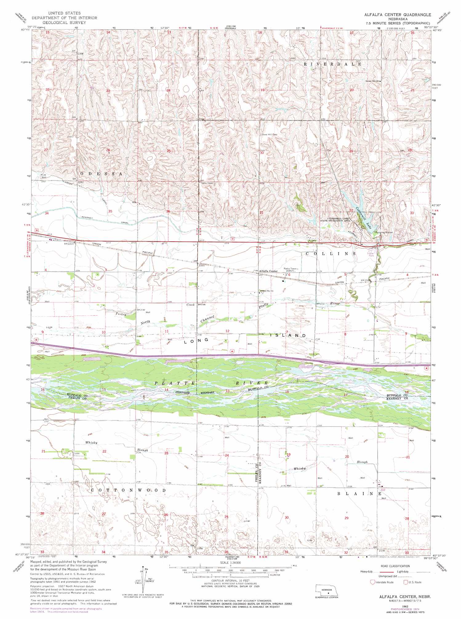
Alfalfa Center Topo Map Nebraska
To zoom in, hover over the map of Alfalfa Center
USGS Topo Quad 40099f2 - 1:24,000 scale
| Topo Map Name: | Alfalfa Center |
| USGS Topo Quad ID: | 40099f2 |
| Print Size: | ca. 21 1/4" wide x 27" high |
| Southeast Coordinates: | 40.625° N latitude / 99.125° W longitude |
| Map Center Coordinates: | 40.6875° N latitude / 99.1875° W longitude |
| U.S. State: | NE |
| Filename: | O40099f2.jpg |
| Download Map JPG Image: | Alfalfa Center topo map 1:24,000 scale |
| Map Type: | Topographic |
| Topo Series: | 7.5´ |
| Map Scale: | 1:24,000 |
| Source of Map Images: | United States Geological Survey (USGS) |
| Alternate Map Versions: |
Alfalfa Center NE 1962, updated 1964 Download PDF Buy paper map Alfalfa Center NE 1962, updated 1977 Download PDF Buy paper map Alfalfa Center NE 2011 Download PDF Buy paper map Alfalfa Center NE 2014 Download PDF Buy paper map |
1:24,000 Topo Quads surrounding Alfalfa Center
Miller |
Miller Ne |
Pleasanton Nw |
Pleasanton |
Poole |
Miller Sw |
Amherst |
Riverdale |
Pleasanton Se |
Buckeye Valley |
Elm Creek West |
Elm Creek East |
Alfalfa Center |
Kearney |
Newark |
Elm Creek Sw |
Elm Creek Se |
Kearney Sw |
Kearney Se |
Minden North |
Holdrege West |
Holdrege East |
Axtell West |
Axtell East |
Minden South |
> Back to 40099e1 at 1:100,000 scale
> Back to 40098a1 at 1:250,000 scale
> Back to U.S. Topo Maps home
Alfalfa Center topo map: Gazetteer
Alfalfa Center: Canals
Kearney Canal elevation 676m 2217′Alfalfa Center: Dams
Cottonmill Dam elevation 673m 2208′Patterson Dam elevation 692m 2270′
Walter Dam elevation 696m 2283′
Alfalfa Center: Islands
Long Island elevation 663m 2175′Alfalfa Center: Parks
Cottonmill Lake State Recreation Area elevation 692m 2270′East Odessa State Wildlife Management Area elevation 659m 2162′
Fort Kearney Historical Marker elevation 662m 2171′
Kearney Cotton Mill Historical Marker elevation 679m 2227′
Watson Ranch Historical Marker elevation 673m 2208′
Alfalfa Center: Populated Places
Alfalfa Center elevation 667m 2188′Cottonmill Mobile Home Court elevation 680m 2230′
Sheens Trailer Court elevation 669m 2194′
Alfalfa Center: Reservoirs
Cottonmill Lake elevation 674m 2211′Cottonmill Reservoir elevation 673m 2208′
Patterson Reservoir elevation 692m 2270′
Walter Reservoir elevation 696m 2283′
Alfalfa Center: Streams
Turkey Creek elevation 663m 2175′Whisky Slough elevation 665m 2181′
Alfalfa Center: Trails
Cottonmill Trail elevation 688m 2257′Alfalfa Center digital topo map on disk
Buy this Alfalfa Center topo map showing relief, roads, GPS coordinates and other geographical features, as a high-resolution digital map file on DVD: