Eustis Sw Topo Map Nebraska
To zoom in, hover over the map of Eustis Sw
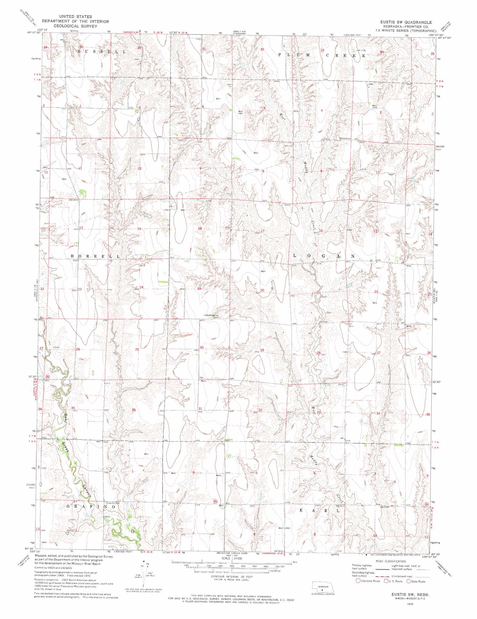
USGS Topo Quad 40100e2 - 1:24,000 scale
| Topo Map Name: | Eustis Sw |
| USGS Topo Quad ID: | 40100e2 |
| Print Size: | ca. 21 1/4" wide x 27" high |
| Southeast Coordinates: | 40.5° N latitude / 100.125° W longitude |
| Map Center Coordinates: | 40.5625° N latitude / 100.1875° W longitude |
| U.S. State: | NE |
| Filename: | O40100e2.jpg |
| Download Map JPG Image: | Eustis Sw topo map 1:24,000 scale |
| Map Type: | Topographic |
| Topo Series: | 7.5´ |
| Map Scale: | 1:24,000 |
| Source of Map Images: | United States Geological Survey (USGS) |
| Alternate Map Versions: |
Eustis SW NE 1970, updated 1973 Download PDF Buy paper map Eustis SW NE 2011 Download PDF Buy paper map Eustis SW NE 2014 Download PDF Buy paper map |
1:24,000 Topo Quads surrounding Eustis Sw
Jeffrey Reservoir Sw |
Jeffrey Reservoir Se |
Gothenburg Sw |
Gothenburg Se |
Cozad |
Moorefield |
Stockville Ne |
Farnam |
Eustis |
Elwood Nw |
Stockville |
Stockville Se |
Eustis Sw |
Eustis Se |
Elwood Sw |
Bartley Nw |
Freedom |
Medicine Creek Dam |
Cambridge Ne |
Arapahoe Nw |
Bartley Sw |
Bartley |
Cambridge |
Holbrook |
Arapahoe |
> Back to 40100e1 at 1:100,000 scale
> Back to 40100a1 at 1:250,000 scale
> Back to U.S. Topo Maps home
Eustis Sw topo map: Gazetteer
Eustis Sw: Dams
Berke Dam elevation 777m 2549′Hess Dam elevation 791m 2595′
Klein Dam elevation 786m 2578′
Schurr Dam Number 2 elevation 770m 2526′
Eustis Sw: Reservoirs
Berke Reservoir elevation 777m 2549′Hess Reservoir elevation 791m 2595′
Klein Reservoir elevation 786m 2578′
Schurr Reservoir Number 2 elevation 770m 2526′
Eustis Sw digital topo map on disk
Buy this Eustis Sw topo map showing relief, roads, GPS coordinates and other geographical features, as a high-resolution digital map file on DVD: