Gothenburg Sw Topo Map Nebraska
To zoom in, hover over the map of Gothenburg Sw
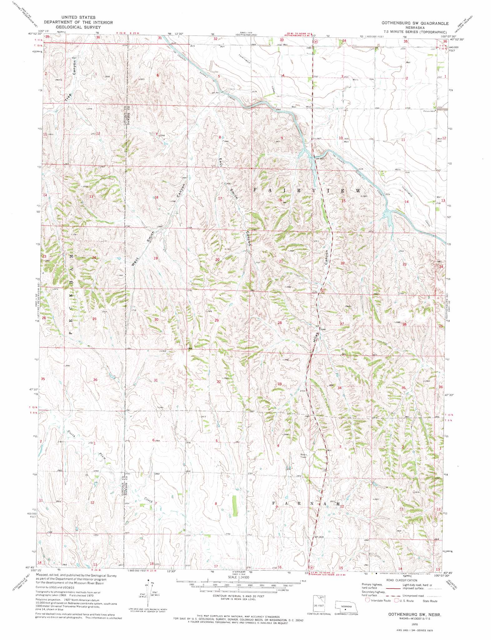
USGS Topo Quad 40100g2 - 1:24,000 scale
| Topo Map Name: | Gothenburg Sw |
| USGS Topo Quad ID: | 40100g2 |
| Print Size: | ca. 21 1/4" wide x 27" high |
| Southeast Coordinates: | 40.75° N latitude / 100.125° W longitude |
| Map Center Coordinates: | 40.8125° N latitude / 100.1875° W longitude |
| U.S. State: | NE |
| Filename: | O40100g2.jpg |
| Download Map JPG Image: | Gothenburg Sw topo map 1:24,000 scale |
| Map Type: | Topographic |
| Topo Series: | 7.5´ |
| Map Scale: | 1:24,000 |
| Source of Map Images: | United States Geological Survey (USGS) |
| Alternate Map Versions: |
Gothenburg SW NE 1970, updated 1973 Download PDF Buy paper map Gothenburg SW NE 2011 Download PDF Buy paper map Gothenburg SW NE 2014 Download PDF Buy paper map |
1:24,000 Topo Quads surrounding Gothenburg Sw
Brady Sw |
Brady |
Odencranze Table South |
Roten Valley South |
Oconto Sw |
Jeffrey Reservoir |
Jeffrey Reservoir Ne |
Gothenburg |
Willow Island |
Cozad Nw |
Jeffrey Reservoir Sw |
Jeffrey Reservoir Se |
Gothenburg Sw |
Gothenburg Se |
Cozad |
Moorefield |
Stockville Ne |
Farnam |
Eustis |
Elwood Nw |
Stockville |
Stockville Se |
Eustis Sw |
Eustis Se |
Elwood Sw |
> Back to 40100e1 at 1:100,000 scale
> Back to 40100a1 at 1:250,000 scale
> Back to U.S. Topo Maps home
Gothenburg Sw topo map: Gazetteer
Gothenburg Sw: Canals
Thirtymile Canal elevation 792m 2598′Gothenburg Sw: Dams
Earth Dam-Canal Mile 408 Dam elevation 820m 2690′Earth Dam-Canal Mile 427 Dam elevation 795m 2608′
Wiggins Dam elevation 817m 2680′
Young Dam elevation 843m 2765′
Gothenburg Sw: Reservoirs
Wiggins Reservoir elevation 817m 2680′Young Reservoir elevation 843m 2765′
Gothenburg Sw: Valleys
East Smith Canyon elevation 808m 2650′Hiles Canyon elevation 802m 2631′
West Smith Canyon elevation 806m 2644′
Gothenburg Sw digital topo map on disk
Buy this Gothenburg Sw topo map showing relief, roads, GPS coordinates and other geographical features, as a high-resolution digital map file on DVD: