Max Se Topo Map Nebraska
To zoom in, hover over the map of Max Se
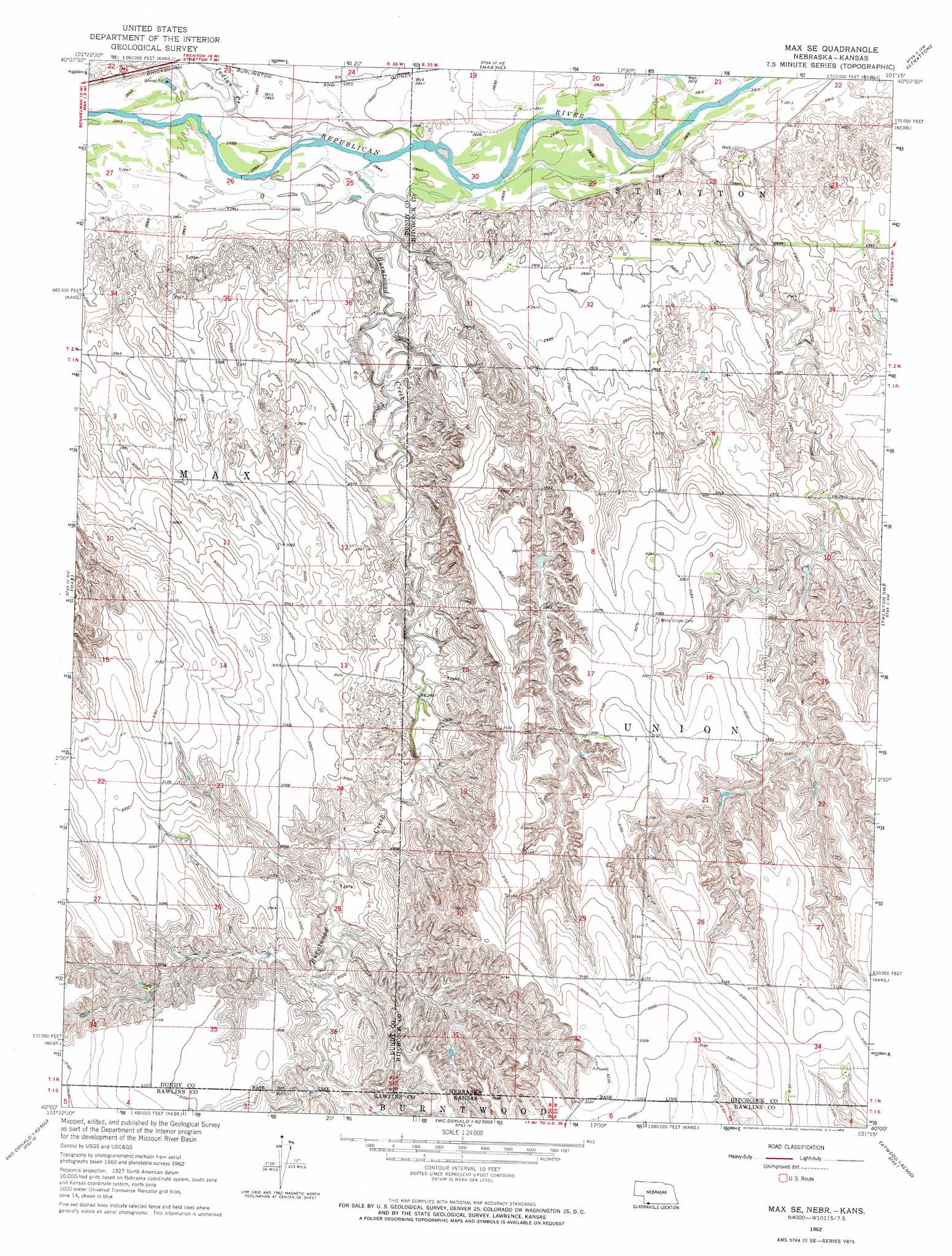
USGS Topo Quad 40101a3 - 1:24,000 scale
| Topo Map Name: | Max Se |
| USGS Topo Quad ID: | 40101a3 |
| Print Size: | ca. 21 1/4" wide x 27" high |
| Southeast Coordinates: | 40° N latitude / 101.25° W longitude |
| Map Center Coordinates: | 40.0625° N latitude / 101.3125° W longitude |
| U.S. States: | NE, KS |
| Filename: | O40101a3.jpg |
| Download Map JPG Image: | Max Se topo map 1:24,000 scale |
| Map Type: | Topographic |
| Topo Series: | 7.5´ |
| Map Scale: | 1:24,000 |
| Source of Map Images: | United States Geological Survey (USGS) |
| Alternate Map Versions: |
Max SE NE 1962, updated 1964 Download PDF Buy paper map Max SE NE 2011 Download PDF Buy paper map Max SE NE 2014 Download PDF Buy paper map |
1:24,000 Topo Quads surrounding Max Se
Ough |
Wauneta Sw |
Wauneta Se |
Palisade Sw |
Palisade |
Arrowhead Lake |
Rock Canyon |
Max Ne |
Stratton |
Trenton |
Benkelman |
Max |
Max Se |
Trenton Sw |
Trenton Se |
Henkle Canyon |
Mcdonald Nw |
Mcdonald Ne |
Atwood Nw |
Atwood Ne |
Bird City North |
Mcdonald Sw |
Mcdonald |
Beardsley |
Atwood |
> Back to 40101a1 at 1:100,000 scale
> Back to 40100a1 at 1:250,000 scale
> Back to U.S. Topo Maps home
Max Se topo map: Gazetteer
Max Se: Dams
Golding Dam elevation 892m 2926′Max Se: Reservoirs
Golding Reservoir elevation 892m 2926′Max Se: Streams
Burntwood Creek elevation 860m 2821′Burntwood Creek elevation 860m 2821′
Indian Creek elevation 871m 2857′
Max Se digital topo map on disk
Buy this Max Se topo map showing relief, roads, GPS coordinates and other geographical features, as a high-resolution digital map file on DVD: