Haigler Topo Map Nebraska
To zoom in, hover over the map of Haigler
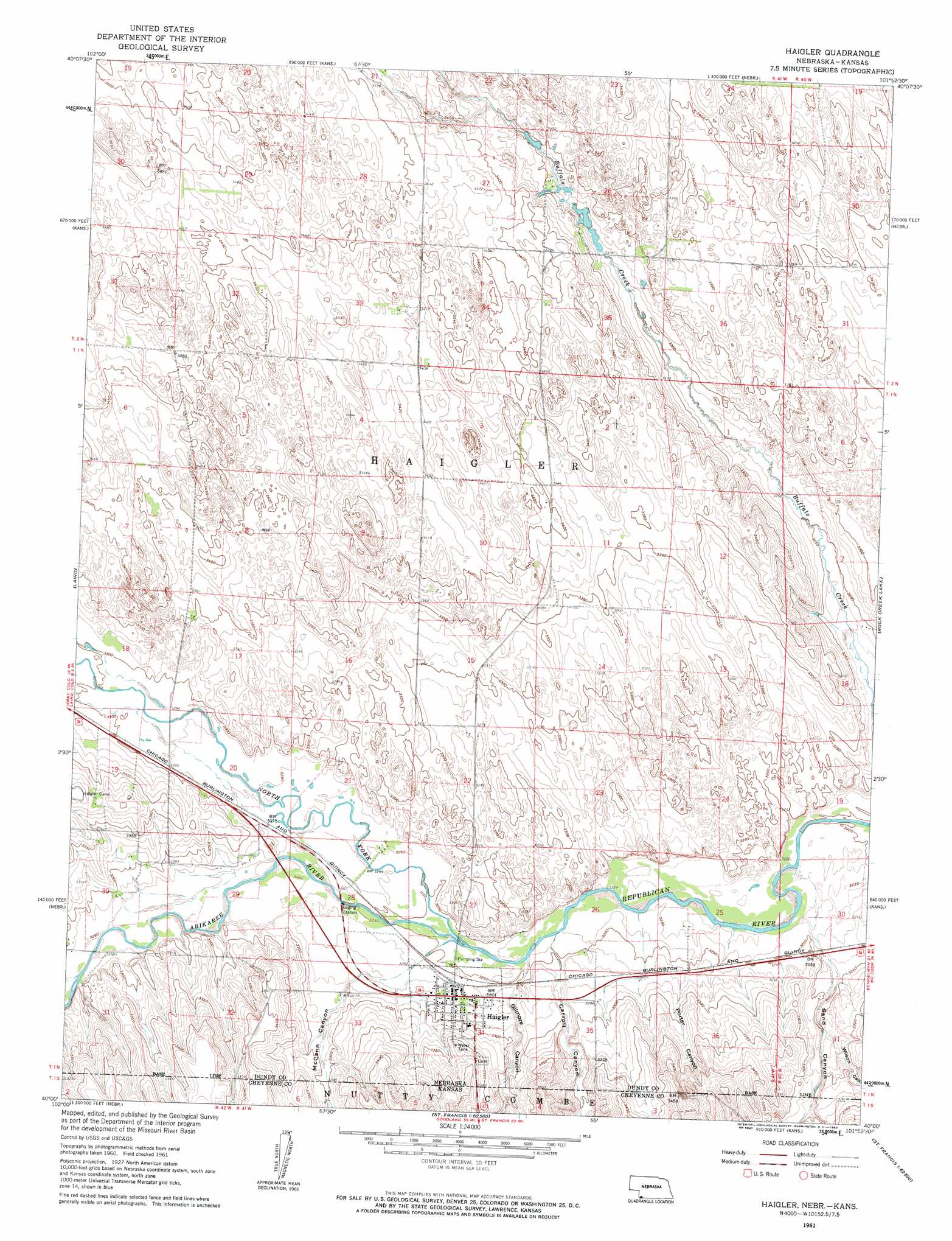
USGS Topo Quad 40101a8 - 1:24,000 scale
| Topo Map Name: | Haigler |
| USGS Topo Quad ID: | 40101a8 |
| Print Size: | ca. 21 1/4" wide x 27" high |
| Southeast Coordinates: | 40° N latitude / 101.875° W longitude |
| Map Center Coordinates: | 40.0625° N latitude / 101.9375° W longitude |
| U.S. States: | NE, KS |
| Filename: | O40101a8.jpg |
| Download Map JPG Image: | Haigler topo map 1:24,000 scale |
| Map Type: | Topographic |
| Topo Series: | 7.5´ |
| Map Scale: | 1:24,000 |
| Source of Map Images: | United States Geological Survey (USGS) |
| Alternate Map Versions: |
Haigler NE 1961, updated 1963 Download PDF Buy paper map Haigler NE 2011 Download PDF Buy paper map Haigler NE 2014 Download PDF Buy paper map |
1:24,000 Topo Quads surrounding Haigler
Alvin Sw |
Alvin |
Reservoir Lake Sw |
Reservoir Lake Se |
Champion Sw |
Wray Nw |
Wray Ne |
Haigler Nw |
Haigler Ne |
Benkelman Nw |
Wray |
Laird |
Haigler |
Rock Creek Lake |
Parks |
Beecher Island Nw |
Willow Creek Ranch |
Saint Francis Nw |
White Canyon |
Heinzelman Canyon |
Beecher Island |
Armel |
Saint Francis Sw |
Saint Francis |
Wheeler |
> Back to 40101a1 at 1:100,000 scale
> Back to 40100a1 at 1:250,000 scale
> Back to U.S. Topo Maps home
Haigler topo map: Gazetteer
Haigler: Populated Places
Haigler elevation 998m 3274′Haigler: Post Offices
Haigler Post Office elevation 999m 3277′Haigler: Streams
Arikaree River elevation 988m 3241′North Fork Republican River elevation 988m 3241′
Haigler: Valleys
Carroll Canyon elevation 992m 3254′Carroll Canyon elevation 990m 3248′
Gilmore Canyon elevation 994m 3261′
Gilmore Canyon elevation 988m 3241′
McCann Canyon elevation 1000m 3280′
McCann Canyon elevation 988m 3241′
Porter Canyon elevation 998m 3274′
Sand Canyon elevation 986m 3234′
Sand Canyon elevation 985m 3231′
Wilson Canyon elevation 994m 3261′
Wilson Canyon elevation 994m 3261′
Haigler digital topo map on disk
Buy this Haigler topo map showing relief, roads, GPS coordinates and other geographical features, as a high-resolution digital map file on DVD: