Reservoir Lake Se Topo Map Nebraska
To zoom in, hover over the map of Reservoir Lake Se
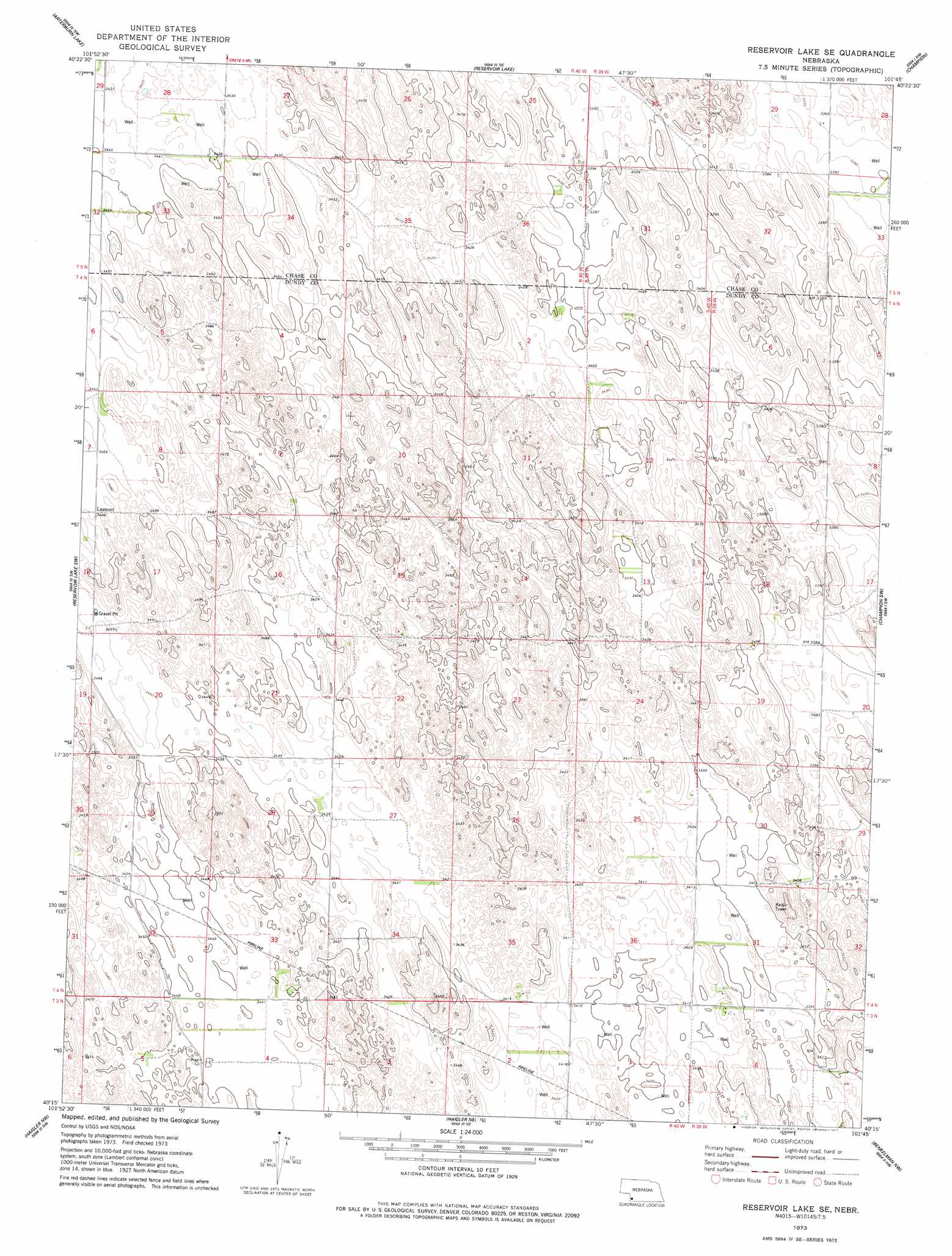
USGS Topo Quad 40101c7 - 1:24,000 scale
| Topo Map Name: | Reservoir Lake Se |
| USGS Topo Quad ID: | 40101c7 |
| Print Size: | ca. 21 1/4" wide x 27" high |
| Southeast Coordinates: | 40.25° N latitude / 101.75° W longitude |
| Map Center Coordinates: | 40.3125° N latitude / 101.8125° W longitude |
| U.S. State: | NE |
| Filename: | O40101c7.jpg |
| Download Map JPG Image: | Reservoir Lake Se topo map 1:24,000 scale |
| Map Type: | Topographic |
| Topo Series: | 7.5´ |
| Map Scale: | 1:24,000 |
| Source of Map Images: | United States Geological Survey (USGS) |
| Alternate Map Versions: |
Reservoir Lake SE NE 1973, updated 1977 Download PDF Buy paper map Reservoir Lake SE NE 2011 Download PDF Buy paper map Reservoir Lake SE NE 2014 Download PDF Buy paper map |
1:24,000 Topo Quads surrounding Reservoir Lake Se
Amherst Se |
Lamar |
Chase |
Imperial |
Imperial Muni Airport |
Alvin Ne |
Arterburn Lake |
Reservoir Lake |
Champion |
Enders |
Alvin |
Reservoir Lake Sw |
Reservoir Lake Se |
Champion Sw |
Ough |
Wray Ne |
Haigler Nw |
Haigler Ne |
Benkelman Nw |
Arrowhead Lake |
Laird |
Haigler |
Rock Creek Lake |
Parks |
Benkelman |
> Back to 40101a1 at 1:100,000 scale
> Back to 40100a1 at 1:250,000 scale
> Back to U.S. Topo Maps home
Reservoir Lake Se topo map: Gazetteer
Reservoir Lake Se: Populated Places
Lamont elevation 1058m 3471′Reservoir Lake Se: Post Offices
Lamont Post Office (historical) elevation 1058m 3471′Reservoir Lake Se digital topo map on disk
Buy this Reservoir Lake Se topo map showing relief, roads, GPS coordinates and other geographical features, as a high-resolution digital map file on DVD: