Reservoir Lake Topo Map Nebraska
To zoom in, hover over the map of Reservoir Lake
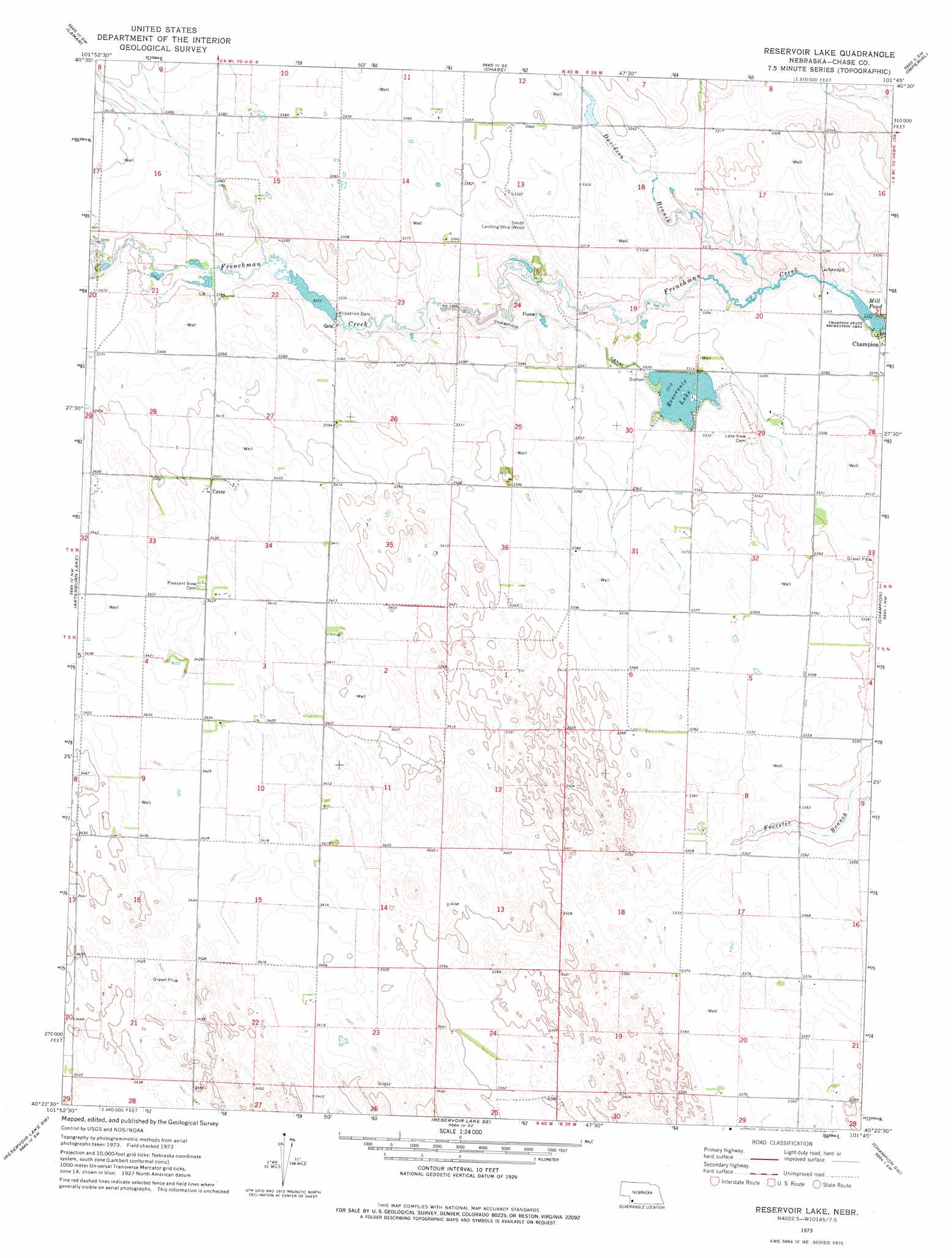
USGS Topo Quad 40101d7 - 1:24,000 scale
| Topo Map Name: | Reservoir Lake |
| USGS Topo Quad ID: | 40101d7 |
| Print Size: | ca. 21 1/4" wide x 27" high |
| Southeast Coordinates: | 40.375° N latitude / 101.75° W longitude |
| Map Center Coordinates: | 40.4375° N latitude / 101.8125° W longitude |
| U.S. State: | NE |
| Filename: | O40101d7.jpg |
| Download Map JPG Image: | Reservoir Lake topo map 1:24,000 scale |
| Map Type: | Topographic |
| Topo Series: | 7.5´ |
| Map Scale: | 1:24,000 |
| Source of Map Images: | United States Geological Survey (USGS) |
| Alternate Map Versions: |
Reservoir Lake NE 1973, updated 1977 Download PDF Buy paper map Reservoir Lake NE 2011 Download PDF Buy paper map Reservoir Lake NE 2014 Download PDF Buy paper map |
1:24,000 Topo Quads surrounding Reservoir Lake
Amherst Ne |
Lamar Nw |
Lamar Ne |
Imperial Nw |
Imperial Ne |
Amherst Se |
Lamar |
Chase |
Imperial |
Imperial Muni Airport |
Alvin Ne |
Arterburn Lake |
Reservoir Lake |
Champion |
Enders |
Alvin |
Reservoir Lake Sw |
Reservoir Lake Se |
Champion Sw |
Ough |
Wray Ne |
Haigler Nw |
Haigler Ne |
Benkelman Nw |
Arrowhead Lake |
> Back to 40101a1 at 1:100,000 scale
> Back to 40100a1 at 1:250,000 scale
> Back to U.S. Topo Maps home
Reservoir Lake topo map: Gazetteer
Reservoir Lake: Airports
Smith Field elevation 1018m 3339′Reservoir Lake: Canals
Champion Canal elevation 1012m 3320′Reservoir Lake: Dams
Kilpatrick Dam elevation 1013m 3323′Kilpatrick Dam 1 elevation 1010m 3313′
Kilpatrick Diversion Dam elevation 1015m 3330′
Reservoir Lake: Parks
Champion Lake State Recreation Area elevation 992m 3254′Champion Mill State Historical Park elevation 994m 3261′
Champion Water Powered Mill Historical Marker elevation 994m 3261′
Reservoir Lake: Populated Places
Crete elevation 1043m 3421′Reservoir Lake: Reservoirs
Kilpatrick Diversion Reservoir elevation 1015m 3330′Kilpatrick Reservoir 1 elevation 1010m 3313′
Mill Pond elevation 992m 3254′
Reservoir Lake elevation 1012m 3320′
Reservoir Lake: Streams
Davidson Branch elevation 993m 3257′McGuires Slough elevation 1021m 3349′
Reservoir Lake: Trails
Champion Mill Trail elevation 994m 3261′Reservoir Lake digital topo map on disk
Buy this Reservoir Lake topo map showing relief, roads, GPS coordinates and other geographical features, as a high-resolution digital map file on DVD: