Brandon Topo Map Nebraska
To zoom in, hover over the map of Brandon
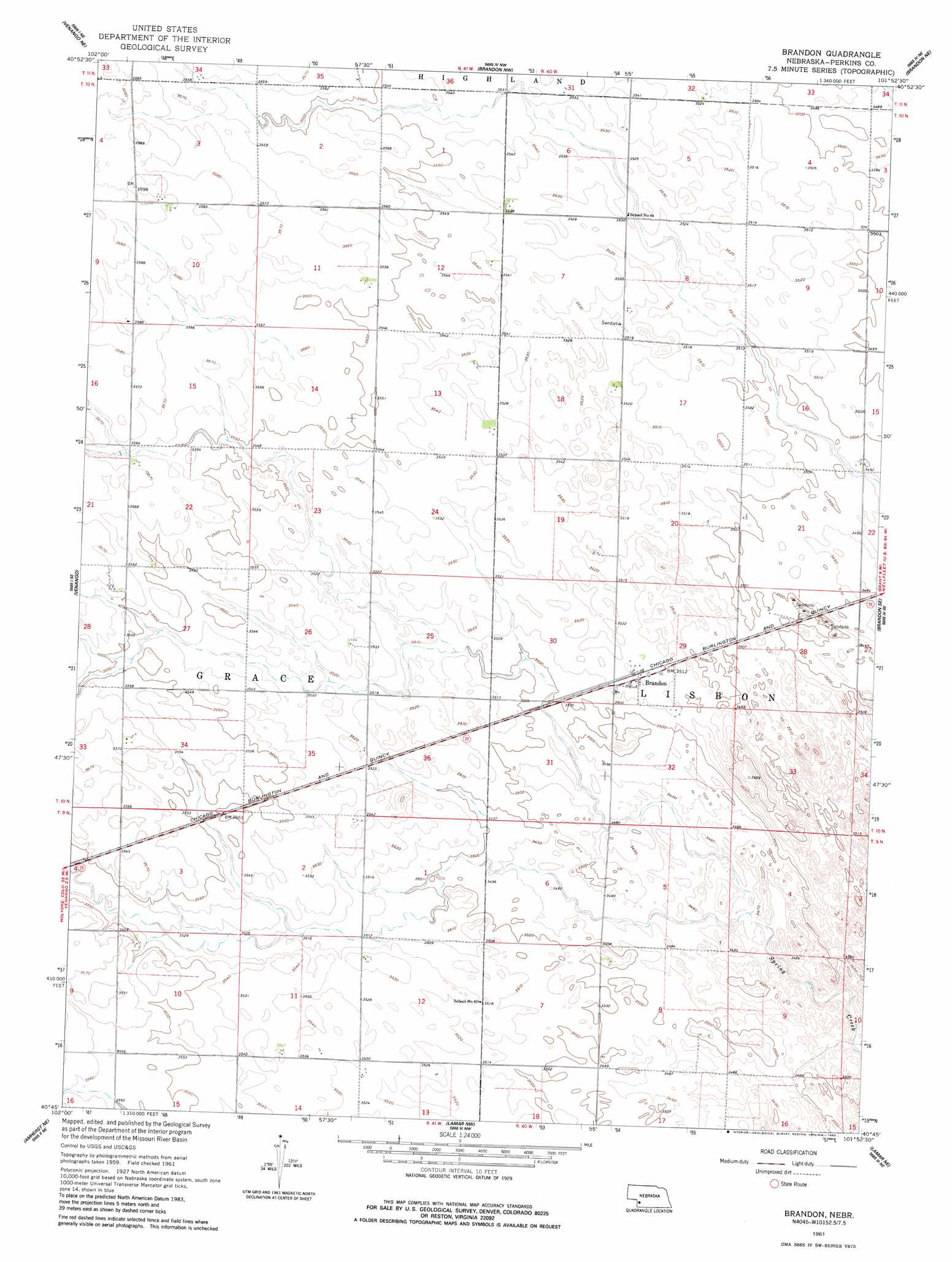
USGS Topo Quad 40101g8 - 1:24,000 scale
| Topo Map Name: | Brandon |
| USGS Topo Quad ID: | 40101g8 |
| Print Size: | ca. 21 1/4" wide x 27" high |
| Southeast Coordinates: | 40.75° N latitude / 101.875° W longitude |
| Map Center Coordinates: | 40.8125° N latitude / 101.9375° W longitude |
| U.S. State: | NE |
| Filename: | O40101g8.jpg |
| Download Map JPG Image: | Brandon topo map 1:24,000 scale |
| Map Type: | Topographic |
| Topo Series: | 7.5´ |
| Map Scale: | 1:24,000 |
| Source of Map Images: | United States Geological Survey (USGS) |
| Alternate Map Versions: |
Brandon NE 1961, updated 1963 Download PDF Buy paper map Brandon NE 1961, updated 1983 Download PDF Buy paper map Brandon NE 2011 Download PDF Buy paper map Brandon NE 2014 Download PDF Buy paper map |
1:24,000 Topo Quads surrounding Brandon
Barton |
Big Springs |
Brule |
Brule Se |
Ogallala Sw |
Venango Nw |
Venango Ne |
Brandon Nw |
Brandon Ne |
Wild Horse Spring |
Venango Sw |
Venango |
Brandon |
Brandon Se |
Grant |
Amherst |
Amherst Ne |
Lamar Nw |
Lamar Ne |
Imperial Nw |
Amherst Sw |
Amherst Se |
Lamar |
Chase |
Imperial |
> Back to 40101e1 at 1:100,000 scale
> Back to 40100a1 at 1:250,000 scale
> Back to U.S. Topo Maps home
Brandon topo map: Gazetteer
Brandon: Airports
Kumor Airport elevation 1079m 3540′Brandon: Populated Places
Brandon elevation 1073m 3520′Brandon: Post Offices
Brandon Post Office (historical) elevation 1073m 3520′Brandon: Streams
Sand Creek elevation 1067m 3500′Brandon digital topo map on disk
Buy this Brandon topo map showing relief, roads, GPS coordinates and other geographical features, as a high-resolution digital map file on DVD: