Laird Topo Map Colorado
To zoom in, hover over the map of Laird
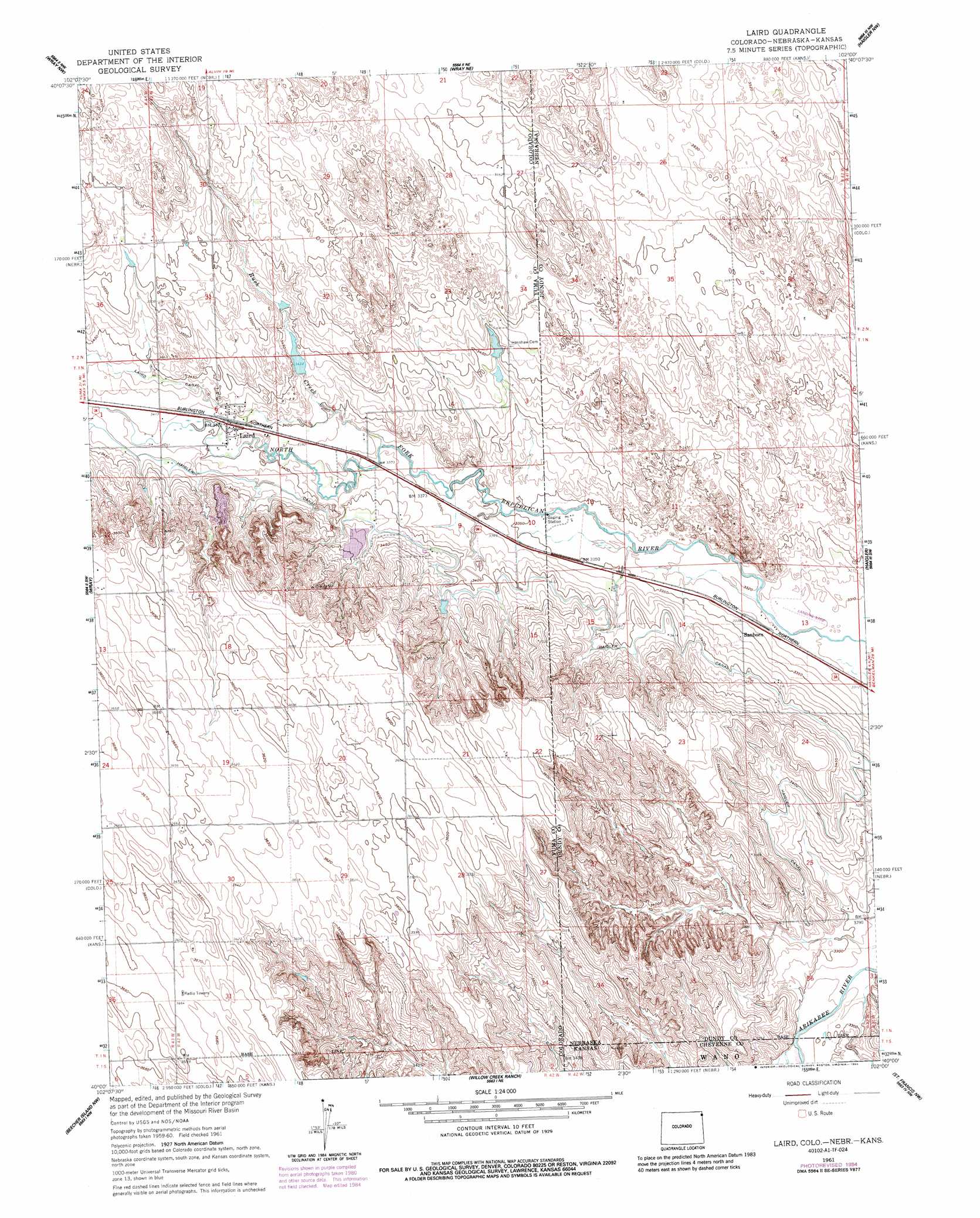
USGS Topo Quad 40102a1 - 1:24,000 scale
| Topo Map Name: | Laird |
| USGS Topo Quad ID: | 40102a1 |
| Print Size: | ca. 21 1/4" wide x 27" high |
| Southeast Coordinates: | 40° N latitude / 102° W longitude |
| Map Center Coordinates: | 40.0625° N latitude / 102.0625° W longitude |
| U.S. States: | CO, KS, NE |
| Filename: | o40102a1.jpg |
| Download Map JPG Image: | Laird topo map 1:24,000 scale |
| Map Type: | Topographic |
| Topo Series: | 7.5´ |
| Map Scale: | 1:24,000 |
| Source of Map Images: | United States Geological Survey (USGS) |
| Alternate Map Versions: |
Laird CO 1961, updated 1963 Download PDF Buy paper map Laird CO 1961, updated 1963 Download PDF Buy paper map Laird CO 1961, updated 1985 Download PDF Buy paper map Laird CO 1961, updated 1985 Download PDF Buy paper map Laird CO 2010 Download PDF Buy paper map Laird CO 2013 Download PDF Buy paper map Laird CO 2016 Download PDF Buy paper map |
1:24,000 Topo Quads surrounding Laird
Wauneta |
Alvin Sw |
Alvin |
Reservoir Lake Sw |
Reservoir Lake Se |
Eckley Ne |
Wray Nw |
Wray Ne |
Haigler Nw |
Haigler Ne |
Robb |
Wray |
Laird |
Haigler |
Rock Creek Lake |
Vernon |
Beecher Island Nw |
Willow Creek Ranch |
Saint Francis Nw |
White Canyon |
Wildcat Canyon |
Beecher Island |
Armel |
Saint Francis Sw |
Saint Francis |
> Back to 40102a1 at 1:100,000 scale
> Back to 40102a1 at 1:250,000 scale
> Back to U.S. Topo Maps home
Laird topo map: Gazetteer
Laird: Canals
Haigler Canal elevation 1039m 3408′Haigler Canal elevation 1040m 3412′
Laird: Populated Places
Laird elevation 1038m 3405′Sanborn elevation 1022m 3353′
Laird: Post Offices
Sanborn Post Office (historical) elevation 1022m 3353′Laird: Streams
Rush Creek elevation 1025m 3362′Laird digital topo map on disk
Buy this Laird topo map showing relief, roads, GPS coordinates and other geographical features, as a high-resolution digital map file on DVD: