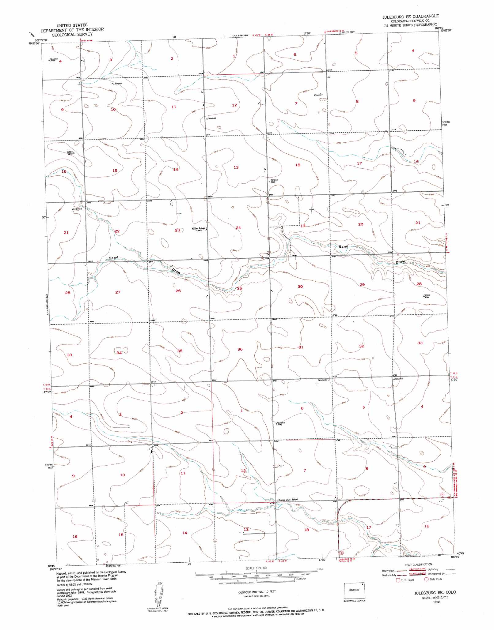
Julesburg Se Topo Map Colorado
To zoom in, hover over the map of Julesburg Se
USGS Topo Quad 40102g3 - 1:24,000 scale
| Topo Map Name: | Julesburg Se |
| USGS Topo Quad ID: | 40102g3 |
| Print Size: | ca. 21 1/4" wide x 27" high |
| Southeast Coordinates: | 40.75° N latitude / 102.25° W longitude |
| Map Center Coordinates: | 40.8125° N latitude / 102.3125° W longitude |
| U.S. State: | CO |
| Filename: | o40102g3.jpg |
| Download Map JPG Image: | Julesburg Se topo map 1:24,000 scale |
| Map Type: | Topographic |
| Topo Series: | 7.5´ |
| Map Scale: | 1:24,000 |
| Source of Map Images: | United States Geological Survey (USGS) |
| Alternate Map Versions: |
Julesburg SE CO 1952, updated 1953 Download PDF Buy paper map Julesburg SE CO 2010 Download PDF Buy paper map Julesburg SE CO 2013 Download PDF Buy paper map Julesburg SE CO 2016 Download PDF Buy paper map |
1:24,000 Topo Quads surrounding Julesburg Se
Lodgepole Se |
Chappell |
Chappell Se |
Barton |
Big Springs |
Sedgwick |
Ovid |
Julesburg |
Venango Nw |
Venango Ne |
Marks Butte |
Julesburg Sw |
Julesburg Se |
Venango Sw |
Venango |
Haxtun East |
Holyoke Nw |
Holyoke Ne |
Amherst |
Amherst Ne |
Haxtun Se |
Paoli |
Holyoke |
Amherst Sw |
Amherst Se |
> Back to 40102e1 at 1:100,000 scale
> Back to 40102a1 at 1:250,000 scale
> Back to U.S. Topo Maps home
Julesburg Se digital topo map on disk
Buy this Julesburg Se topo map showing relief, roads, GPS coordinates and other geographical features, as a high-resolution digital map file on DVD: