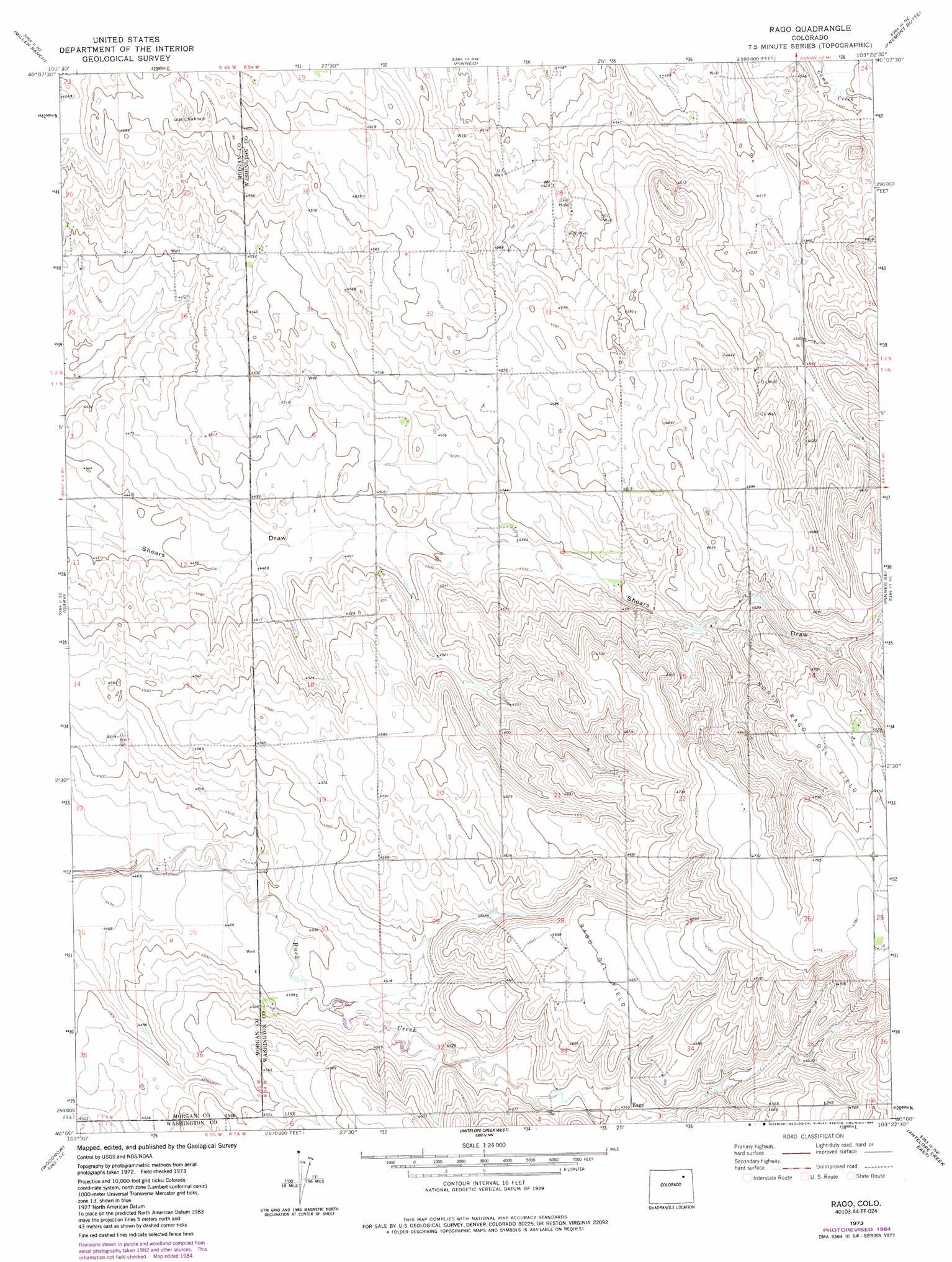
Rago Topo Map Colorado
To zoom in, hover over the map of Rago
USGS Topo Quad 40103a4 - 1:24,000 scale
| Topo Map Name: | Rago |
| USGS Topo Quad ID: | 40103a4 |
| Print Size: | ca. 21 1/4" wide x 27" high |
| Southeast Coordinates: | 40° N latitude / 103.375° W longitude |
| Map Center Coordinates: | 40.0625° N latitude / 103.4375° W longitude |
| U.S. State: | CO |
| Filename: | o40103a4.jpg |
| Download Map JPG Image: | Rago topo map 1:24,000 scale |
| Map Type: | Topographic |
| Topo Series: | 7.5´ |
| Map Scale: | 1:24,000 |
| Source of Map Images: | United States Geological Survey (USGS) |
| Alternate Map Versions: |
Rago CO 1973, updated 1976 Download PDF Buy paper map Rago CO 1973, updated 1976 Download PDF Buy paper map Rago CO 1973, updated 1984 Download PDF Buy paper map Rago CO 2010 Download PDF Buy paper map Rago CO 2013 Download PDF Buy paper map Rago CO 2016 Download PDF Buy paper map |
1:24,000 Topo Quads surrounding Rago
Brush West |
Brush East |
Merino Sw |
Merino Se |
Buffalo Springs Ranch |
Round Top |
Miller Ranch |
Pinneo |
Fremont Butte |
Akron |
Huey Ranch |
Gary |
Rago |
Pinneo Se |
Akron Sw |
Woodrow Nw |
Woodrow |
Antelope Creek West |
Antelope Creek East |
Elba |
Wetzel Creek |
Woodlin School |
Dry Gulch |
Antelope Creek Se |
Elba Sw |
> Back to 40103a1 at 1:100,000 scale
> Back to 40102a1 at 1:250,000 scale
> Back to U.S. Topo Maps home
Rago topo map: Gazetteer
Rago: Oilfields
North Rago Oil Field elevation 1443m 4734′Rago Oil Field elevation 1418m 4652′
Rago: Populated Places
Rago elevation 1391m 4563′Rago digital topo map on disk
Buy this Rago topo map showing relief, roads, GPS coordinates and other geographical features, as a high-resolution digital map file on DVD: