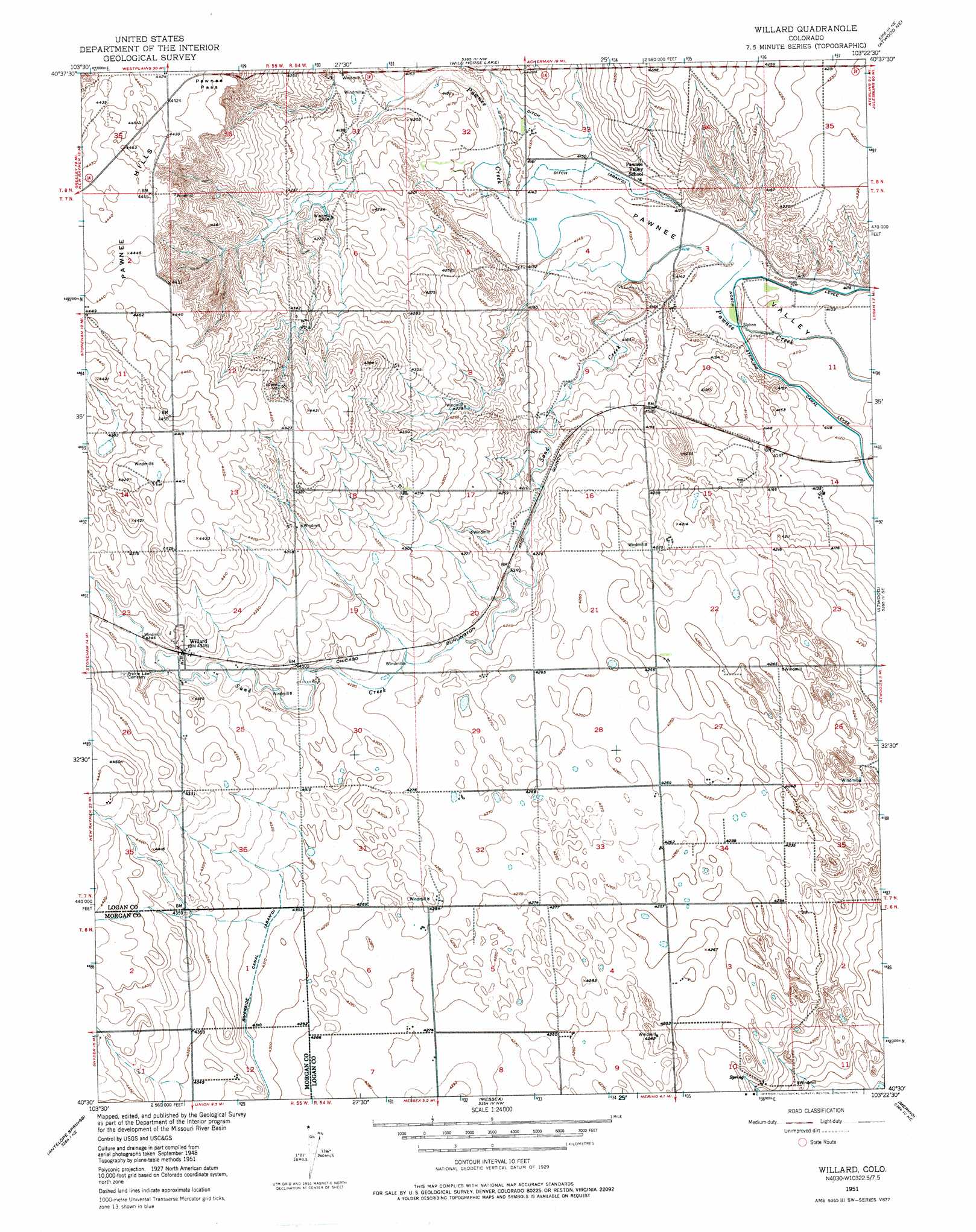
Willard Topo Map Colorado
To zoom in, hover over the map of Willard
USGS Topo Quad 40103e4 - 1:24,000 scale
| Topo Map Name: | Willard |
| USGS Topo Quad ID: | 40103e4 |
| Print Size: | ca. 21 1/4" wide x 27" high |
| Southeast Coordinates: | 40.5° N latitude / 103.375° W longitude |
| Map Center Coordinates: | 40.5625° N latitude / 103.4375° W longitude |
| U.S. State: | CO |
| Filename: | o40103e4.jpg |
| Download Map JPG Image: | Willard topo map 1:24,000 scale |
| Map Type: | Topographic |
| Topo Series: | 7.5´ |
| Map Scale: | 1:24,000 |
| Source of Map Images: | United States Geological Survey (USGS) |
| Alternate Map Versions: |
Willard CO 1951, updated 1976 Download PDF Buy paper map Willard CO 2010 Download PDF Buy paper map Willard CO 2013 Download PDF Buy paper map Willard CO 2016 Download PDF Buy paper map |
1:24,000 Topo Quads surrounding Willard
Avalo |
Avalo Se |
Westplains |
North Sterling Reservoir |
Padroni |
Stoneham Nw |
Stoneham Ne |
Wild Horse Lake |
Atwood Ne |
Sterling North |
Stoneham |
Stoneham Se |
Willard |
Atwood |
Sterling South |
Dead Horse Springs |
Antelope Springs |
Messex |
Merino |
Buffalo Springs Ranch Nw |
Brush West |
Brush East |
Merino Sw |
Merino Se |
Buffalo Springs Ranch |
> Back to 40103e1 at 1:100,000 scale
> Back to 40102a1 at 1:250,000 scale
> Back to U.S. Topo Maps home
Willard topo map: Gazetteer
Willard: Gaps
Pawnee Pass elevation 1347m 4419′Willard: Populated Places
Willard elevation 1322m 4337′Willard: Ranges
Pawnee Hills elevation 1354m 4442′Willard: Streams
Sand Creek elevation 1259m 4130′Willard digital topo map on disk
Buy this Willard topo map showing relief, roads, GPS coordinates and other geographical features, as a high-resolution digital map file on DVD: